How to get to Merced (Metro La Merced) by bus?
Click on the bus route to see step by step directions with maps, line arrival times and updated time schedules.
From Museo Soumaya, Naucalpan De Juárez
39 minFrom Parque Hundido, Miguel Hidalgo
43 minFrom Comite Olímpico Mexicano (Comité Olímpico Mexicano), Naucalpan De Juárez
50 minFrom Direccion de Seguridad Social ISSFAM, Naucalpan De Juárez
48 minFrom Costco (Costco Mixcoac), Miguel Hidalgo
47 minFrom Oficinas del Issste Miguel Angel de Quevedo, Alvaro Obregón
47 minFrom Metro Toreo Cuatro Caminos, Tultitlán
50 minFrom Afore Sura, Iztapalapa
49 minFrom Deportivo Hermanos Galeana, Gustavo A. Madero
39 minFrom Instituto Nacional de Neurologia y Neurocirugia "Manuel Velasco Suarez", Alvaro Obregón
36 min
How to get to Merced (Metro La Merced) by metro?
Click on the metro route to see step by step directions with maps, line arrival times and updated time schedules.
From Museo Soumaya, Naucalpan De Juárez
70 minFrom Parque Hundido, Miguel Hidalgo
57 minFrom Costco (Costco Mixcoac), Miguel Hidalgo
52 minFrom Oficinas del Issste Miguel Angel de Quevedo, Alvaro Obregón
67 minFrom Metro Toreo Cuatro Caminos, Tultitlán
51 minFrom Afore Sura, Iztapalapa
65 minFrom Instituto Nacional de Neurologia y Neurocirugia "Manuel Velasco Suarez", Alvaro Obregón
55 min
Bus stops near Merced (Metro La Merced) in Azcapotzalco
- Eje 1 Ote. Anillo de Circunvalación Y Plaza de San Pablo, 1 min walk,VIEW
- Calle Abraham Olvera #12532, 1 min walk,VIEW
- Calle Abraham Olvera #30735, 1 min walk,VIEW
- Anillo de Circunvalación - San Pablo, 1 min walk,VIEW
- Calle Carretones #1230, 1 min walk,VIEW
- Calle Abraham Olvera #17297, 1 min walk,VIEW
- Calle Abraham Olvera #12801, 1 min walk,VIEW
- La Merced, 1 min walk,VIEW
- Calle Carretones Tránsito Ciudad de México Cuauhtémoc Cdmx 06820 México, 2 min walk,VIEW
- Calle Abraham Olvera #30855, 2 min walk,VIEW
Metro stations near Merced (Metro La Merced) in Azcapotzalco
Bus lines to Merced (Metro La Merced) in Azcapotzalco
- Z4A, Base Metro Santa Anita,VIEW
- Z4B, Base Eje 2 Ote. H. Congreso de La Unión Y Prol. Canal Nacional,VIEW
- Z4E, Eje 1 Ote. Anillo de Circunvalación Y Plaza de San Pablo,VIEW
- Z4H, Base Metro Pino Suárez Y,VIEW
- 115, La Virgen,VIEW
- 58, Merced,VIEW
- 33, Calz. San Antonio Abad - Calz. Chabacano,VIEW
- 90, Santo Domingo,VIEW
- 18, Calle Cabaña,VIEW
- 115, Chabacano,VIEW
- 4, Amajac - Aicm,VIEW
- 14, Merced - Unidad Infonavit Tulyehualco,VIEW
- 44, San Sebastian,VIEW
- 58, Cine Sonora Vergel de Guadalupe,VIEW
What are the closest stations to Merced (Metro La Merced)?
The closest stations to Merced (Metro La Merced) are:
- Eje 1 Ote. Anillo de Circunvalación Y Plaza de San Pablo is 13 meters away, 1 min walk.
- Calle Abraham Olvera #12532 is 14 meters away, 1 min walk.
- Calle Abraham Olvera #30735 is 14 meters away, 1 min walk.
- Anillo de Circunvalación - San Pablo is 19 meters away, 1 min walk.
- Calle Carretones #1230 is 40 meters away, 1 min walk.
- Calle Abraham Olvera #17297 is 43 meters away, 1 min walk.
- Calle Abraham Olvera #12801 is 53 meters away, 1 min walk.
- La Merced is 68 meters away, 1 min walk.
- Calle Carretones Tránsito Ciudad de México Cuauhtémoc Cdmx 06820 México is 80 meters away, 2 min walk.
- Calle Abraham Olvera #30855 is 99 meters away, 2 min walk.
- Candelaria is 174 meters away, 3 min walk.
- Pino Suárez is 287 meters away, 4 min walk.
Which bus lines stop near Merced (Metro La Merced)?
These bus lines stop near Merced (Metro La Merced): 1, 115, 90, Z4E, Z4H.
Which metro line stops near Merced (Metro La Merced)?
1 (Dirección Pantitlán)
What’s the nearest metro station to Merced (Metro La Merced) in Azcapotzalco?
The nearest metro station to Merced (Metro La Merced) in Azcapotzalco is Candelaria. It’s a 3 min walk away.
What’s the nearest bus station to Merced (Metro La Merced) in Azcapotzalco?
The nearest bus stations to Merced (Metro La Merced) in Azcapotzalco are Eje 1 Ote. Anillo de Circunvalación Y Plaza de San Pablo, Calle Abraham Olvera #12532, Calle Abraham Olvera #30735, Anillo de Circunvalación - San Pablo, Calle Carretones #1230, Calle Abraham Olvera #17297, Calle Abraham Olvera #12801 and La Merced. The closest one is a 1 min walk away.
What time is the first metro to Merced (Metro La Merced) in Azcapotzalco?
The 1 is the first metro that goes to Merced (Metro La Merced) in Azcapotzalco. It stops nearby at 5:01 AM.
What time is the last metro to Merced (Metro La Merced) in Azcapotzalco?
The 2 is the last metro that goes to Merced (Metro La Merced) in Azcapotzalco. It stops nearby at 12:28 AM.
What time is the first bus to Merced (Metro La Merced) in Azcapotzalco?
The 4 is the first bus that goes to Merced (Metro La Merced) in Azcapotzalco. It stops nearby at 4:48 AM.
What time is the last bus to Merced (Metro La Merced) in Azcapotzalco?
The Z4A is the last bus that goes to Merced (Metro La Merced) in Azcapotzalco. It stops nearby at 12:50 AM.
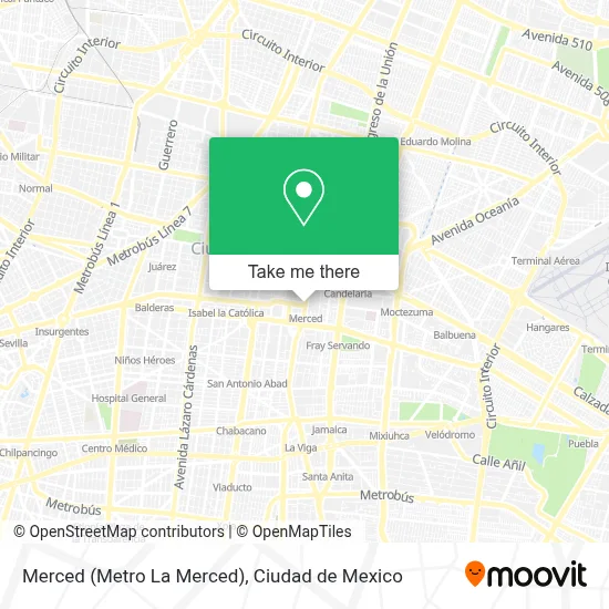
See Merced (Metro La Merced), Azcapotzalco, on the map
Public Transit to Merced (Metro La Merced) in Azcapotzalco
Wondering how to get to Merced (Metro La Merced) in Azcapotzalco? Moovit helps you find the best way to get to Merced (Metro La Merced) with step-by-step directions from the nearest public transit station.
Moovit provides free maps and live directions to help you navigate through your city. View schedules, routes, timetables, and find out how long does it take to get to Merced (Metro La Merced) in real time.
Looking for the nearest stop or station to Merced (Metro La Merced)? Check out this list of stops closest to your destination: Eje 1 Ote. Anillo de Circunvalación Y Plaza de San Pablo; Calle Abraham Olvera #12532; Calle Abraham Olvera #30735; Anillo de Circunvalación - San Pablo; Calle Carretones #1230; Calle Abraham Olvera #17297; Calle Abraham Olvera #12801; La Merced; Calle Carretones Tránsito Ciudad de México Cuauhtémoc Cdmx 06820 México; Calle Abraham Olvera #30855; Candelaria; Pino Suárez.
Bus: 1, 115, 90, Z4E, Z4H, Z4A, Z4B, 33, 58.Metro: 1, 4, 2.
Want to see if there’s another route that gets you there at an earlier time? Moovit helps you find alternative routes or times. Get directions from and directions to Merced (Metro La Merced) easily from the Moovit App or Website.
We make riding to Merced (Metro La Merced) easy, which is why over 1.5 million users, including users in Azcapotzalco, trust Moovit as the best app for public transit. You don’t need to download an individual bus app or train app, Moovit is your all-in-one transit app that helps you find the best bus time or train time available.
For information on prices of bus and metro, costs and ride fares to Merced (Metro La Merced), please check the Moovit app.
Use the app to navigate to popular places including to the airport, hospital, stadium, grocery store, mall, coffee shop, school, college, and university.
Merced (Metro La Merced) Address: Eje 1 Oriente Centro street in Azcapotzalco
- Instituto Esparta,
- Plaza de San Pablo & Circunvalación,
- San Pablo Anillo de Circunvalación,
- Circunvalación y San Pablo,
- Estación Merced,
- Colonia Merced Balbuena,
- Flores y Naturaleza Muerta,
- Venta de Productos de Unicel,
- Metrobus Anillo de Circunvalación,
- Metrobus Circunvalación,
- Metrobús La Merced L4,
- Metro Merced,
- Anillo de Circunvalación,
- Mercado de Flores,
- Mercado de la Merced,
- Caldos De Gallina Don Pepe,
- Cristalería La Económica,
- Mercado De Los Dulces (La Merced),
- Dulcería Don Goloso,
- Parroquia Santo Tomas Apostol 'La Palma'
Places Near Merced (Metro La Merced) (Azcapotzalco)
- Instituto Nacional de Neurologia y Neurocirugia "Manuel Velasco Suarez", Alvaro Obregón,
- Clínica 29 Imss, Gustavo A. Madero,
- Central de Abasto de la Ciudad de México, Cuauhtémoc,
- Monumental Plaza de Toros México, Miguel Hidalgo,
- CECyT 6 Miguel Othón de Mendizábal, Azcapotzalco,
- Parque Las Antenas, Iztapalapa,
- Antara Polanco (Antara Polanco-Puerta 1), Naucalpan De Juárez,
- Plaza Galerias De Las Estrellas, Azcapotzalco,
- World Trade Center Ciudad de México, Miguel Hidalgo,
- HAMBURGO 213, Azcapotzalco,
- Centro Banamex (Centro Citibanamex), Naucalpan De Juárez,
- Hospital Magdalena de las Salinas, Gustavo A. Madero,
- Plaza Tepeyac, Gustavo A. Madero,
- Plaza Parque Tezontle, Iztapalapa,
- Hospital Gabriel Mancera - Urgencias, Miguel Hidalgo,
- Hospital Juarez de México, Gustavo A. Madero,
- Hospital Regional Lic. Adolfo López Mateos, Miguel Hidalgo,
- BUCARELI 134 COL CENTRO DELEG CUAUHTEMOC D F, Azcapotzalco,
- Zona de Hospitales Tlalpan, Alvaro Obregón,
- Deportivo Los Galeana, Gustavo A. Madero
How to get to popular places in Ciudad de Mexico with public transit
Get around Azcapotzalco by public transit!
Traveling around Azcapotzalco has never been so easy. See step by step directions as you travel to any attraction, street or major public transit station. View bus and train schedules, arrival times, service alerts and detailed routes on a map, so you know exactly how to get to anywhere in Azcapotzalco.
When traveling to any destination around Azcapotzalco use Moovit's Live Directions with Get Off Notifications to know exactly where and how far to walk, how long to wait for your line, and how many stops are left. Moovit will alert you when it's time to get off — no need to constantly re-check whether yours is the next stop.
Wondering how to use public transit in Azcapotzalco or how to pay for public transit in Azcapotzalco? Moovit public transit app can help you navigate your way with public transit easily, and at minimum cost. It includes public transit fees, ticket prices, and costs. Looking for a map of Azcapotzalco public transit lines? Moovit public transit app shows all public transit maps in Azcapotzalco with all Bus, Train, Metro, Cable Car and Gondola routes and stops on an interactive map.
Ciudad de Mexico has 5 transit type(s), including: Bus, Train, Metro, Cable Car and Gondola, operated by several transit agencies, including STC (Metro CDMX), Metrobús, RTP, Trolebús elevado, Trolebús, Tren El Insurgente, Tren Ligero, Cablebús, Corredores Concesionados, Ferrocarriles Suburbanos, Mexibus, Mexicable, Puma Bus and Potrobús