Directions to Merge (Boston) with public transportation
The following transit lines have routes that pass near Merge
 Bus: 354, 4, SL1, SL2, SL3.
- Train: FITCHBURG, NEWBURYPORT/ROCKPORT, COMMUTER RAIL SHUTTLE, FAIRMOUNT LINE SHUTTLE, FRANKLIN LINE SHUTTLE.
- Subway: BLUE LINE, RED LINE.
- Ferry: QUINCY FERRY, WINTHROP FERRY, WINTHROP/QUINCY FERRY, EAST, LOVEJOY - FAN PIER - PIER 10.
How to get to Merge by bus?
Click on the bus route to see step by step directions with maps, line arrival times and updated time schedules.
From Winthrop, Winthrop Town
81 minFrom AC Hotel Boston Cambridge, Cambridge
80 minFrom Homewood Suites by Hilton Boston Logan Airport Chelsea, Chelsea
37 minFrom Conte Forum, Boston
74 minFrom Comfort Inn & Suites Logan International Airport, Revere
64 minFrom Cambridge Health Alliance (CHA), Cambridge
50 minFrom Ramada by Wyndham Boston, Boston
79 minFrom Boston College (BC), Boston
73 minFrom Chestnut Hill, Boston
74 minFrom Boston College, Boston
72 min
How to get to Merge by train?
Click on the train route to see step by step directions with maps, line arrival times and updated time schedules.
How to get to Merge by subway?
Click on the subway route to see step by step directions with maps, line arrival times and updated time schedules.
From AC Hotel Boston Cambridge, Cambridge
50 minFrom Conte Forum, Boston
74 minFrom Comfort Inn & Suites Logan International Airport, Revere
47 minFrom Cambridge Health Alliance (CHA), Cambridge
41 minFrom Ramada by Wyndham Boston, Boston
50 minFrom Boston College (BC), Boston
73 minFrom Chestnut Hill, Boston
74 minFrom Boston College, Boston
72 min
Bus stops near Merge in Boston
Train station near Merge in Boston
- South Station, 7 min walk,VIEW
Ferry stations near Merge in Boston
Bus lines to Merge in Boston
What are the closest stations to Merge?
The closest stations to Merge are:
- Summer St Opp Wtc Ave is 243 yards away, 4 min walk.
- Courthouse is 336 yards away, 4 min walk.
- South Station is 502 yards away, 7 min walk.
- Seaport (Fan Pier) is 790 yards away, 10 min walk.
- Rowes Wharf is 960 yards away, 12 min walk.
- A St @ Necco St is 966 yards away, 12 min walk.
- World Trade Center Pier, Boston, MA is 2500 yards away, 30 min walk.
Which bus lines stop near Merge?
These bus lines stop near Merge: 354, 4, SL1, SL2, SL3, SL4.
Which train lines stop near Merge?
These train lines stop near Merge: FITCHBURG, NEWBURYPORT/ROCKPORT.
Which subway lines stop near Merge?
These subway lines stop near Merge: BLUE LINE, RED LINE.
What’s the nearest train station to Merge in Boston?
The nearest train station to Merge in Boston is South Station. It’s a 7 min walk away.
What’s the nearest bus station to Merge in Boston?
The nearest bus stations to Merge in Boston are Summer St Opp Wtc Ave and Courthouse. The closest one is a 4 min walk away.
What’s the nearest ferry station to Merge in Boston?
The nearest ferry station to Merge in Boston is Seaport (Fan Pier). It’s a 10 min walk away.
What time is the first subway to Merge in Boston?
The RED LINE is the first subway that goes to Merge in Boston. It stops nearby at 5:30 AM.
What time is the last subway to Merge in Boston?
The RED LINE is the last subway that goes to Merge in Boston. It stops nearby at 1:49 AM.
What time is the first train to Merge in Boston?
The PROVIDENCE/STOUGHTON is the first train that goes to Merge in Boston. It stops nearby at 4:20 AM.
What time is the last train to Merge in Boston?
The LAKE SHORE LIMITED is the last train that goes to Merge in Boston. It stops nearby at 8:32 PM.
What time is the first bus to Merge in Boston?
The SLW is the first bus that goes to Merge in Boston. It stops nearby at 4:14 AM.
What time is the last bus to Merge in Boston?
The SL1 is the last bus that goes to Merge in Boston. It stops nearby at 1:26 AM.
What time is the first ferry to Merge in Boston?
The EAST is the first ferry that goes to Merge in Boston. It stops nearby at 6:01 AM.
What time is the last ferry to Merge in Boston?
The FAST FERRY is the last ferry that goes to Merge in Boston. It stops nearby at 9:05 PM.
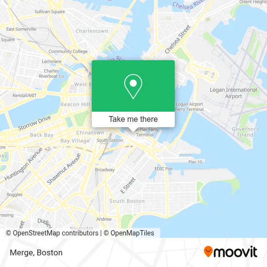
See Merge, Boston, on the map
Public Transit to Merge in Boston
Wondering how to get to Merge in Boston? Moovit helps you find the best way to get to Merge with step-by-step directions from the nearest public transit station.
Moovit provides free maps and live directions to help you navigate through your city. View schedules, routes, timetables, and find out how long does it take to get to Merge in real time.
Looking for the nearest stop or station to Merge? Check out this list of stops closest to your destination: Summer St Opp Wtc Ave; Courthouse; South Station; Seaport (Fan Pier); Rowes Wharf; A St @ Necco St; World Trade Center Pier.
Bus: 354, 4, SL1, SL2, SL3, SL4, 7, SLW, 11.Train: FITCHBURG, NEWBURYPORT/ROCKPORT, COMMUTER RAIL SHUTTLE, FAIRMOUNT LINE SHUTTLE, FRANKLIN LINE SHUTTLE, KINGSTON LINE SHUTTLE, WORCESTER LINE SHUTTLE.Subway: BLUE LINE, RED LINE.Ferry: QUINCY FERRY, WINTHROP FERRY, WINTHROP/QUINCY FERRY, EAST, LOVEJOY - FAN PIER - PIER 10, HINGHAM FERRY.
Want to see if there’s another route that gets you there at an earlier time? Moovit helps you find alternative routes or times. Get directions from and directions to Merge easily from the Moovit App or Website.
We make riding to Merge easy, which is why over 1.7 million users, including users in Boston, trust Moovit as the best app for public transit. You don’t need to download an individual bus app or train app, Moovit is your all-in-one transit app that helps you find the best bus time or train time available.
For information on prices of bus, subway and train, costs and ride fares to Merge, please check the Moovit app.
Use the app to navigate to popular places including to the airport, hospital, stadium, grocery store, mall, coffee shop, school, college, and university.
Merge Address: 35 Thomson Pl street in Boston
- Ember,
- Grace Loves Lace,
- Bartaco,
- Trader Joe's,
- City Tap House,
- Caffe Nero,
- YOTEL Boston,
- Thomson Reuters at 44 Thomson Place,
- Sportello,
- Sweetgreen (Sweet Green),
- Pink Taco Boston,
- Sheraton,
- Residence Inn by Marriott Boston Downtown Seaport,
- Flour Bakery,
- Residence Inn-Boston Seaport,
- JSGD,
- Lucky's Lounge,
- Grand Circle Gallery,
- Komyuniti at Yotel (Yotel Boston First Floor),
- Shake Shack
Places Near Merge (Boston)
- Wilbur Theatre, Boston,
- Wang Theater, Boston,
- Seaport District, Boston,
- Cheers, Boston,
- Castle Island, Boston,
- Boston Medical Center, Boston,
- Museum Of Science, Boston,
- Faneuil Hall, Boston,
- Leader Bank Pavilion (Leader Bank Pavillion), Boston,
- Prudential Center, Boston,
- Boston Common, Boston,
- Mgm Music Hall, Boston,
- Td Garden, Boston,
- Isabella Stewart Gardner Museum, Boston,
- Quincy Market, Boston,
- Boston Children's Hospital, Boston,
- North End, Boston,
- Boston Convention & Exhibition Center, Boston,
- House Of Blues, Boston,
- Massachusetts General Hospital, Boston
How to get to popular places in Boston with public transit
Get around Boston by public transit!
Traveling around Boston has never been so easy. See step by step directions as you travel to any attraction, street or major public transit station. View bus and train schedules, arrival times, service alerts and detailed routes on a map, so you know exactly how to get to anywhere in Boston.
When traveling to any destination around Boston use Moovit's Live Directions with Get Off Notifications to know exactly where and how far to walk, how long to wait for your line, and how many stops are left. Moovit will alert you when it's time to get off — no need to constantly re-check whether yours is the next stop.
Wondering how to use public transit in Boston or how to pay for public transit in Boston? Moovit public transit app can help you navigate your way with public transit easily, and at minimum cost. It includes public transit fees, ticket prices, and costs. Looking for a map of Boston public transit lines? Moovit public transit app shows all public transit maps in Boston with all Bus, Train, Subway and Ferry routes and stops on an interactive map.
Boston has 4 transit type(s), including: Bus, Train, Subway and Ferry, operated by several transit agencies, including MBTA, Southeastern Regional Transit Authority, MetroWest Regional Transit Authority, Rhode Island Public Transit Authority, WRTA, Lowell Regional Transit Authority, Merrimack Valley Transit, Montachusett Regional Transit Authority, Cape Cod Regional Transit Authority, Brockton Area Transit Authority, Martha's Vineyard Transit Authority, the WAVE - Nantucket Regional Transit Authority, GATRA, Cape Ann Transportation Authority and Massport