Directions to Merkert Hall (Boston) with public transportation
The following transit lines have routes that pass near Merkert Hall
 Bus: 57, 60, 86, GREEN LINE B SHUTTLE, SHUTTLE.
- Subway: GREEN LINE B, GREEN LINE D.
How to get to Merkert Hall by bus?
Click on the bus route to see step by step directions with maps, line arrival times and updated time schedules.
From Hewlett Room 32-G882 (MIT Stata Center), Cambridge
64 minFrom Charlestown, Boston
101 minFrom Boston Marriott Long Wharf, Boston
72 minFrom Boston Long Wharf Ferry Terminal, Boston
72 minFrom Brigham and Women's, Boston
41 minFrom The Salty Pig, Boston
49 minFrom Dorchester, Boston
92 minFrom Sheraton, Boston
75 minFrom Boston Harborwalk, Boston
74 minFrom Le Meridien Cambridge-Mit, Cambridge
63 min
How to get to Merkert Hall by subway?
Click on the subway route to see step by step directions with maps, line arrival times and updated time schedules.
From Hewlett Room 32-G882 (MIT Stata Center), Cambridge
61 minFrom Charlestown, Boston
74 minFrom Boston Marriott Long Wharf, Boston
57 minFrom Boston Long Wharf Ferry Terminal, Boston
58 minFrom Brigham and Women's, Boston
41 minFrom The Salty Pig, Boston
46 minFrom Dorchester, Boston
82 minFrom Sheraton, Boston
66 minFrom Boston Harborwalk, Boston
59 minFrom Le Meridien Cambridge-Mit, Cambridge
64 min
Subway stations near Merkert Hall in Boston
Bus stops near Merkert Hall in Boston
Bus lines to Merkert Hall in Boston
- GREEN LINE B SHUTTLE, Back Bay (Shuttle),VIEW
- SHUTTLE, Kenmore (Shuttle),VIEW
- GREEN LINE B SHUTTLE, Boston College - Blandford Street,VIEW
- GREEN LINE B SHUTTLE, Boston College - Babcock Street,VIEW
- GREEN LINE B SHUTTLE, Boston College - Washington Street,VIEW
- GREEN LINE B SHUTTLE, Boston College - Packard's Corner,VIEW
What are the closest stations to Merkert Hall?
The closest stations to Merkert Hall are:
- Chestnut Hill Ave. is 698 yards away, 9 min walk.
- Boston College - Commonwealth Ave @ St Thomas More Rd is 729 yards away, 9 min walk.
- Boston College - Commonwealth Ave @ Lake St is 736 yards away, 9 min walk.
- Reservoir is 1499 yards away, 18 min walk.
Which bus lines stop near Merkert Hall?
These bus lines stop near Merkert Hall: 57, 60, 86.
Which subway lines stop near Merkert Hall?
These subway lines stop near Merkert Hall: GREEN LINE B, GREEN LINE D.
What’s the nearest subway station to Merkert Hall in Boston?
The nearest subway station to Merkert Hall in Boston is Chestnut Hill Ave.. It’s a 9 min walk away.
What’s the nearest bus station to Merkert Hall in Boston?
The nearest bus stations to Merkert Hall in Boston are Boston College - Commonwealth Ave @ St Thomas More Rd and Boston College - Commonwealth Ave @ Lake St. The closest one is a 9 min walk away.
What time is the first subway to Merkert Hall in Boston?
The GREEN LINE D is the first subway that goes to Merkert Hall in Boston. It stops nearby at 4:45 AM.
What time is the last subway to Merkert Hall in Boston?
The GREEN LINE B is the last subway that goes to Merkert Hall in Boston. It stops nearby at 2:39 AM.
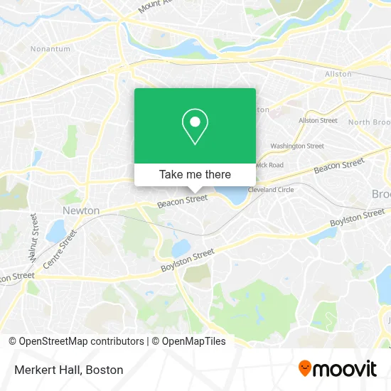
See Merkert Hall, Boston, on the map
Public Transit to Merkert Hall in Boston
Wondering how to get to Merkert Hall in Boston? Moovit helps you find the best way to get to Merkert Hall with step-by-step directions from the nearest public transit station.
Moovit provides free maps and live directions to help you navigate through your city. View schedules, routes, timetables, and find out how long does it take to get to Merkert Hall in real time.
Looking for the nearest stop or station to Merkert Hall? Check out this list of stops closest to your destination: Chestnut Hill Ave.; Boston College - Commonwealth Ave @ St Thomas More Rd; Boston College - Commonwealth Ave @ Lake St; Reservoir.
Bus: 57, 60, 86, GREEN LINE B SHUTTLE, SHUTTLE, GREEN LINE B SHUTTLE, GREEN LINE B SHUTTLE, GREEN LINE B SHUTTLE, GREEN LINE B SHUTTLE.Subway: GREEN LINE B, GREEN LINE D.
Want to see if there’s another route that gets you there at an earlier time? Moovit helps you find alternative routes or times. Get directions from and directions to Merkert Hall easily from the Moovit App or Website.
We make riding to Merkert Hall easy, which is why over 1.7 million users, including users in Boston, trust Moovit as the best app for public transit. You don’t need to download an individual bus app or train app, Moovit is your all-in-one transit app that helps you find the best bus time or train time available.
For information on prices of subway and bus, costs and ride fares to Merkert Hall, please check the Moovit app.
Use the app to navigate to popular places including to the airport, hospital, stadium, grocery store, mall, coffee shop, school, college, and university.
Merkert Hall Address: Boston College street in Boston
- Beacon Street Garage,
- President's Box- Alumni Stadium,
- Conte Forum,
- Alumni Stadium,
- The Schiller Institute for Integrated Science and Society,
- Statue of St Ignatius,
- Chestnut Hill,
- Doug Flutie Statue,
- Boston College (BC),
- Devlin Hall,
- Boston College Bookstore,
- Ignacio Hall,
- The Chocolate Bar,
- The Robsham Theater Arts Center,
- Micros Northeast - Che,
- Collegiate Press - BOS,
- Follett,
- USPS Collection Box - Blue Box,
- Trustees of BC Tom Peters,
- Boston College Soe
Places Near Merkert Hall (Boston)
- House Of Blues, Boston,
- Faneuil Hall, Boston,
- Quincy Market, Boston,
- Museum Of Science, Boston,
- Boston Children's Hospital, Boston,
- Wang Theater, Boston,
- Isabella Stewart Gardner Museum, Boston,
- Boston Common, Boston,
- Leader Bank Pavilion (Leader Bank Pavillion), Boston,
- Cheers, Boston,
- Prudential Center, Boston,
- Td Garden, Boston,
- Massachusetts General Hospital, Boston,
- Seaport District, Boston,
- Boston Medical Center, Boston,
- Castle Island, Boston,
- Boston Convention & Exhibition Center, Boston,
- Mgm Music Hall, Boston,
- North End, Boston,
- Wilbur Theatre, Boston
How to get to popular places in Boston with public transit
Get around Boston by public transit!
Traveling around Boston has never been so easy. See step by step directions as you travel to any attraction, street or major public transit station. View bus and train schedules, arrival times, service alerts and detailed routes on a map, so you know exactly how to get to anywhere in Boston.
When traveling to any destination around Boston use Moovit's Live Directions with Get Off Notifications to know exactly where and how far to walk, how long to wait for your line, and how many stops are left. Moovit will alert you when it's time to get off — no need to constantly re-check whether yours is the next stop.
Wondering how to use public transit in Boston or how to pay for public transit in Boston? Moovit public transit app can help you navigate your way with public transit easily, and at minimum cost. It includes public transit fees, ticket prices, and costs. Looking for a map of Boston public transit lines? Moovit public transit app shows all public transit maps in Boston with all Bus, Train, Subway and Ferry routes and stops on an interactive map.
Boston has 4 transit type(s), including: Bus, Train, Subway and Ferry, operated by several transit agencies, including MBTA, Southeastern Regional Transit Authority, MetroWest Regional Transit Authority, Rhode Island Public Transit Authority, WRTA, Lowell Regional Transit Authority, Merrimack Valley Transit, Montachusett Regional Transit Authority, Cape Cod Regional Transit Authority, Brockton Area Transit Authority, Martha's Vineyard Transit Authority, the WAVE - Nantucket Regional Transit Authority, GATRA, Cape Ann Transportation Authority and Massport