Directions to Mervin Restaurant (Boston) with public transportation
The following transit lines have routes that pass near Mervin Restaurant
 Bus: 16, 23, 22, 26.
- Train: FAIRMOUNT, FRANKLIN/FOXBORO, PROVIDENCE/STOUGHTON, FAIRMOUNT LINE SHUTTLE.
- Subway: RED LINE.
How to get to Mervin Restaurant by bus?
Click on the bus route to see step by step directions with maps, line arrival times and updated time schedules.
From Arsenal Yards, Watertown Town
97 minFrom Arsenal Mall, Watertown Town
97 minFrom Mount Ida College, Newton
71 minFrom Citizenm Boston Back Bay Hotel, Boston
47 minFrom Hotel Indigo Boston Garden an IHG Hotel, Boston
82 minFrom Museum of Fine Arts (MFA), Boston
44 minFrom Hyatt Regency Boston, Boston
52 minFrom The Schrafft Center, Boston
84 minFrom Cambria Hotel Boston Somerville, Somerville
90 minFrom The Mall At Chestnut Hill, Newton
89 min
How to get to Mervin Restaurant by train?
Click on the train route to see step by step directions with maps, line arrival times and updated time schedules.
How to get to Mervin Restaurant by subway?
Click on the subway route to see step by step directions with maps, line arrival times and updated time schedules.
From Citizenm Boston Back Bay Hotel, Boston
47 minFrom Hotel Indigo Boston Garden an IHG Hotel, Boston
39 minFrom Museum of Fine Arts (MFA), Boston
53 minFrom Hyatt Regency Boston, Boston
33 minFrom The Schrafft Center, Boston
46 minFrom Cambria Hotel Boston Somerville, Somerville
62 minFrom The Mall At Chestnut Hill, Newton
88 min
Bus stop near Mervin Restaurant in Boston
- Talbot Ave @ Lithgow St, 1 min walk,VIEW
Train stations near Mervin Restaurant in Boston
Subway station near Mervin Restaurant in Boston
- Fields Corner, 15 min walk,VIEW
Bus lines to Mervin Restaurant in Boston
What are the closest stations to Mervin Restaurant?
The closest stations to Mervin Restaurant are:
- Talbot Ave @ Lithgow St is 61 yards away, 1 min walk.
- Four Corners/Geneva is 619 yards away, 8 min walk.
- Talbot Avenue is 1157 yards away, 14 min walk.
- Fields Corner is 1214 yards away, 15 min walk.
Which bus lines stop near Mervin Restaurant?
These bus lines stop near Mervin Restaurant: 16, 23.
Which train line stops near Mervin Restaurant?
FAIRMOUNT (#1619 | Fairmount)
Which subway line stops near Mervin Restaurant?
RED LINE (Ashmont/Braintree)
What’s the nearest subway station to Mervin Restaurant in Boston?
The nearest subway station to Mervin Restaurant in Boston is Fields Corner. It’s a 15 min walk away.
What’s the nearest train station to Mervin Restaurant in Boston?
The nearest train station to Mervin Restaurant in Boston is Four Corners/Geneva. It’s a 8 min walk away.
What’s the nearest bus station to Mervin Restaurant in Boston?
The nearest bus station to Mervin Restaurant in Boston is Talbot Ave @ Lithgow St. It’s a 1 min walk away.
What time is the first subway to Mervin Restaurant in Boston?
The RED LINE is the first subway that goes to Mervin Restaurant in Boston. It stops nearby at 5:16 AM.
What time is the last subway to Mervin Restaurant in Boston?
The RED LINE is the last subway that goes to Mervin Restaurant in Boston. It stops nearby at 2:03 AM.
What time is the first train to Mervin Restaurant in Boston?
The FAIRMOUNT is the first train that goes to Mervin Restaurant in Boston. It stops nearby at 4:41 AM.
What time is the last train to Mervin Restaurant in Boston?
The FAIRMOUNT is the last train that goes to Mervin Restaurant in Boston. It stops nearby at 12:03 AM.
What time is the first bus to Mervin Restaurant in Boston?
The 23 is the first bus that goes to Mervin Restaurant in Boston. It stops nearby at 4:51 AM.
What time is the last bus to Mervin Restaurant in Boston?
The 23 is the last bus that goes to Mervin Restaurant in Boston. It stops nearby at 2:40 AM.
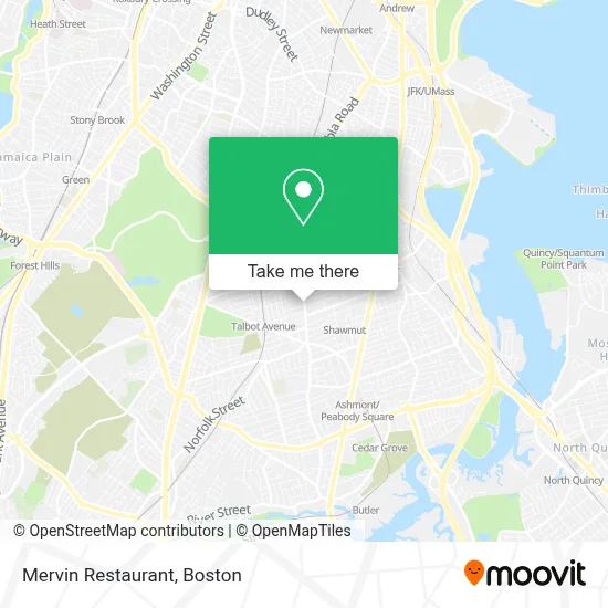
See Mervin Restaurant, Boston, on the map
Public Transit to Mervin Restaurant in Boston
Wondering how to get to Mervin Restaurant in Boston? Moovit helps you find the best way to get to Mervin Restaurant with step-by-step directions from the nearest public transit station.
Moovit provides free maps and live directions to help you navigate through your city. View schedules, routes, timetables, and find out how long does it take to get to Mervin Restaurant in real time.
Looking for the nearest stop or station to Mervin Restaurant? Check out this list of stops closest to your destination: Talbot Ave @ Lithgow St; Four Corners/Geneva; Talbot Avenue; Fields Corner.
Bus: 16, 23, 22, 26.Train: FAIRMOUNT, FRANKLIN/FOXBORO, PROVIDENCE/STOUGHTON, FAIRMOUNT LINE SHUTTLE.Subway: RED LINE.
Want to see if there’s another route that gets you there at an earlier time? Moovit helps you find alternative routes or times. Get directions from and directions to Mervin Restaurant easily from the Moovit App or Website.
We make riding to Mervin Restaurant easy, which is why over 1.7 million users, including users in Boston, trust Moovit as the best app for public transit. You don’t need to download an individual bus app or train app, Moovit is your all-in-one transit app that helps you find the best bus time or train time available.
For information on prices of bus, subway and train, costs and ride fares to Mervin Restaurant, please check the Moovit app.
Use the app to navigate to popular places including to the airport, hospital, stadium, grocery store, mall, coffee shop, school, college, and university.
Mervin Restaurant Address: 487 Washington St street in Boston
- Caribbean Rhythn,
- Super Laundromat,
- Diva Nail Bar & Beauty,
- ATM,
- Lawson Hair Studios,
- Senior Locksmith,
- USPS,
- Godfrey Hotel Boston,
- Dorchester District Court,
- Boston Municipal Court Department, Dorchester Division,
- Dorchester Division, Boston Municipal Court ,
- Lafountain & Wollman P.C.,
- Constable Services,
- Orthogonal Chiropractic,
- Macy's,
- American Locksmith,
- Codman Square Health Center,
- Jesus Way Network,
- Faibian/Kenoco,
- Abcd Dorchester NSC Food Pantry
Places Near Mervin Restaurant (Boston)
- Massachusetts General Hospital, Boston,
- Boston Children's Hospital, Boston,
- Mgm Music Hall, Boston,
- Isabella Stewart Gardner Museum, Boston,
- Boston Common, Boston,
- Castle Island, Boston,
- Leader Bank Pavilion (Leader Bank Pavillion), Boston,
- Wilbur Theatre, Boston,
- Seaport District, Boston,
- Quincy Market, Boston,
- Boston Convention & Exhibition Center, Boston,
- House Of Blues, Boston,
- Td Garden, Boston,
- Prudential Center, Boston,
- Museum Of Science, Boston,
- Boston Medical Center, Boston,
- Wang Theater, Boston,
- Cheers, Boston,
- Faneuil Hall, Boston,
- North End, Boston
How to get to popular places in Boston with public transit
Get around Boston by public transit!
Traveling around Boston has never been so easy. See step by step directions as you travel to any attraction, street or major public transit station. View bus and train schedules, arrival times, service alerts and detailed routes on a map, so you know exactly how to get to anywhere in Boston.
When traveling to any destination around Boston use Moovit's Live Directions with Get Off Notifications to know exactly where and how far to walk, how long to wait for your line, and how many stops are left. Moovit will alert you when it's time to get off — no need to constantly re-check whether yours is the next stop.
Wondering how to use public transit in Boston or how to pay for public transit in Boston? Moovit public transit app can help you navigate your way with public transit easily, and at minimum cost. It includes public transit fees, ticket prices, and costs. Looking for a map of Boston public transit lines? Moovit public transit app shows all public transit maps in Boston with all Bus, Train, Subway and Ferry routes and stops on an interactive map.
Boston has 4 transit type(s), including: Bus, Train, Subway and Ferry, operated by several transit agencies, including MBTA, Southeastern Regional Transit Authority, MetroWest Regional Transit Authority, Rhode Island Public Transit Authority, WRTA, Lowell Regional Transit Authority, Merrimack Valley Transit, Montachusett Regional Transit Authority, Cape Cod Regional Transit Authority, Brockton Area Transit Authority, Martha's Vineyard Transit Authority, the WAVE - Nantucket Regional Transit Authority, GATRA, Cape Ann Transportation Authority and Massport