Directions to Met Life (Quincy) with public transportation
The following transit lines have routes that pass near Met Life
 Bus: 215, 238, 210, RED LINE SHUTTLE, RED LINE SHUTTLE.
- Train: GREENBUSH.
- Subway: RED LINE.
How to get to Met Life by bus?
Click on the bus route to see step by step directions with maps, line arrival times and updated time schedules.
From Boston Scientific, Quincy
80 minFrom Beth Israel Deaconess Hospital-Milton, Milton
60 minFrom Doubletree-Boston Bayside, Boston
87 minFrom Hingham, MA, Hingham
80 minFrom Franklin Park Zoo, Boston
92 minFrom 240 Mount Vernon Street, Boston
86 minFrom Uphams Corner, Boston
76 minFrom Marina Bay, Quincy
79 minFrom Children's Hospital, Boston
85 minFrom Best Western Adams Inn Quincy - Boston, Quincy
64 min
How to get to Met Life by train?
Click on the train route to see step by step directions with maps, line arrival times and updated time schedules.
How to get to Met Life by subway?
Click on the subway route to see step by step directions with maps, line arrival times and updated time schedules.
From Beth Israel Deaconess Hospital-Milton, Milton
80 minFrom Doubletree-Boston Bayside, Boston
35 minFrom Franklin Park Zoo, Boston
80 minFrom 240 Mount Vernon Street, Boston
33 minFrom Uphams Corner, Boston
39 minFrom Children's Hospital, Boston
33 minFrom Best Western Adams Inn Quincy - Boston, Quincy
36 min
Bus stops near Met Life in Quincy
Bus lines to Met Life in Quincy
- 238, Quincy Center,VIEW
- 210, Fields Corner - Quincy Center,VIEW
- RED LINE SHUTTLE, Ashmont - Braintree,VIEW
- RED LINE SHUTTLE, Braintree - Broadway,VIEW
- RED LINE SHUTTLE, Braintree - Quincy Center,VIEW
- RED LINE SHUTTLE, Braintree - JFK/UMass (Shuttle),VIEW
- RED LINE SHUTTLE, Braintree - North Quincy (Shuttle),VIEW
- RED LINE, Red Line,VIEW
- 230, Montello,VIEW
What are the closest stations to Met Life?
The closest stations to Met Life are:
- Centre St @ Crown Colony Dr is 353 yards away, 5 min walk.
- Quincy Adams is 464 yards away, 6 min walk.
- Independence Ave @ Federal Ave is 1679 yards away, 20 min walk.
Which bus lines stop near Met Life?
These bus lines stop near Met Life: 215, 238.
Which train line stops near Met Life?
GREENBUSH (#1061 | Greenbush)
Which subway line stops near Met Life?
RED LINE (Ashmont/Braintree)
What’s the nearest bus station to Met Life in Quincy?
The nearest bus station to Met Life in Quincy is Centre St @ Crown Colony Dr. It’s a 5 min walk away.
What time is the first subway to Met Life in Quincy?
The RED LINE is the first subway that goes to Met Life in Quincy. It stops nearby at 5:12 AM.
What time is the last subway to Met Life in Quincy?
The RED LINE is the last subway that goes to Met Life in Quincy. It stops nearby at 1:55 AM.
What time is the first bus to Met Life in Quincy?
The 230 is the first bus that goes to Met Life in Quincy. It stops nearby at 4:57 AM.
What time is the last bus to Met Life in Quincy?
The 210 is the last bus that goes to Met Life in Quincy. It stops nearby at 1:24 AM.
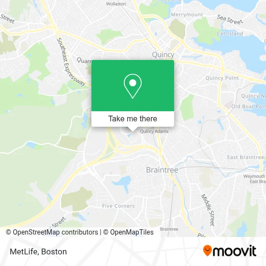
See Met Life, Quincy, on the map
Public Transit to Met Life in Quincy
Wondering how to get to Met Life in Quincy? Moovit helps you find the best way to get to Met Life with step-by-step directions from the nearest public transit station.
Moovit provides free maps and live directions to help you navigate through your city. View schedules, routes, timetables, and find out how long does it take to get to Met Life in real time.
Looking for the nearest stop or station to Met Life? Check out this list of stops closest to your destination: Centre St @ Crown Colony Dr; Quincy Adams; Independence Ave @ Federal Ave.
Bus: 215, 238, 210, RED LINE SHUTTLE, RED LINE SHUTTLE, RED LINE SHUTTLE, RED LINE SHUTTLE, 230.Train: GREENBUSH.Subway: RED LINE.
Want to see if there’s another route that gets you there at an earlier time? Moovit helps you find alternative routes or times. Get directions from and directions to Met Life easily from the Moovit App or Website.
We make riding to Met Life easy, which is why over 1.7 million users, including users in Quincy, trust Moovit as the best app for public transit. You don’t need to download an individual bus app or train app, Moovit is your all-in-one transit app that helps you find the best bus time or train time available.
For information on prices of bus, subway and train, costs and ride fares to Met Life, please check the Moovit app.
Use the app to navigate to popular places including to the airport, hospital, stadium, grocery store, mall, coffee shop, school, college, and university.
Met Life Address: 400 Crown Colony Dr street in Quincy
- Bayada Assistive Care,
- Nmt Capital,
- Jones Lang Lasalle,
- Hcl Technologies,
- Xfinity,
- Michel Associates,
- Career Builder. Com,
- Gulf Computer,
- Carter Mackay,
- Connie Marcusa, Dds,
- Hans-Peter Weber, Dmd,
- Nguyet Doan, Dds,
- Jie Sun, Dmd,
- Natasha Bhalla, Dds,
- Quincy (Unpub),
- Dr Stephen Matarazzo (Quincy Best Dentist Steve Matarazzo, DDS),
- Excel Garage Door Repair,
- Elevate Technology Solutions,
- Stephen J. Matarazzo,
- Quincy Plumbing and Heating
Places Near Met Life (Quincy)
- Faneuil Hall, Boston,
- Mgm Music Hall, Boston,
- Boston Children's Hospital, Boston,
- Td Garden, Boston,
- House Of Blues, Boston,
- North End, Boston,
- Museum Of Science, Boston,
- Seaport District, Boston,
- Boston Common, Boston,
- Wilbur Theatre, Boston,
- Cheers, Boston,
- Leader Bank Pavilion (Leader Bank Pavillion), Boston,
- Boston Medical Center, Boston,
- Boston Convention & Exhibition Center, Boston,
- Prudential Center, Boston,
- Massachusetts General Hospital, Boston,
- Wang Theater, Boston,
- Castle Island, Boston,
- Isabella Stewart Gardner Museum, Boston,
- Quincy Market, Boston
How to get to popular places in Boston with public transit
Get around Quincy by public transit!
Traveling around Quincy has never been so easy. See step by step directions as you travel to any attraction, street or major public transit station. View bus and train schedules, arrival times, service alerts and detailed routes on a map, so you know exactly how to get to anywhere in Quincy.
When traveling to any destination around Quincy use Moovit's Live Directions with Get Off Notifications to know exactly where and how far to walk, how long to wait for your line, and how many stops are left. Moovit will alert you when it's time to get off — no need to constantly re-check whether yours is the next stop.
Wondering how to use public transit in Quincy or how to pay for public transit in Quincy? Moovit public transit app can help you navigate your way with public transit easily, and at minimum cost. It includes public transit fees, ticket prices, and costs. Looking for a map of Quincy public transit lines? Moovit public transit app shows all public transit maps in Quincy with all Bus, Train, Subway and Ferry routes and stops on an interactive map.
Boston has 4 transit type(s), including: Bus, Train, Subway and Ferry, operated by several transit agencies, including MBTA, Southeastern Regional Transit Authority, MetroWest Regional Transit Authority, Rhode Island Public Transit Authority, WRTA, Lowell Regional Transit Authority, Merrimack Valley Transit, Montachusett Regional Transit Authority, Cape Cod Regional Transit Authority, Brockton Area Transit Authority, Martha's Vineyard Transit Authority, the WAVE - Nantucket Regional Transit Authority, GATRA, Cape Ann Transportation Authority and Massport