Directions to Met Limo Of Boston (Cambridge) with public transportation
The following transit lines have routes that pass near Met Limo Of Boston
 Bus: 350, 74, 78, 83, 94.
- Train: FITCHBURG, RED LINE.
- Subway: RED LINE, GREEN LINE B, GREEN LINE C, GREEN LINE E.
How to get to Met Limo Of Boston by bus?
Click on the bus route to see step by step directions with maps, line arrival times and updated time schedules.
From Faulkner Hospital, Boston
94 minFrom Arnold Arboretum, Boston
100 minFrom Leader Bank Pavilion (Leader Bank Pavillion), Boston
109 minFrom Fire & Ice (Fire Ice Restaurant), Boston
51 minFrom Brigham and Women's Faulkner Hospital, Boston
93 minFrom South Boston, Boston
77 minFrom Stone Zoo, Stoneham
92 minFrom Lechmere Station, Cambridge
47 minFrom Hampton Inn Boston Seaport District (Hampton Inn-Hampton Inn Boston), Boston
109 minFrom Home2 Suites-Boston South Bay, Boston
77 min
How to get to Met Limo Of Boston by train?
Click on the train route to see step by step directions with maps, line arrival times and updated time schedules.
How to get to Met Limo Of Boston by subway?
Click on the subway route to see step by step directions with maps, line arrival times and updated time schedules.
From Faulkner Hospital, Boston
71 minFrom Arnold Arboretum, Boston
64 minFrom Leader Bank Pavilion (Leader Bank Pavillion), Boston
59 minFrom Fire & Ice (Fire Ice Restaurant), Boston
42 minFrom Brigham and Women's Faulkner Hospital, Boston
71 minFrom South Boston, Boston
44 minFrom Lechmere Station, Cambridge
47 minFrom Hampton Inn Boston Seaport District (Hampton Inn-Hampton Inn Boston), Boston
57 minFrom Home2 Suites-Boston South Bay, Boston
48 min
Train station near Met Limo Of Boston in Cambridge
- Porter, 4 min walk,VIEW
Bus stops near Met Limo Of Boston in Cambridge
Subway station near Met Limo Of Boston in Cambridge
- Ball Square Station, 26 min walk,VIEW
Bus lines to Met Limo Of Boston in Cambridge
- 74, Harvard - Belmont Center,VIEW
- 78, Harvard - Arlmont Village,VIEW
- 83, Central Square,VIEW
- FLIXBUS 2610, NYC - Boston,VIEW
- FLIXBUS 2619, Boston - NYC - Philadelphia,VIEW
- 62, Alewife - Bedford VA,VIEW
- 67, Alewife via Arlington Center - Turkey Hill via Arlington Center,VIEW
- 76, Alewife - Lincoln Lab via Hanscom Airport,VIEW
- 350, Alewife via Mall Rd - North Burlington via Mall Rd,VIEW
- FITCHBURG LINE SHUTTLE, Littleton/Route 495 - Alewife (Local),VIEW
- FITCHBURG LINE SHUTTLE, Littleton/Route 495 - Alewife (Express),VIEW
- RED LINE SHUTTLE, Alewife - Park Street,VIEW
- RED LINE SHUTTLE, Alewife - Kendall/MIT via Porter (Express),VIEW
- RED LINE SHUTTLE, Alewife - Harvard via Brattle Street,VIEW
- RED LINE SHUTTLE, Alewife - Davis,VIEW
- RED LINE SHUTTLE, Alewife - Kendall/MIT,VIEW
- RED LINE SHUTTLE, Alewife - Harvard via Holyoke Street,VIEW
- R1, Rev Bus - R1,VIEW
- R2, Rev Bus - R2 Inbound,VIEW
What are the closest stations to Met Limo Of Boston?
The closest stations to Met Limo Of Boston are:
- Porter is 290 yards away, 4 min walk.
- Concord Ave Opp Fawcett St is 538 yards away, 7 min walk.
- Rindge Ave @ Russell Field is 787 yards away, 10 min walk.
- Cambridge (Ma) is 802 yards away, 10 min walk.
- Alewife is 883 yards away, 11 min walk.
- Alewife Station (Arrive) is 892 yards away, 11 min walk.
- Ball Square Station is 2215 yards away, 26 min walk.
Which bus lines stop near Met Limo Of Boston?
These bus lines stop near Met Limo Of Boston: 350, 74, 78, 83, 94.
Which train line stops near Met Limo Of Boston?
FITCHBURG (#409 | Wachusett)
Which subway line stops near Met Limo Of Boston?
RED LINE (Alewife)
What’s the nearest subway station to Met Limo Of Boston in Cambridge?
The nearest subway station to Met Limo Of Boston in Cambridge is Ball Square Station. It’s a 26 min walk away.
What’s the nearest train station to Met Limo Of Boston in Cambridge?
The nearest train station to Met Limo Of Boston in Cambridge is Porter. It’s a 4 min walk away.
What’s the nearest bus station to Met Limo Of Boston in Cambridge?
The nearest bus station to Met Limo Of Boston in Cambridge is Concord Ave Opp Fawcett St. It’s a 7 min walk away.
What time is the first subway to Met Limo Of Boston in Cambridge?
The GREEN LINE E is the first subway that goes to Met Limo Of Boston in Cambridge. It stops nearby at 4:55 AM.
What time is the last subway to Met Limo Of Boston in Cambridge?
The GREEN LINE E is the last subway that goes to Met Limo Of Boston in Cambridge. It stops nearby at 2:39 AM.
What time is the first train to Met Limo Of Boston in Cambridge?
The FITCHBURG is the first train that goes to Met Limo Of Boston in Cambridge. It stops nearby at 5:47 AM.
What time is the last train to Met Limo Of Boston in Cambridge?
The FITCHBURG is the last train that goes to Met Limo Of Boston in Cambridge. It stops nearby at 12:17 AM.
What time is the first bus to Met Limo Of Boston in Cambridge?
The 83 is the first bus that goes to Met Limo Of Boston in Cambridge. It stops nearby at 5:10 AM.
What time is the last bus to Met Limo Of Boston in Cambridge?
The 83 is the last bus that goes to Met Limo Of Boston in Cambridge. It stops nearby at 1:28 AM.
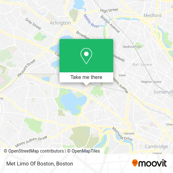
See Met Limo Of Boston, Cambridge, on the map
Public Transit to Met Limo Of Boston in Cambridge
Wondering how to get to Met Limo Of Boston in Cambridge? Moovit helps you find the best way to get to Met Limo Of Boston with step-by-step directions from the nearest public transit station.
Moovit provides free maps and live directions to help you navigate through your city. View schedules, routes, timetables, and find out how long does it take to get to Met Limo Of Boston in real time.
Looking for the nearest stop or station to Met Limo Of Boston? Check out this list of stops closest to your destination: Porter; Concord Ave Opp Fawcett St; Rindge Ave @ Russell Field; Cambridge (Ma); Alewife; Alewife Station (Arrive); Ball Square Station.
Bus: 350, 74, 78, 83, 94, FLIXBUS 2610, FLIXBUS 2619, 62, 67, 76, FITCHBURG LINE SHUTTLE.Train: FITCHBURG, RED LINE.Subway: RED LINE, GREEN LINE B, GREEN LINE C, GREEN LINE E.
Want to see if there’s another route that gets you there at an earlier time? Moovit helps you find alternative routes or times. Get directions from and directions to Met Limo Of Boston easily from the Moovit App or Website.
We make riding to Met Limo Of Boston easy, which is why over 1.7 million users, including users in Cambridge, trust Moovit as the best app for public transit. You don’t need to download an individual bus app or train app, Moovit is your all-in-one transit app that helps you find the best bus time or train time available.
For information on prices of subway, bus and train, costs and ride fares to Met Limo Of Boston, please check the Moovit app.
Use the app to navigate to popular places including to the airport, hospital, stadium, grocery store, mall, coffee shop, school, college, and university.
Met Limo Of Boston Address: 185 Alewife Brook Pkwy Ste 407 street in Cambridge
- Dietsensor,
- Cluepoints,
- Alewife Brook Locksmith Company,
- Eos Imaging,
- Marie Landel & Associates,
- Marie Landel-2,
- American Association of Variable Star Observers,
- Petsafe Brand,
- Jury Associates,
- Pearson Vue,
- Pearson Vue (Pearson Professional Centers),
- Xfinity,
- Verizon Wireless,
- Wholefoods Fresh Pond,
- Takeda Pharmaceuticals,
- Santana Team,
- Pearson Vue Test Center,
- Trader Joe's,
- Sleepy's, The Mattress Professionals,
- Amazon Hub Counter+ (Fresh Pond-Whole Foods)
Places Near Met Limo Of Boston (Cambridge)
- Boston Convention & Exhibition Center, Boston,
- Mgm Music Hall, Boston,
- Boston Medical Center, Boston,
- Prudential Center, Boston,
- Wang Theater, Boston,
- Boston Children's Hospital, Boston,
- Massachusetts General Hospital, Boston,
- Leader Bank Pavilion (Leader Bank Pavillion), Boston,
- North End, Boston,
- Wilbur Theatre, Boston,
- Td Garden, Boston,
- Cheers, Boston,
- House Of Blues, Boston,
- Faneuil Hall, Boston,
- Quincy Market, Boston,
- Castle Island, Boston,
- Boston Common, Boston,
- Isabella Stewart Gardner Museum, Boston,
- Museum Of Science, Boston,
- Seaport District, Boston
How to get to popular places in Boston with public transit
Get around Cambridge by public transit!
Traveling around Cambridge has never been so easy. See step by step directions as you travel to any attraction, street or major public transit station. View bus and train schedules, arrival times, service alerts and detailed routes on a map, so you know exactly how to get to anywhere in Cambridge.
When traveling to any destination around Cambridge use Moovit's Live Directions with Get Off Notifications to know exactly where and how far to walk, how long to wait for your line, and how many stops are left. Moovit will alert you when it's time to get off — no need to constantly re-check whether yours is the next stop.
Wondering how to use public transit in Cambridge or how to pay for public transit in Cambridge? Moovit public transit app can help you navigate your way with public transit easily, and at minimum cost. It includes public transit fees, ticket prices, and costs. Looking for a map of Cambridge public transit lines? Moovit public transit app shows all public transit maps in Cambridge with all Bus, Train, Subway and Ferry routes and stops on an interactive map.
Boston has 4 transit type(s), including: Bus, Train, Subway and Ferry, operated by several transit agencies, including MBTA, Southeastern Regional Transit Authority, MetroWest Regional Transit Authority, Rhode Island Public Transit Authority, WRTA, Lowell Regional Transit Authority, Merrimack Valley Transit, Montachusett Regional Transit Authority, Cape Cod Regional Transit Authority, Brockton Area Transit Authority, Martha's Vineyard Transit Authority, the WAVE - Nantucket Regional Transit Authority, GATRA, Cape Ann Transportation Authority and Massport