How to get to Metalock by bus?
Click on the bus route to see step by step directions with maps, line arrival times and updated time schedules.
From Üsküdar Belediyesi Yeni Nikah Sarayı, Mimar Sinan, Üsküdar
52 minFrom 522b Mecidiyeköy Ümraniye, Şişli
41 minFrom Sabiha Gokcen Yolu-istanbul, Çekmekoy
61 minFrom 4.levent - zincirlikuyu, Şişli
43 minFrom Beşiktaş Nişantaşı Dolmuşları, Beşiktaş
72 minFrom Tepe Nautilus, Acıbadem, Kadıköy
47 minFrom Ortaköy, Beşiktaş
74 minFrom Bebek İETT Durağı, Bebek, Beşiktaş
71 minFrom Havaş Sabiha Gökçen Servisi, Beşiktaş
68 minFrom Göztepe Prof. Dr. Süleyman Yalçın Şehir Hastanesi, Kadıköy
51 min
How to get to Metalock by metro?
Click on the metro route to see step by step directions with maps, line arrival times and updated time schedules.
Bus stops near Metalock in Ümraniye
Metro station near Metalock in Ümraniye
- Çakmak, 11 min walk,VIEW
Bus lines to Metalock in Ümraniye
- C307, Adem Yavuz,VIEW
- 11H, Çifteçınarlar-Tepeüstü,VIEW
- 13Y, Tepeüstü-Kadıköy,VIEW
- 20Ü, Kadıköy-Tepeüstü,VIEW
- ŞL05, Üsküdar,VIEW
- C56, Alemdağ,VIEW
- C56, Reşadiye,VIEW
- C77, Ümraniye,VIEW
- C77, Şahinbey,VIEW
- C317+56, Doğu Ataşehir,VIEW
- 8K, Tepeüstü - Ataşehir / Kozyatağı Metro / Ring,VIEW
- 10, Elmalıkent-Bostancı Peronlar,VIEW
- 10F, Bostancı Peronlar-Estergon Caddesi,VIEW
- 11P, Harem Peronlar 2-Sarıgazi Garajı,VIEW
- 11ÇB, Kavacık Aktarma-Elmalıkent,VIEW
- 11ÜS, Sultanbeyli Peronlar-Üsküdar,VIEW
- 13, Aşık Veysel Caddesi-Kadıköy,VIEW
- 13H, Evtaş Blokları - Ümraniye Metro / Ü.Eğt.Arş.Hastanesi / Ring,VIEW
- 14, Kadıköy-Yenidoğan Peronlar,VIEW
- 14B, Kadıköy-Adem Yavuz Mahallesi,VIEW
What are the closest stations to Metalock?
The closest stations to Metalock are:
- Şiir Sokak - Ümraniye Yönü is 81 meters away, 2 min walk.
- Çakmak Köprüsü - Üsküdar Yönü is 563 meters away, 8 min walk.
- Çakmak Köprüsü - Dudullu Yönü is 571 meters away, 9 min walk.
- Hz.Ali Camii - Armagan Evler Yönü is 752 meters away, 10 min walk.
- Çakmak is 799 meters away, 11 min walk.
- Ümr.İski-Şehit Emre Büyükyildirim - Sarigazi Yönü is 865 meters away, 12 min walk.
Which bus lines stop near Metalock?
These bus lines stop near Metalock: 13, 14, 14B, 20Ü, 522.
Which metro line stops near Metalock?
M5 (Samandıra Merkez→Üsküdar)
Which Dolmus & Minibus line stops near Metalock?
ÜSKÜDAR - ALEMDAĞ (Üsküdar - Alemdağ)
What’s the nearest metro station to Metalock in Ümraniye?
The nearest metro station to Metalock in Ümraniye is Çakmak. It’s a 11 min walk away.
What’s the nearest bus station to Metalock in Ümraniye?
The nearest bus station to Metalock in Ümraniye is Şiir Sokak - Ümraniye Yönü. It’s a 2 min walk away.
What time is the first metro to Metalock in Ümraniye?
The M5 is the first metro that goes to Metalock in Ümraniye. It stops nearby at 3:20 AM.
What time is the last metro to Metalock in Ümraniye?
The M5 is the last metro that goes to Metalock in Ümraniye. It stops nearby at 12:24 AM.
What time is the first bus to Metalock in Ümraniye?
The 11ÜS is the first bus that goes to Metalock in Ümraniye. It stops nearby at 3:28 AM.
What time is the last bus to Metalock in Ümraniye?
The 11ÜS is the last bus that goes to Metalock in Ümraniye. It stops nearby at 3:30 AM.
What time is the first Dolmus & Minibus to Metalock in Ümraniye?
The ÇAKMAK - ATAŞEHIR is the first Dolmus & Minibus that goes to Metalock in Ümraniye. It stops nearby at 6:00 AM.
What time is the last Dolmus & Minibus to Metalock in Ümraniye?
The ÇAKMAK - ATAŞEHIR is the last Dolmus & Minibus that goes to Metalock in Ümraniye. It stops nearby at 10:44 PM.
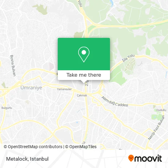
See Metalock, Ümraniye, on the map
Public Transit to Metalock in Ümraniye
Wondering how to get to Metalock in Ümraniye? Moovit helps you find the best way to get to Metalock with step-by-step directions from the nearest public transit station.
Moovit provides free maps and live directions to help you navigate through your city. View schedules, routes, timetables, and find out how long does it take to get to Metalock in real time.
Looking for the nearest stop or station to Metalock? Check out this list of stops closest to your destination: Şiir Sokak - Ümraniye Yönü; Çakmak Köprüsü - Üsküdar Yönü; Çakmak Köprüsü - Dudullu Yönü; Hz.Ali Camii - Armagan Evler Yönü; Çakmak; Ümr.İski-Şehit Emre Büyükyildirim - Sarigazi Yönü.
Bus: 13, 14, 14B, 20Ü, 522, C307, 11H, 13Y, ŞL05, C56, C56, C77, C77, 19D, 139, 139A, 13B, C65, C74.Metro: M5.Dolmus & Minibus: ÜSKÜDAR - ALEMDAĞ.
Want to see if there’s another route that gets you there at an earlier time? Moovit helps you find alternative routes or times. Get directions from and directions to Metalock easily from the Moovit App or Website.
We make riding to Metalock easy, which is why over 1.5 million users, including users in Ümraniye, trust Moovit as the best app for public transit. You don’t need to download an individual bus app or train app, Moovit is your all-in-one transit app that helps you find the best bus time or train time available.
For information on prices of bus, metro and Dolmus & Minibus, costs and ride fares to Metalock, please check the Moovit app.
Use the app to navigate to popular places including to the airport, hospital, stadium, grocery store, mall, coffee shop, school, college, and university.
Metalock Address: Sanayi Caddesi, 36C 34768 Saray, İstanbul street in Ümraniye
- ENG Mercedes Benz Yedek Parça,
- meriç oto,
- Bemaps Chiptuning,
- Klas Oto Cam Kilit,
- Kacmaz Anahtar,
- İlker Makina,
- Mithat Torna,
- Es-Daş Ventil,
- Atalar Şase,
- Carglass,
- Esen Ventil Körük,
- Candan Mühendislik LPG Sistemleri,
- Candan Muhendislik,
- Hilal Makina Model & Döküm Sanayii,
- Beykoz konaklari,
- Ümraniye - Sarıgazi Vergi Dairesi,
- Taşdelen Oto Tamir Servisi,
- Ümraniye Özentaş Sanayi Sitesi,
- Üçel Otomotiv Özel İveco Servisi,
- Kotan Kardeşler Oto
Places Near Metalock (Ümraniye)
- VİALAND AVM, Eyüp,
- 41 Burda AVM, Kocaeli Merkezi,
- Topkule Kışlası 47.Komando Tugay Komutanlığı, Esenler,
- Karaköy Genelevi, Karaköy, Beyoğlu,
- Hz. Yuşa Tepesi, Beykoz,
- Hilltown AVM, Maltepe,
- Tersane İstanbul, Beyoğlu,
- Şehit Prof. Dr. İlhan Varank Eğitim Ve Araştırma Hastanesi, Sancaktepe,
- Mehmet Emin Tokadî Hz. Türbesi, Fatih,
- Beylikdüzü - 4 Nolu Minibüs Hattı, Beylikduzu,
- Başakşehir Çam Ve Sakura Şehir Hastanesi, Basaksehir,
- Bakırköy Sosyete Pazarı, Bakirköy,
- 212 AVM, Bagcilar,
- İstinye Park, Sariyer,
- İstanbul,
- METROPOL IsTaNBuL, Ataşehir,
- 2 Nolu Minibüss, Beylikduzu,
- Mall Of İstanbul, Basaksehir,
- Gebze-Harem Minibüs Hattı, Gebze,
- Gebze Koop Durağı, Gebze
How to get to popular places in Istanbul with public transit
Get around Ümraniye by public transit!
Traveling around Ümraniye has never been so easy. See step by step directions as you travel to any attraction, street or major public transit station. View bus and train schedules, arrival times, service alerts and detailed routes on a map, so you know exactly how to get to anywhere in Ümraniye.
When traveling to any destination around Ümraniye use Moovit's Live Directions with Get Off Notifications to know exactly where and how far to walk, how long to wait for your line, and how many stops are left. Moovit will alert you when it's time to get off — no need to constantly re-check whether yours is the next stop.
Wondering how to use public transit in Ümraniye or how to pay for public transit in Ümraniye? Moovit public transit app can help you navigate your way with public transit easily, and at minimum cost. It includes public transit fees, ticket prices, and costs. Looking for a map of Ümraniye public transit lines? Moovit public transit app shows all public transit maps in Ümraniye with all Bus, Train, Metro, Tram, Ferry, Metrobus and Dolmus & Minibus routes and stops on an interactive map.
Istanbul has 7 transit type(s), including: Bus, Train, Metro, Tram, Ferry, Metrobus and Dolmus & Minibus, operated by several transit agencies, including Marmaray, Metro İstanbul, Metrobüs, UAB, İETT, İETT ÇIFT KATLI HATLAR, İETT BÖLGESEL HATLAR, TCDD, Şehir Hatları, Dentur Avrasya, Beyden, Turyol, Mavi Marmara, Havaist and Prenstur
