See Metro Tacuba, Tultitlán, on the map
Directions to Metro Tacuba (Tultitlán) with public transportation
The following transit lines have routes that pass near Metro Tacuba
 Bus:
Bus: - Metro:
How to get to Metro Tacuba by bus?
Click on the bus route to see step by step directions with maps, line arrival times and updated time schedules.
How to get to Metro Tacuba by metro?
Click on the metro route to see step by step directions with maps, line arrival times and updated time schedules.
Bus stations near Metro Tacuba in Tultitlán
- Calz. México Tacuba - Frente A Metro Tacuba,1 min walk,
- Mercado Tacuba,1 min walk,
- Calz. México-Tacuba - Metro Tacuba,2 min walk,
- México-Tacuba - Puente,3 min walk,
- Calz. México-Tacuba - Parque En Tacuba,3 min walk,
- Avenida Marina Nacional, 162,3 min walk,
- Calle Lago Athabasca Azcapotzalco Cdmx 02099 México,5 min walk,
- Calle Mar Mediterráneo Ángel Zimbrón Miguel Hidalgo Cdmx 11410 México,5 min walk,
- Metro Tacuba,6 min walk,
Metro stations near Metro Tacuba in Tultitlán
- Cuitlahuac,6 min walk,
- Refinería,23 min walk,
Bus lines to Metro Tacuba in Tultitlán
- 18,Cetram Metro Cuatro Caminos,
- 107,Calz. México Tacuba - Frente A Metro Tacuba,
- RUTA 3,Metro Normal – Democaracias,
- RUTA 3,Pino Suárez - Metro Toreo,
- RUTA 17,Metro Hidalgo - Metro Tacuba,
- RUTA 17,Deportivo Pensil – Metro Tacuba,
- RUTA 23,El Rosario - Tacuba,
- RUTA 23,Metro Popotla- El Rosario,
- RUTA 23,Metro Popotla - Rio Blanco,
- RUTA 23,Metro Cuitlahuac - Metro Rosario,
- RUTA 23,Metro Cuitlahuac - Prados del Rosario,
- RUTA 28,Tacuba - Tecamachalco,
- RUTA 28,Tacuba - Esia,
- RUTA 89,Tacuba - Higuera,
- RUTA 99,Bellas Artes - Toreo,
- RUTA 99,Tacuba - Labor,
- 102,,
- 402,,
- 586,,
- 16A,Cuatro Caminos - Alameda,
What are the closest stations to Metro Tacuba?
The closest stations to Metro Tacuba are:
- Calz. México Tacuba - Frente A Metro Tacuba is 33 meters away, 1 min walk.
- Calz. México-Tacuba - Metro Tacuba is 63 meters away, 2 min walk.
- Mercado Tacuba is 73 meters away, 1 min walk.
- México-Tacuba - Puente is 132 meters away, 3 min walk.
- Calz. México-Tacuba - Parque En Tacuba is 132 meters away, 3 min walk.
- Avenida Marina Nacional, 162 is 197 meters away, 3 min walk.
- Calle Lago Athabasca Azcapotzalco Cdmx 02099 México is 364 meters away, 5 min walk.
- Calle Mar Mediterráneo Ángel Zimbrón Miguel Hidalgo Cdmx 11410 México is 385 meters away, 5 min walk.
- Cuitlahuac is 400 meters away, 6 min walk.
- Metro Tacuba is 415 meters away, 6 min walk.
- Refinería is 1698 meters away, 23 min walk.
Which bus lines stop near Metro Tacuba?
These bus lines stop near Metro Tacuba: 16A, 16C, 23D, RUTA 3, RUTA 99.
Which metro lines stop near Metro Tacuba?
These metro lines stop near Metro Tacuba: 2, 7.
What’s the nearest metro station to Metro Tacuba in Tultitlán?
The nearest metro station to Metro Tacuba in Tultitlán is Cuitlahuac. It’s a 6 min walk away.
What’s the nearest bus stop to Metro Tacuba in Tultitlán?
The nearest bus stops to Metro Tacuba in Tultitlán are Calz. México Tacuba - Frente A Metro Tacuba and Mercado Tacuba. The closest one is a 1 min walk away.
What time is the first metro to Metro Tacuba in Tultitlán?
The 2 is the first metro that goes to Metro Tacuba in Tultitlán. It stops nearby at 5:02 AM.
What time is the last metro to Metro Tacuba in Tultitlán?
The 2 is the last metro that goes to Metro Tacuba in Tultitlán. It stops nearby at 12:51 AM.
What time is the first bus to Metro Tacuba in Tultitlán?
The 107-B is the first bus that goes to Metro Tacuba in Tultitlán. It stops nearby at 5:00 AM.
What time is the last bus to Metro Tacuba in Tultitlán?
The RUTA 89 is the last bus that goes to Metro Tacuba in Tultitlán. It stops nearby at 12:24 AM.
How much is the bus fare to Metro Tacuba?
The bus fare to Metro Tacuba costs about $7.50.
How much is the metro fare to Metro Tacuba?
The metro fare to Metro Tacuba costs about $5.00.
See Metro Tacuba, Tultitlán, on the map
Public Transit to Metro Tacuba in Tultitlán
Wondering how to get to Metro Tacuba in Tultitlán, México? Moovit helps you find the best way to get to Metro Tacuba with step-by-step directions from the nearest public transit station.
Moovit provides free maps and live directions to help you navigate through your city. View schedules, routes, timetables, and find out how long does it take to get to Metro Tacuba in real time.
Looking for the nearest stop or station to Metro Tacuba? Check out this list of stops closest to your destination: Calz. México Tacuba - Frente A Metro Tacuba; Calz. México-Tacuba - Metro Tacuba; Mercado Tacuba; México-Tacuba - Puente; Calz. México-Tacuba - Parque En Tacuba; Avenida Marina Nacional; Calle Lago Athabasca Azcapotzalco Cdmx 02099 México; Calle Mar Mediterráneo Ángel Zimbrón Miguel Hidalgo Cdmx 11410 México; Cuitlahuac; Metro Tacuba; Refinería.
Bus:Metro:
Want to see if there’s another route that gets you there at an earlier time? Moovit helps you find alternative routes or times. Get directions from and directions to Metro Tacuba easily from the Moovit App or Website.
We make riding to Metro Tacuba easy, which is why over 1.5 million users, including users in Tultitlán, trust Moovit as the best app for public transit. You don’t need to download an individual bus app or train app, Moovit is your all-in-one transit app that helps you find the best bus time or train time available.
For information on prices of bus and metro, costs and ride fares to Metro Tacuba, please check the Moovit app.
Use the app to navigate to popular places including to the airport, hospital, stadium, grocery store, mall, coffee shop, school, college, and university.
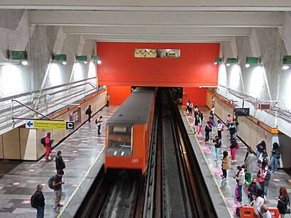
Metro Tacuba Address: Calzada México - Tacuba street in Tultitlán
Attractions near Metro Tacuba
Comedor Tacuba STC(Metro),Puesto de Filetes de Pescado El Filetillo,Unidad Tacuba,calzada mexico tacuba 815,Moneygram,Nacional Monte de Piedad Ciudad de México 317,Calzada México-Tacuba 785,Super Tortas Gigantes,Juguetes,Departamento en Golfo de San Lorenzo Tacuba Cdmx,Oxxo,Calzada Mexico - Tacuba - Calz. Legaria,Calz. Legaria - Calzada Mexico - Tacuba,Calzada México Tacuba Calzada Legaria,Puesto de Antojitos Mexicanos,Calzada Mexico - Tacuba - Av. Azcapotzalco,Av. Azcapotzalco - Calzada Mexico - Tacuba,Paleteria Real Michoacana,Escuela de Baile Los Ángeles,Pastes VictoriaHow to get to popular attractions in Tultitlán with public transit
LG Electronics, Cuautitlán Izcalli,Starbucks, Cuautitlán Izcalli,Starbucks, Atizapán De Zaragoza,Nokia Solutions & Networks, Cuautitlán Izcalli,Lomas de Padierna, Alvaro Obregón,Piantao, Alvaro Obregón,Terminal Central del Norte, Azcapotzalco,RCI Latinoamérica, Naucalpan De Juárez,Chedraui, Coyoacán,Perisur, Alvaro Obregón,Corporativo Atlas, Naucalpan De Juárez,Centro de Distribucion Comex Perinorte / Kroma, Cuautitlán Izcalli,Palacio de Bellas Artes, Azcapotzalco,Johnny Rockets, Naucalpan De Juárez,Walmart, Huixquilucan,San Andrés Totoltepec, Alvaro Obregón,Centro de Distribucion Comex Crisol, Tepotzotlán,Kimberly-Clark de México, Naucalpan De Juárez,Universidad Del Valle de México, Tultepec,Bar Casa De Piedra, Alvaro ObregónGet around Tultitlán by public transit!
Traveling around Tultitlán has never been so easy. See step by step directions as you travel to any attraction, street or major public transit station. View bus and train schedules, arrival times, service alerts and detailed routes on a map, so you know exactly how to get to anywhere in Tultitlán.
When traveling to any destination around Tultitlán use Moovit's Live Directions with Get Off Notifications to know exactly where and how far to walk, how long to wait for your line, and how many stops are left. Moovit will alert you when it's time to get off — no need to constantly re-check whether yours is the next stop.
Wondering how to use public transit in Tultitlán or how to pay for public transit in Tultitlán? Moovit public transit app can help you navigate your way with public transit easily, and at minimum cost. It includes public transit fees, ticket prices, and costs. Looking for a map of Tultitlán public transit lines? Moovit public transit app shows all public transit maps in Tultitlán with all bus or metro routes and stops on an interactive map.
Tultitlán has 2 transit type(s), including: bus or metro, operated by several transit agencies, including STC (Metro CDMX), Metrobús, RTP, Trolebús elevado, Trolebús, Tren Ligero, Corredores Concesionados, Ferrocarriles Suburbanos, Mexibus, Mexicable, Cablebús, Puma Bus, Peseros and Autobuses / Combis