Metro Tacubaya stop - Wednesday schedule
| Line | Direction | Time |
|---|---|---|
| 115 | Circuito Interior - Metro Chapultepec | 5:08 |
| 115 | Circuito Interior - Metro Chapultepec | 5:08 |
| 115 | Circuito Interior - Metro Chapultepec | 5:23 |
| 115 | Circuito Interior - Metro Chapultepec | 5:23 |
| 115 | Circuito Interior - Metro Chapultepec | 5:38 |
| 115 | Circuito Interior - Metro Chapultepec | 5:38 |
| 115 | Circuito Interior - Metro Chapultepec | 5:53 |
| 115 | Circuito Interior - Metro Chapultepec | 5:53 |
| 115 | Circuito Interior - Metro Chapultepec | 6:08 |
| 115 | Circuito Interior - Metro Chapultepec | 6:08 |
| 115 | Circuito Interior - Metro Chapultepec | 6:23 |
| 115 | Circuito Interior - Metro Chapultepec | 6:23 |
| 115 | Circuito Interior - Metro Chapultepec | 6:38 |
| 115 | Circuito Interior - Metro Chapultepec | 6:53 |
| 115 | Circuito Interior - Metro Chapultepec | 7:08 |
| 115 | Circuito Interior - Metro Chapultepec | 7:23 |
| 115 | Circuito Interior - Metro Chapultepec | 7:38 |
| 115 | Circuito Interior - Metro Chapultepec | 7:53 |
| 115 | Circuito Interior - Metro Chapultepec | 8:08 |
| 115 | Circuito Interior - Metro Chapultepec | 8:23 |
| 115 | Circuito Interior - Metro Chapultepec | 8:38 |
| 115 | Circuito Interior - Metro Chapultepec | 8:53 |
| 115 | Circuito Interior - Metro Chapultepec | 9:08 |
| 115 | Circuito Interior - Metro Chapultepec | 9:23 |
| 115 | Circuito Interior - Metro Chapultepec | 9:38 |
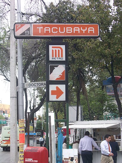
Directions to Metro Tacubaya stop (Miguel Hidalgo) with public transit
The following transit lines have routes that pass near Metro Tacubaya
How to get to Metro Tacubaya stop by bus?
Click on the bus route to see step by step directions with maps, line arrival times and updated time schedules.
How to get to Metro Tacubaya stop by metro?
Click on the metro route to see step by step directions with maps, line arrival times and updated time schedules.
Bus stops near Metro Tacubaya stop in Miguel Hidalgo
- Cierre de Circuito Metro Tacubaya (Cartagena), 1 min walk,
- Tacubaya, 1 min walk,
- Calle Arquitecto Carlos Lazo Tacubaya Miguel Hidalgo Cdmx 11870 México, 1 min walk,
- Av. Jalisco - Metro Tacubaya, 2 min walk,
- Iturbe Y Av. Jalisco, 2 min walk,
- Tacubaya (Base), 2 min walk,
- Tacubaya Miguel Hidalgo Cdmx 11870 México, 2 min walk,
- Tacubaya_1_2, 2 min walk,
- Cetram Tacubaya, 3 min walk,
- Metro Tacubaya, 3 min walk,
- Avenida Jalisco, 215, 4 min walk,
Metro stations near Metro Tacubaya station in Miguel Hidalgo
- Patriotismo, 7 min walk,
- San Pedro de los Pinos, 23 min walk,
- Tacubaya, 26 min walk,
Cable Car stations near Metro Tacubaya station in Miguel Hidalgo
- Los Pinos / Constituyentes, 27 min walk,
Bus lines to Metro Tacubaya stop in Miguel Hidalgo
- RUTA 4, Metro Tacubaya - Col. San Fernando,
- RUTA 4, Metro Tacubaya por Av. Observatorio y Col. Las Tinajas Cuajimalpa por carretera libre México-Toluca,
- RUTA 4, Metro Tacubaya - Huixquilucan,
- RUTA 5, Metro Tacubaya por Av. Jalisco y Centro comercial santa rosa por Av. Santa Fe,
- RUTA 5, Metro Tacubaya por Av. Jalisco y Col. La loma por Av. Vasco de Quiroga,
- RUTA 15, Metro Tacubaya por Av. Camino Real y Col. Santa Lucía por Av. Alta tensión,
- RUTA 24, Metro Tacubaya por Av. Jalisco y Vocacional 4 por Av. Constituyentes,
- RUTA 27, Metro Tacubaya por Av. Revolución y Col. Barrio Norte por Prolongación San Antonio,
- RUTA 46, Metro Tacubaya- Piloto,
- RUTA 46, Metro Tacubaya por Av. Viaducto y Col. Jalalpa las torres por Av. Gustavo Días Ortiz,
- RUTA 46, Metro Tacubaya por Av. Revolución y Col. Piloto Capula por Av. Días Ordaz,
- RUTA 46, Metro Tacubaya - Piru,
- RUTA 98, Metro Tacubaya - Av. Lago de Guadalupe,
- Z2I, Metro Tacubaya - Cehuayo,
- Z2J, Metro Tacubaya - Tepeaca,
- 2, Tepalcates - Tacubaya,
- 12, Tren Suburbano Tlalnepantla,
- RUTA 23, Tacuba,
- 160, Ejercito,
- METRO AEROPUERTO - METRO TACUBAYA, Metro Aeropuerto - Metro Tacubaya,
What are the closest stations to Metro Tacubaya?
The closest stations to Metro Tacubaya are:
- Cierre de Circuito Metro Tacubaya (Cartagena) is 21 meters away, 1 min walk.
- Tacubaya is 35 meters away, 1 min walk.
- Calle Arquitecto Carlos Lazo Tacubaya Miguel Hidalgo Cdmx 11870 México is 59 meters away, 1 min walk.
- Av. Jalisco - Metro Tacubaya is 78 meters away, 2 min walk.
- Iturbe Y Av. Jalisco is 88 meters away, 2 min walk.
- Tacubaya (Base) is 123 meters away, 2 min walk.
- Tacubaya Miguel Hidalgo Cdmx 11870 México is 129 meters away, 2 min walk.
- Tacubaya_1_2 is 142 meters away, 2 min walk.
- Cetram Tacubaya is 152 meters away, 3 min walk.
- Metro Tacubaya is 161 meters away, 3 min walk.
- Avenida Jalisco, 215 is 234 meters away, 4 min walk.
- Patriotismo is 541 meters away, 7 min walk.
- San Pedro de los Pinos is 1744 meters away, 23 min walk.
- Los Pinos / Constituyentes is 2063 meters away, 27 min walk.
Which bus lines stop near Metro Tacubaya?
These bus lines stop near Metro Tacubaya: 2, 252, 9E, RUTA 46, RUTA 80.
Which metro lines stop near Metro Tacubaya?
These metro lines stop near Metro Tacubaya: 1, 7, 9.
What’s the nearest metro station to Metro Tacubaya in Miguel Hidalgo?
The nearest metro station to Metro Tacubaya in Miguel Hidalgo is Patriotismo. It’s a 7 min walk away.
What’s the nearest bus stop to Metro Tacubaya in Miguel Hidalgo?
The nearest bus stops to Metro Tacubaya in Miguel Hidalgo are Cierre de Circuito Metro Tacubaya (Cartagena), Tacubaya and Calle Arquitecto Carlos Lazo Tacubaya Miguel Hidalgo Cdmx 11870 México. The closest one is a 1 min walk away.
What’s the nearest cable car station to Metro Tacubaya in Miguel Hidalgo?
The nearest cable car station to Metro Tacubaya in Miguel Hidalgo is Los Pinos / Constituyentes. It’s a 27 min walk away.
What time is the first metro to Metro Tacubaya in Miguel Hidalgo?
The 9 is the first metro that goes to Metro Tacubaya in Miguel Hidalgo. It stops nearby at 5:00 AM.
What time is the last metro to Metro Tacubaya in Miguel Hidalgo?
The 9 is the last metro that goes to Metro Tacubaya in Miguel Hidalgo. It stops nearby at 12:27 AM.
What time is the first bus to Metro Tacubaya in Miguel Hidalgo?
The 115 is the first bus that goes to Metro Tacubaya in Miguel Hidalgo. It stops nearby at 3:13 AM.
What time is the last bus to Metro Tacubaya in Miguel Hidalgo?
The 115 is the last bus that goes to Metro Tacubaya in Miguel Hidalgo. It stops nearby at 2:58 AM.
What time is the first cable car to Metro Tacubaya in Miguel Hidalgo?
The L3 is the first cable car that goes to Metro Tacubaya in Miguel Hidalgo. It stops nearby at 5:00 AM.
What time is the last cable car to Metro Tacubaya in Miguel Hidalgo?
The L3 is the last cable car that goes to Metro Tacubaya in Miguel Hidalgo. It stops nearby at 11:15 PM.
See Metro Tacubaya stop, Miguel Hidalgo, on the map
Public transit to Metro Tacubaya stop in Miguel Hidalgo
Looking for directions to Metro Tacubaya in Miguel Hidalgo, México?
Download the Moovit App to find the current schedule and step-by-step directions for Bus or Metro routes that pass through Metro Tacubaya.
Looking for the nearest stops closest to Metro Tacubaya ? Check out this list of closest stops to your destination: Cierre de Circuito Metro Tacubaya (Cartagena); Tacubaya; Calle Arquitecto Carlos Lazo Tacubaya Miguel Hidalgo Cdmx 11870 México; Av. Jalisco - Metro Tacubaya; Iturbe Y Av. Jalisco; Tacubaya (Base); Tacubaya Miguel Hidalgo Cdmx 11870 México; Tacubaya_1_2; Cetram Tacubaya; Metro Tacubaya; Avenida Jalisco; Patriotismo; San Pedro de los Pinos; Los Pinos / Constituyentes.
Bus: 2, 252, 9E, RUTA 46, RUTA 80, RUTA 4, RUTA 4, RUTA 4, RUTA 5, RUTA 5.Metro: 1, 7, 9.Cable Car: L3.
We make riding on public transit to Metro Tacubaya easy, which is why over 1.5 million users, including users in Miguel Hidalgo trust Moovit as the best app for public transit.
Use the app to navigate to popular places including to the airport, hospital, stadium, grocery store, mall, coffee shop, school, college, and university.
The first line to this stop is 115, at 5:08, and the last line is 115 at 4:53.
This stop serves RTP’s lines
Bus stops near Metro Tacubaya stop
Cable Car station near Metro Tacubaya station
Popular public transit stations in Miguel Hidalgo
Get around Miguel Hidalgo by public transit!
Traveling around Miguel Hidalgo has never been so easy. See step by step directions as you travel to any attraction, street or major public transit station. View bus and train schedules, arrival times, service alerts and detailed routes on a map, so you know exactly how to get to anywhere in Miguel Hidalgo.
When traveling to any destination around Miguel Hidalgo use Moovit's Live Directions with Get Off Notifications to know exactly where and how far to walk, how long to wait for your line, and how many stops are left. Moovit will alert you when it's time to get off — no need to constantly re-check whether yours is the next stop.
Wondering how to use public transit in Miguel Hidalgo or how to pay for public transit in Miguel Hidalgo? Moovit public transit app can help you navigate your way with public transit easily, and at minimum cost. It includes public transit fees, ticket prices, and costs. Looking for a map of Miguel Hidalgo public transit lines? Moovit public transit app shows all public transit maps in Miguel Hidalgo with all Bus, Train, Metro, Cable Car and Gondola routes and stops on an interactive map.
Ciudad de Mexico has 5 transit type(s), including: Bus, Train, Metro, Cable Car and Gondola, operated by several transit agencies, including STC (Metro CDMX), Ferrocarriles Suburbanos, Trolebús, Puma Bus, Mexibus, Autobuses / Combis, Tren Ligero, Mexicable, Peseros, Cablebús, Trolebús elevado, Corredores Concesionados, RTP, Metrobús and Tren El Insurgente