Directions to Metropolitan District Commission Pumping House (Stoneham) with public transportation
The following transit lines have routes that pass near Metropolitan District Commission Pumping House
 Bus: 101, 132, 99.
- Train: HAVERHILL, ORANGE LINE.
- Subway: ORANGE LINE.
How to get to Metropolitan District Commission Pumping House by bus?
Click on the bus route to see step by step directions with maps, line arrival times and updated time schedules.
From Boston North Station, Boston
73 minFrom Inman Square, Cambridge
87 minFrom Ac Hotel Cambridge, Cambridge
153 minFrom Davis Sq, Somerville
60 minFrom KNL, Cambridge
74 minFrom Sanofi-aventis, Cambridge
80 minFrom 7F Everett Street, Revere
68 minFrom Central Square, Cambridge
89 minFrom East Boston, Boston
88 minFrom Reelhouse, Boston
89 min
How to get to Metropolitan District Commission Pumping House by train?
Click on the train route to see step by step directions with maps, line arrival times and updated time schedules.
How to get to Metropolitan District Commission Pumping House by subway?
Click on the subway route to see step by step directions with maps, line arrival times and updated time schedules.
From Boston North Station, Boston
60 minFrom Inman Square, Cambridge
80 minFrom Ac Hotel Cambridge, Cambridge
94 minFrom Davis Sq, Somerville
85 minFrom KNL, Cambridge
80 minFrom Sanofi-aventis, Cambridge
78 minFrom 7F Everett Street, Revere
90 minFrom Central Square, Cambridge
71 minFrom East Boston, Boston
77 minFrom Reelhouse, Boston
75 min
Bus stops near Metropolitan District Commission Pumping House in Stoneham
Train station near Metropolitan District Commission Pumping House in Stoneham
- Oak Grove, 30 min walk,VIEW
Bus lines to Metropolitan District Commission Pumping House in Stoneham
What are the closest stations to Metropolitan District Commission Pumping House?
The closest stations to Metropolitan District Commission Pumping House are:
- Wyoming Ave @ Ravine Rd is 334 yards away, 4 min walk.
- 3 Woodland Rd is 1552 yards away, 19 min walk.
- Oak Grove is 2515 yards away, 30 min walk.
Which bus lines stop near Metropolitan District Commission Pumping House?
These bus lines stop near Metropolitan District Commission Pumping House: 101, 132, 99.
Which train line stops near Metropolitan District Commission Pumping House?
HAVERHILL (#223 | Haverhill)
Which subway line stops near Metropolitan District Commission Pumping House?
ORANGE LINE (Oak Grove)
What’s the nearest train station to Metropolitan District Commission Pumping House in Stoneham?
The nearest train station to Metropolitan District Commission Pumping House in Stoneham is Oak Grove. It’s a 30 min walk away.
What’s the nearest bus station to Metropolitan District Commission Pumping House in Stoneham?
The nearest bus station to Metropolitan District Commission Pumping House in Stoneham is Wyoming Ave @ Ravine Rd. It’s a 4 min walk away.
What time is the first subway to Metropolitan District Commission Pumping House in Stoneham?
The ORANGE LINE is the first subway that goes to Metropolitan District Commission Pumping House in Stoneham. It stops nearby at 5:15 AM.
What time is the last subway to Metropolitan District Commission Pumping House in Stoneham?
The ORANGE LINE is the last subway that goes to Metropolitan District Commission Pumping House in Stoneham. It stops nearby at 1:59 AM.
What time is the first train to Metropolitan District Commission Pumping House in Stoneham?
The HAVERHILL is the first train that goes to Metropolitan District Commission Pumping House in Stoneham. It stops nearby at 5:35 AM.
What time is the last train to Metropolitan District Commission Pumping House in Stoneham?
The HAVERHILL is the last train that goes to Metropolitan District Commission Pumping House in Stoneham. It stops nearby at 11:53 PM.
What time is the first bus to Metropolitan District Commission Pumping House in Stoneham?
The 132 is the first bus that goes to Metropolitan District Commission Pumping House in Stoneham. It stops nearby at 5:36 AM.
What time is the last bus to Metropolitan District Commission Pumping House in Stoneham?
The 99 is the last bus that goes to Metropolitan District Commission Pumping House in Stoneham. It stops nearby at 1:47 AM.
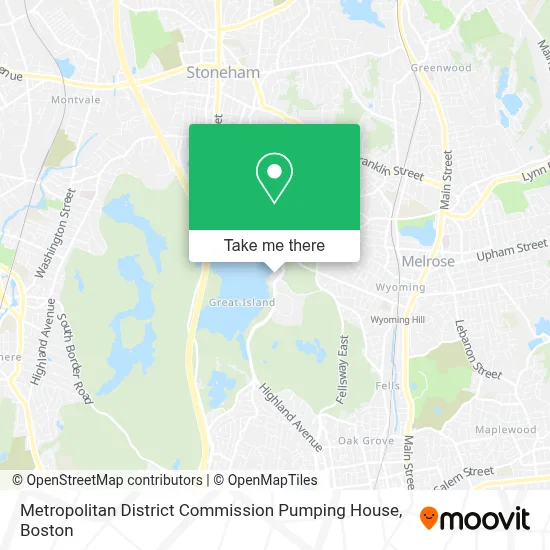
See Metropolitan District Commission Pumping House, Stoneham, on the map
Public Transit to Metropolitan District Commission Pumping House in Stoneham
Wondering how to get to Metropolitan District Commission Pumping House in Stoneham? Moovit helps you find the best way to get to Metropolitan District Commission Pumping House with step-by-step directions from the nearest public transit station.
Moovit provides free maps and live directions to help you navigate through your city. View schedules, routes, timetables, and find out how long does it take to get to Metropolitan District Commission Pumping House in real time.
Looking for the nearest stop or station to Metropolitan District Commission Pumping House? Check out this list of stops closest to your destination: Wyoming Ave @ Ravine Rd; 3 Woodland Rd; Oak Grove.
Bus: 101, 132, 99.Train: HAVERHILL, ORANGE LINE.Subway: ORANGE LINE.
Want to see if there’s another route that gets you there at an earlier time? Moovit helps you find alternative routes or times. Get directions from and directions to Metropolitan District Commission Pumping House easily from the Moovit App or Website.
We make riding to Metropolitan District Commission Pumping House easy, which is why over 1.7 million users, including users in Stoneham, trust Moovit as the best app for public transit. You don’t need to download an individual bus app or train app, Moovit is your all-in-one transit app that helps you find the best bus time or train time available.
For information on prices of bus, subway and train, costs and ride fares to Metropolitan District Commission Pumping House, please check the Moovit app.
Use the app to navigate to popular places including to the airport, hospital, stadium, grocery store, mall, coffee shop, school, college, and university.
Metropolitan District Commission Pumping House Address: Woodland Rd street in Stoneham
- Alta Clara at the Fells,
- Super Petroleum,
- DUNKIN',
- SuperPumper,
- Spot Pond,
- Stone Zoo,
- White Cheeked Gibbon,
- Snow Leopards,
- Mexican Gray Wolf,
- Charron & Flaws,
- JMS Masonry & Restoration,
- Melrose Historical Society,
- Straw Point,
- Ann Casey,
- Middlesex Fells Reservation,
- Sheepfold Parking,
- Rug Cleaning Near Me,
- Stoneham Pool,
- Jornal dos Sports,
- Find A Plumbers
Places Near Metropolitan District Commission Pumping House (Stoneham)
- Wilbur Theatre, Boston,
- House Of Blues, Boston,
- Castle Island, Boston,
- Boston Medical Center, Boston,
- Prudential Center, Boston,
- Museum Of Science, Boston,
- Boston Common, Boston,
- Quincy Market, Boston,
- Td Garden, Boston,
- Isabella Stewart Gardner Museum, Boston,
- Cheers, Boston,
- Boston Convention & Exhibition Center, Boston,
- Wang Theater, Boston,
- Boston Children's Hospital, Boston,
- Massachusetts General Hospital, Boston,
- Mgm Music Hall, Boston,
- North End, Boston,
- Seaport District, Boston,
- Leader Bank Pavilion (Leader Bank Pavillion), Boston,
- Faneuil Hall, Boston
How to get to popular places in Boston with public transit
Get around Stoneham by public transit!
Traveling around Stoneham has never been so easy. See step by step directions as you travel to any attraction, street or major public transit station. View bus and train schedules, arrival times, service alerts and detailed routes on a map, so you know exactly how to get to anywhere in Stoneham.
When traveling to any destination around Stoneham use Moovit's Live Directions with Get Off Notifications to know exactly where and how far to walk, how long to wait for your line, and how many stops are left. Moovit will alert you when it's time to get off — no need to constantly re-check whether yours is the next stop.
Wondering how to use public transit in Stoneham or how to pay for public transit in Stoneham? Moovit public transit app can help you navigate your way with public transit easily, and at minimum cost. It includes public transit fees, ticket prices, and costs. Looking for a map of Stoneham public transit lines? Moovit public transit app shows all public transit maps in Stoneham with all Bus, Train, Subway and Ferry routes and stops on an interactive map.
Boston has 4 transit type(s), including: Bus, Train, Subway and Ferry, operated by several transit agencies, including MBTA, Southeastern Regional Transit Authority, MetroWest Regional Transit Authority, Rhode Island Public Transit Authority, WRTA, Lowell Regional Transit Authority, Merrimack Valley Transit, Montachusett Regional Transit Authority, Cape Cod Regional Transit Authority, Brockton Area Transit Authority, Martha's Vineyard Transit Authority, the WAVE - Nantucket Regional Transit Authority, GATRA, Cape Ann Transportation Authority and Massport