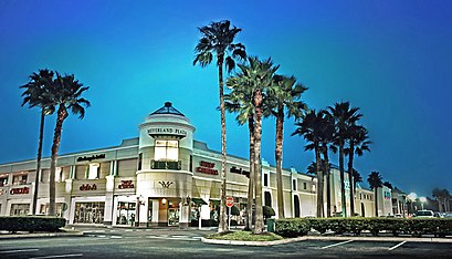
Directions to Meyerland (Houston) with public transportation
The following transit lines have routes that pass near Meyerland
How to get to Meyerland by bus?
Click on the bus route to see step by step directions with maps, line arrival times and updated time schedules.
Bus stations near Meyerland in Houston
- Hillcroft Ave @ Beechnut St,3 min walk,
- Beechnut St @ Hillcroft Ave,5 min walk,
- Renwick Dr @ Imogene St,8 min walk,
Bus lines to Meyerland in Houston
- 47,Northwest Tc - Northbound,
- 4,Eastwood Tc - Eastbound,
- 32,Downtown - Eastbound,
What are the closest stations to Meyerland?
The closest stations to Meyerland are:
- Hillcroft Ave @ Beechnut St is 233 yards away, 3 min walk.
- Beechnut St @ Hillcroft Ave is 343 yards away, 5 min walk.
- Renwick Dr @ Imogene St is 652 yards away, 8 min walk.
Which bus lines stop near Meyerland?
These bus lines stop near Meyerland: 4, 47, 68.
What’s the nearest bus stop to Meyerland in Houston?
The nearest bus stop to Meyerland in Houston is Hillcroft Ave @ Beechnut St. It’s a 3 min walk away.
What time is the first bus to Meyerland in Houston?
The 4 is the first bus that goes to Meyerland in Houston. It stops nearby at 5:07 AM.
What time is the last bus to Meyerland in Houston?
The 4 is the last bus that goes to Meyerland in Houston. It stops nearby at 1:30 AM.
How much is the light rail fare to Meyerland?
The light rail fare to Meyerland costs about $1.25.
How much is the bus fare to Meyerland?
The bus fare to Meyerland costs about $1.25.
See Meyerland, Houston, on the map
Public Transit to Meyerland in Houston
Wondering how to get to Meyerland in Houston, United States? Moovit helps you find the best way to get to Meyerland with step-by-step directions from the nearest public transit station.
Moovit provides free maps and live directions to help you navigate through your city. View schedules, routes, timetables, and find out how long does it take to get to Meyerland in real time.
Looking for the nearest stop or station to Meyerland? Check out this list of stops closest to your destination: Hillcroft Ave @ Beechnut St; Beechnut St @ Hillcroft Ave; Renwick Dr @ Imogene St.
Bus:4476832
Want to see if there’s another route that gets you there at an earlier time? Moovit helps you find alternative routes or times. Get directions from and directions to Meyerland easily from the Moovit App or Website.
We make riding to Meyerland easy, which is why over 1.5 million users, including users in Houston, trust Moovit as the best app for public transit. You don’t need to download an individual bus app or train app, Moovit is your all-in-one transit app that helps you find the best bus time or train time available.
For information on prices of bus and light rail, costs and ride fares to Meyerland, please check the Moovit app.
Use the app to navigate to popular places including to the airport, hospital, stadium, grocery store, mall, coffee shop, school, college, and university.
Meyerland Address: Jackwood Street street in Houston
Attractions near Meyerland
Meyerland Section 10,Gary L. Herod Elementary School,Dominion Investor Services,Kids Haven (A1-Kids Connect),Jason St,Olympic Karate & Sport Center (Kid Karate Class Summer Hours),Asbestos & Mold Services,UPS Access Point Location,Kingsway Garage Door Services,ATM,MoneyGram,Beechnut St @ Mullins Dr,Aan Solution,Renwick Dr @ Beechnut St,7925 Rampart St,Red Saver Coupons,Accountable Source,Barber Shop,The Tin Man (The Tin Ceiling Company with A Heart),Digital Marketing and WebsitesHow to get to popular attractions in Houston with public transit
290, Houston,TC Jester & Beltway 8,FM 1960 at Kuykendahl, Houston,Burlington Coat Factory, Houston,UH-Downtown Academic Building, Houston,KIPP Liberation College Preparatory, Houston,Shell OTM, Houston,Intersection of I-10 and N Wayside Dr, Houston,Cinemark 19 And XD, Houston,288 South Freeway and Airport Blvd., Houston,Ross Dress for Less, Houston,METRO Cypress Park & Ride,Bellaire Blvd. & Beltway 8, Houston,Park At Voss Apartments, Houston,Texas Children's Hospital Garage 19, Houston,Food Town, Houston,Buca di Beppo Italian Restaurant, Houston,Westheimer & Beltway 8, Houston,Post Oak Blvd, Houston,Intersection of I-45 and W Little York Rd, HoustonGet around Houston by public transit!
Traveling around Houston has never been so easy. See step by step directions as you travel to any attraction, street or major public transit station. View bus and train schedules, arrival times, service alerts and detailed routes on a map, so you know exactly how to get to anywhere in Houston.
When traveling to any destination around Houston use Moovit's Live Directions with Get Off Notifications to know exactly where and how far to walk, how long to wait for your line, and how many stops are left. Moovit will alert you when it's time to get off — no need to constantly re-check whether yours is the next stop.
Wondering how to use public transit in Houston or how to pay for public transit in Houston? Moovit public transit app can help you navigate your way with public transit easily, and at minimum cost. It includes public transit fees, ticket prices, and costs. Looking for a map of Houston public transit lines? Moovit public transit app shows all public transit maps in Houston with all bus or light rail routes and stops on an interactive map.
Houston has 2 transit type(s), including: bus or light rail, operated by several transit agencies, including METRO, METRO, Greyhound-us, FlixBus-us and Megabus