Directions to Mgh Pediatric Group Practice (Boston) with public transportation
The following transit lines have routes that pass near Mgh Pediatric Group Practice
 Bus: 354, 43, 504, 92, EZRIDE.
- Train: FAIRMOUNT, HAVERHILL, FITCHBURG, LOWELL, NEWBURYPORT/ROCKPORT.
- Subway: GREEN LINE D, GREEN LINE E, ORANGE LINE, RED LINE, BLUE LINE.
How to get to Mgh Pediatric Group Practice by bus?
Click on the bus route to see step by step directions with maps, line arrival times and updated time schedules.
From Staybridge Suites Boston-Quincy, Quincy
110 minFrom Heartbreak Hill, Newton
56 minFrom Melrose, MA, Melrose
72 minFrom MBTA / Alewife #6, Cambridge
83 minFrom The Mall At Chestnut Hill, Newton
90 minFrom Codman Square, Boston
72 minFrom Wollaston Beach, Quincy
134 minFrom Chevalier Theater, Medford
36 minFrom Medford, MA, Medford
52 minFrom Best Western Adams Inn Quincy - Boston, Quincy
101 min
How to get to Mgh Pediatric Group Practice by train?
Click on the train route to see step by step directions with maps, line arrival times and updated time schedules.
How to get to Mgh Pediatric Group Practice by subway?
Click on the subway route to see step by step directions with maps, line arrival times and updated time schedules.
From Staybridge Suites Boston-Quincy, Quincy
35 minFrom Heartbreak Hill, Newton
62 minFrom MBTA / Alewife #6, Cambridge
27 minFrom The Mall At Chestnut Hill, Newton
69 minFrom Codman Square, Boston
43 minFrom Wollaston Beach, Quincy
52 minFrom Chevalier Theater, Medford
50 minFrom Medford, MA, Medford
43 minFrom Best Western Adams Inn Quincy - Boston, Quincy
45 min
Bus stops near Mgh Pediatric Group Practice in Boston
- Tremont St @ Beacon St, 2 min walk,VIEW
- Charles/Mgh - Cambridge St @ Lindall Pl, 5 min walk,VIEW
- Congress St @ Sudbury St, 6 min walk,VIEW
- North Station - Lomasney Way @ Causeway St, 7 min walk,VIEW
- North Station - Nashua St @ Red Auerbach Way, 7 min walk,VIEW
- Government Center - Cambridge St @ Sudbury St, 8 min walk,VIEW
- Cambridge St @ Government Ctr Sta, 9 min walk,VIEW
- Beacon St Opp Walnut St, 10 min walk,VIEW
- North Station, 10 min walk,VIEW
Subway stations near Mgh Pediatric Group Practice in Boston
Train station near Mgh Pediatric Group Practice in Boston
- North Station, 9 min walk,VIEW
Bus lines to Mgh Pediatric Group Practice in Boston
- 15, Mattapan Via Nubian & Fields Corner,VIEW
- 39, Forest Hills,VIEW
- 57, Watertown Via Kenmore,VIEW
- RED LINE SHUTTLE, Harvard - JFK/UMass via Congress Street,VIEW
- RED LINE SHUTTLE, Alewife - Park Street,VIEW
- RED LINE SHUTTLE, Harvard - Broadway,VIEW
- RED LINE SHUTTLE, Kendall/MIT - Park Street,VIEW
- RED LINE SHUTTLE, Kendall/MIT - JFK/UMass,VIEW
- RED LINE SHUTTLE, Kendall/MIT - Broadway via Pearl Street,VIEW
- RED LINE SHUTTLE, Harvard - JFK/UMass via State Street,VIEW
- RED LINE SHUTTLE, Harvard - South Station,VIEW
- RED LINE SHUTTLE, JFK/UMass - Kendall/MIT (Shuttle),VIEW
- RED LINE SHUTTLE, Harvard - Park Street,VIEW
- RED LINE SHUTTLE, Kendall/MIT - Broadway via Downtown Crossing,VIEW
- 4, Design Center,VIEW
- 92, Downtown,VIEW
- 93, Downtown Via Navy Yard,VIEW
- GREEN LINE SHUTTLE, Union Square (Shuttle),VIEW
- GREEN LINE SHUTTLE, Medford/Tufts Via Union Square (Shuttle),VIEW
- GREEN LINE E SHUTTLE, Medford/Tufts (Shuttle),VIEW
What are the closest stations to Mgh Pediatric Group Practice?
The closest stations to Mgh Pediatric Group Practice are:
- Tremont St @ Beacon St is 94 yards away, 2 min walk.
- Government Center is 284 yards away, 4 min walk.
- Charles/Mgh - Cambridge St @ Lindall Pl is 384 yards away, 5 min walk.
- Congress St @ Sudbury St is 398 yards away, 6 min walk.
- Charles/Mgh is 519 yards away, 7 min walk.
- North Station - Lomasney Way @ Causeway St is 553 yards away, 7 min walk.
- North Station - Nashua St @ Red Auerbach Way is 575 yards away, 7 min walk.
- Government Center - Cambridge St @ Sudbury St is 606 yards away, 8 min walk.
- North Station is 670 yards away, 9 min walk.
- Cambridge St @ Government Ctr Sta is 721 yards away, 9 min walk.
- Causeway St (East) is 751 yards away, 9 min walk.
- Beacon St Opp Walnut St is 774 yards away, 10 min walk.
Which bus lines stop near Mgh Pediatric Group Practice?
These bus lines stop near Mgh Pediatric Group Practice: 354, 43, 504, 92, EZRIDE, SL4, SL5.
Which train lines stop near Mgh Pediatric Group Practice?
These train lines stop near Mgh Pediatric Group Practice: FAIRMOUNT, HAVERHILL.
Which subway lines stop near Mgh Pediatric Group Practice?
These subway lines stop near Mgh Pediatric Group Practice: GREEN LINE D, GREEN LINE E, ORANGE LINE, RED LINE.
What’s the nearest subway station to Mgh Pediatric Group Practice in Boston?
The nearest subway station to Mgh Pediatric Group Practice in Boston is Government Center. It’s a 4 min walk away.
What’s the nearest train station to Mgh Pediatric Group Practice in Boston?
The nearest train station to Mgh Pediatric Group Practice in Boston is North Station. It’s a 9 min walk away.
What’s the nearest bus station to Mgh Pediatric Group Practice in Boston?
The nearest bus station to Mgh Pediatric Group Practice in Boston is Tremont St @ Beacon St. It’s a 2 min walk away.
What time is the first subway to Mgh Pediatric Group Practice in Boston?
The GREEN LINE E is the first subway that goes to Mgh Pediatric Group Practice in Boston. It stops nearby at 5:01 AM.
What time is the last subway to Mgh Pediatric Group Practice in Boston?
The GREEN LINE E is the last subway that goes to Mgh Pediatric Group Practice in Boston. It stops nearby at 2:24 AM.
What time is the first train to Mgh Pediatric Group Practice in Boston?
The LOWELL is the first train that goes to Mgh Pediatric Group Practice in Boston. It stops nearby at 5:20 AM.
What time is the last train to Mgh Pediatric Group Practice in Boston?
The LOWELL is the last train that goes to Mgh Pediatric Group Practice in Boston. It stops nearby at 12:34 AM.
What time is the first bus to Mgh Pediatric Group Practice in Boston?
The 57 is the first bus that goes to Mgh Pediatric Group Practice in Boston. It stops nearby at 5:07 AM.
What time is the last bus to Mgh Pediatric Group Practice in Boston?
The 116 is the last bus that goes to Mgh Pediatric Group Practice in Boston. It stops nearby at 1:58 AM.
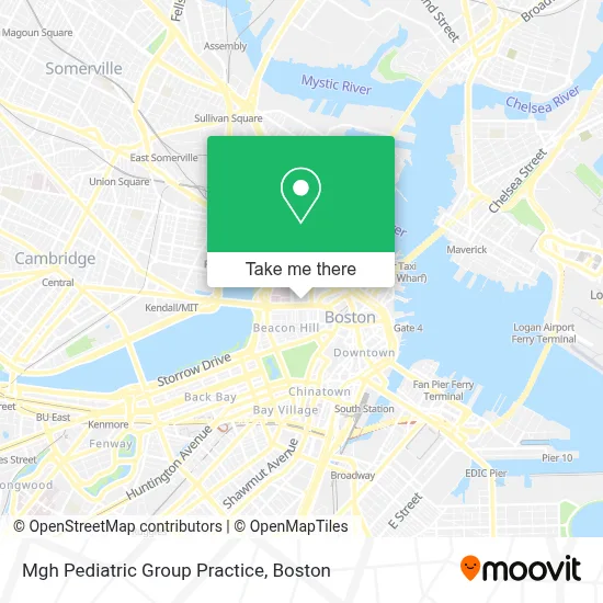
See Mgh Pediatric Group Practice, Boston, on the map
Public Transit to Mgh Pediatric Group Practice in Boston
Wondering how to get to Mgh Pediatric Group Practice in Boston? Moovit helps you find the best way to get to Mgh Pediatric Group Practice with step-by-step directions from the nearest public transit station.
Moovit provides free maps and live directions to help you navigate through your city. View schedules, routes, timetables, and find out how long does it take to get to Mgh Pediatric Group Practice in real time.
Looking for the nearest stop or station to Mgh Pediatric Group Practice? Check out this list of stops closest to your destination: Tremont St @ Beacon St; Government Center; Charles/Mgh - Cambridge St @ Lindall Pl; Congress St @ Sudbury St; Charles/Mgh; North Station - Lomasney Way @ Causeway St; North Station - Nashua St @ Red Auerbach Way; Government Center - Cambridge St @ Sudbury St; North Station; Cambridge St @ Government Ctr Sta; Causeway St (East); Beacon St Opp Walnut St.
Bus: 354, 43, 504, 92, EZRIDE, SL4, SL5, 15, 39, 57, RED LINE SHUTTLE, RED LINE SHUTTLE, RED LINE SHUTTLE, RED LINE SHUTTLE, RED LINE SHUTTLE.Train: FAIRMOUNT, HAVERHILL, FITCHBURG, LOWELL, NEWBURYPORT/ROCKPORT, DOWNEASTER.Subway: GREEN LINE D, GREEN LINE E, ORANGE LINE, RED LINE, BLUE LINE, GREEN LINE B, GREEN LINE C, HAVERHILL LINE SHUTTLE, HAVERHILL LINE SHUTTLE, LOWELL LINE SHUTTLE, LOWELL LINE SHUTTLE, NEWBURYPORT/ROCKPORT LINE SHUTTLE.
Want to see if there’s another route that gets you there at an earlier time? Moovit helps you find alternative routes or times. Get directions from and directions to Mgh Pediatric Group Practice easily from the Moovit App or Website.
We make riding to Mgh Pediatric Group Practice easy, which is why over 1.7 million users, including users in Boston, trust Moovit as the best app for public transit. You don’t need to download an individual bus app or train app, Moovit is your all-in-one transit app that helps you find the best bus time or train time available.
For information on prices of bus, subway and train, costs and ride fares to Mgh Pediatric Group Practice, please check the Moovit app.
Use the app to navigate to popular places including to the airport, hospital, stadium, grocery store, mall, coffee shop, school, college, and university.
Mgh Pediatric Group Practice Address: 165 Cambridge St, Floor 2 Ste 460 street in Boston
- MGH,
- Prooptical Boston (Nguyen Baokim Od Pro Optical Boston),
- Charles River Plaza,
- Charles River Plaza Shopping Center,
- MGH Simches Research Building,
- Joy St / Cambridge St,
- MGH 50 Staniford Street 3rd flr,
- KMHW,
- Wyndham Boston Beacon Hill,
- Dental Partners of Boston - Charles River (DPB Charles River),
- Ophthalmic Consultants of Boston,
- Wingate by Wyndham-Beacon Hill,
- Department Of Unemployment Assistance,
- Somewhere on Stanford St,
- Regina Cleri,
- Longfellow Garage (Longfellow Place),
- EV Charging Station,
- Tip Tap Room,
- St Joseph's Rectory (St. Joseph Catholic Church (Roxbury, Massachusetts)),
- Alcott Garage (Propark)
Places Near Mgh Pediatric Group Practice (Boston)
- Mgm Music Hall, Boston,
- Museum Of Science, Boston,
- Faneuil Hall, Boston,
- Massachusetts General Hospital, Boston,
- Boston Convention & Exhibition Center, Boston,
- Isabella Stewart Gardner Museum, Boston,
- Castle Island, Boston,
- Wilbur Theatre, Boston,
- Boston Common, Boston,
- House Of Blues, Boston,
- Boston Medical Center, Boston,
- Boston Children's Hospital, Boston,
- Cheers, Boston,
- Td Garden, Boston,
- Quincy Market, Boston,
- Wang Theater, Boston,
- Prudential Center, Boston,
- North End, Boston,
- Seaport District, Boston,
- Leader Bank Pavilion (Leader Bank Pavillion), Boston
How to get to popular places in Boston with public transit
Get around Boston by public transit!
Traveling around Boston has never been so easy. See step by step directions as you travel to any attraction, street or major public transit station. View bus and train schedules, arrival times, service alerts and detailed routes on a map, so you know exactly how to get to anywhere in Boston.
When traveling to any destination around Boston use Moovit's Live Directions with Get Off Notifications to know exactly where and how far to walk, how long to wait for your line, and how many stops are left. Moovit will alert you when it's time to get off — no need to constantly re-check whether yours is the next stop.
Wondering how to use public transit in Boston or how to pay for public transit in Boston? Moovit public transit app can help you navigate your way with public transit easily, and at minimum cost. It includes public transit fees, ticket prices, and costs. Looking for a map of Boston public transit lines? Moovit public transit app shows all public transit maps in Boston with all Bus, Train, Subway and Ferry routes and stops on an interactive map.
Boston has 4 transit type(s), including: Bus, Train, Subway and Ferry, operated by several transit agencies, including MBTA, Southeastern Regional Transit Authority, MetroWest Regional Transit Authority, Rhode Island Public Transit Authority, WRTA, Lowell Regional Transit Authority, Merrimack Valley Transit, Montachusett Regional Transit Authority, Cape Cod Regional Transit Authority, Brockton Area Transit Authority, Martha's Vineyard Transit Authority, the WAVE - Nantucket Regional Transit Authority, GATRA, Cape Ann Transportation Authority and Massport