See Miami Edison Middle School on the map
Directions to Miami Edison Middle School with public transportation
The following transit lines have routes that pass near Miami Edison Middle School
 Bus:
Bus: - Subway:
How to get to Miami Edison Middle School by bus?
Click on the bus route to see step by step directions with maps, line arrival times and updated time schedules.
How to get to Miami Edison Middle School by subway?
Click on the subway route to see step by step directions with maps, line arrival times and updated time schedules.
Bus stations near Miami Edison Middle School
- Nw 2 Av & Nw 60 St,1 min walk,
- Nw 62 St & Nw 2 Av,2 min walk,
Bus lines to Miami Edison Middle School
- 2,2 - Downtown Miami,
- MIAHAIT,Little Haiti,
- 62,62 - Hialeah Palm Av/W 3 St,
- MIALIB,Liberty City,
What are the closest stations to Miami Edison Middle School?
The closest stations to Miami Edison Middle School are:
- Nw 2 Av & Nw 60 St is 70 yards away, 1 min walk.
- Nw 62 St & Nw 2 Av is 136 yards away, 2 min walk.
Which bus line stops near Miami Edison Middle School?
2
Which subway line stops near Miami Edison Middle School?
GREEN
What’s the nearest bus stop to Miami Edison Middle School?
The nearest bus stop to Miami Edison Middle School is Nw 2 Av & Nw 60 St. It’s a 1 min walk away.
See Miami Edison Middle School on the map
Public Transportation to Miami Edison Middle School
Wondering how to get to Miami Edison Middle School, United States? Moovit helps you find the best way to get to Miami Edison Middle School with step-by-step directions from the nearest public transit station.
Moovit provides free maps and live directions to help you navigate through your city. View schedules, routes, timetables, and find out how long does it take to get to Miami Edison Middle School in real time.
Looking for the nearest stop or station to Miami Edison Middle School? Check out this list of stops closest to your destination: Nw 2 Av & Nw 60 St; Nw 62 St & Nw 2 Av.
Bus:Subway:
Want to see if there’s another route that gets you there at an earlier time? Moovit helps you find alternative routes or times. Get directions from and directions to Miami Edison Middle School easily from the Moovit App or Website.
We make riding to Miami Edison Middle School easy, which is why over 1.5 million users, including users in Miami, trust Moovit as the best app for public transit. You don’t need to download an individual bus app or train app, Moovit is your all-in-one transit app that helps you find the best bus time or train time available.
For information on prices of bus, subway and light rail, costs and ride fares to Miami Edison Middle School, please check the Moovit app.
Use the app to navigate to popular places including to the airport, hospital, stadium, grocery store, mall, coffee shop, school, college, and university.
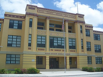
Miami Edison Middle School Address: 6101 NW 2nd Ave street in Miami
Attractions near Miami Edison Middle School
Janet Reno New Chance Alternative Middle School,Miam Edison Middle,Miami - Dade School Police Department,Itech Magnet High School,Itech High School,1,Miami - Dade School Police Department,NW 2 Av & NW 62 St,6195 NW 2nd Ave,Family Grill,Creole Bahamian American Deli,6101 Northwest 2nd Avenue,Auxiladora Dollar Str Big Five,200 Northwest 62nd Street,Zapha Business Center,6160 NW 1st Pl,200 NW 60th St,Chez Rosie Restaurant,National Group Insurance Agency,Cipion AybarHow to get to popular attractions in Miami with public transit
Mizner Park, Boca Raton,The Cheesecake Factory, Boca Raton,Palm Beach State College, Lake Worth,The Home Depot, Fort Lauderdale,The Breakers Palm Beach, West Palm Beach,Target, Deerfield Beach,Pompano Beach Service Plaza, Coral Springs-Margate,Novecento, Miami,Costco Wholesale, Davie,Haulover Beach Park, Miami Beach,The Cheesecake Factory, Miramar-Pembroke Pines,Venetian Pool, Miami,Hunters, Fort Lauderdale,Publix, Fort Lauderdale,The Mall at Wellington Green, Sunshine Parkway,Best Western Plus Miami-Doral / Dolphin Mall, North Westside,Jaxson's Ice Cream Parlour, Restaurant & Country Store, Hollywood,City of Plantation, Plantation,Holiday Inn Express Miami Airport Doral Area, North Westside,Flanigan's Seafood Bar & Grill, North WestsideGet around Miami by public transit!
Traveling around Miami has never been so easy. See step by step directions as you travel to any attraction, street or major public transit station. View bus and train schedules, arrival times, service alerts and detailed routes on a map, so you know exactly how to get to anywhere in Miami.
When traveling to any destination around Miami use Moovit's Live Directions with Get Off Notifications to know exactly where and how far to walk, how long to wait for your line, and how many stops are left. Moovit will alert you when it's time to get off — no need to constantly re-check whether yours is the next stop.
Wondering how to use public transit in Miami or how to pay for public transit in Miami? Moovit public transit app can help you navigate your way with public transit easily, and at minimum cost. It includes public transit fees, ticket prices, and costs. Looking for a map of Miami public transit lines? Moovit public transit app shows all public transit maps in Miami with all bus, subway or light rail routes and stops on an interactive map.
Miami has 3 transit type(s), including: bus, subway or light rail, operated by several transit agencies, including Miami-Dade Transit, Miami-Dade Transit, Miami Dade Transit-Rail, Tri-Rail, Miami-Dade Transit, Broward County Transit, Palm Tran, Brightline, Brightline, MARTY, City of Homestead Trolley, Key West Transit, Treasure Coast Connector, GoLine IRT and Amtrak