Directions to Miami MetroZoo (Kendale Lakes-Tamiami) with public transportation
The following transit lines have routes that pass near Miami MetroZoo
How to get to Miami MetroZoo by bus?
Click on the bus route to see step by step directions with maps, line arrival times and updated time schedules.
Bus stations near Miami MetroZoo in Kendale Lakes-Tamiami
- Sw 184 St & Sw 129 Av, 32 min walk,
- Sw 124 Av & Gold Coast Rr Muse, 43 min walk,
Bus lines to Miami MetroZoo in Kendale Lakes-Tamiami
- 137, 137 - Dolphin Mall Terminal,
- 152, 152 - SW 152 St/152 Av,
What are the closest stations to Miami MetroZoo?
The closest stations to Miami MetroZoo are:
- Sw 184 St & Sw 129 Av is 2625 yards away, 32 min walk.
- Sw 124 Av & Gold Coast Rr Muse is 3703 yards away, 43 min walk.
Which bus line stops near Miami MetroZoo?
137
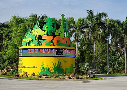
See Miami MetroZoo, Kendale Lakes-Tamiami, on the map
Public Transit to Miami MetroZoo in Kendale Lakes-Tamiami
Wondering how to get to Miami MetroZoo in Kendale Lakes-Tamiami, United States? Moovit helps you find the best way to get to Miami MetroZoo with step-by-step directions from the nearest public transit station.
Moovit provides free maps and live directions to help you navigate through your city. View schedules, routes, timetables, and find out how long does it take to get to Miami MetroZoo in real time.
Looking for the nearest stop or station to Miami MetroZoo? Check out this list of stops closest to your destination: Sw 184 St & Sw 129 Av; Sw 124 Av & Gold Coast Rr Muse.
Bus: 137, 152.
Want to see if there’s another route that gets you there at an earlier time? Moovit helps you find alternative routes or times. Get directions from and directions to Miami MetroZoo easily from the Moovit App or Website.
We make riding to Miami MetroZoo easy, which is why over 1.5 million users, including users in Kendale Lakes-Tamiami, trust Moovit as the best app for public transit. You don’t need to download an individual bus app or train app, Moovit is your all-in-one transit app that helps you find the best bus time or train time available.
For information on prices of bus, costs and ride fares to Miami MetroZoo, please check the Moovit app.
Use the app to navigate to popular places including to the airport, hospital, stadium, grocery store, mall, coffee shop, school, college, and university.
Location: Kendale Lakes-Tamiami, Miami
Attractions near Miami MetroZoo
1,Miami-Dade Zoological Park and Gardens,Komodo Dragon,Asian Otters,Zoo Miami - Asian River Life,Wild Ass,Banteng,Monorail Station 2,Addax,Kaziranga Camp Rhino Encounter,Miami-Dade County,Miami Zoo Monorail,12400 Southwest 152nd Street,Children's Zoo,Great Eland,Wacky Barn,Zebras,American Banker’s Family Aviary, Wings of Asia,Wildlife Carousel,GorillasHow to get to popular attractions in Kendale Lakes-Tamiami with public transit
Costco Wholesale, Boca Raton,The Westin Fort Lauderdale, Fort Lauderdale,Palm Beach Gardens, Jupiter,Palm Beach State College, Lake Worth,Walmart Supercenter, Miami,Lauderdale-By-The-Sea Beach, Fort Lauderdale,Blue Martini Kendall, Kendale Lakes-Tamiami,Miller's Ale House - Miami Doral, North Westside,Walmart Supercenter, Plantation,Regal Cinemas Sawgrass 23 & IMAX, Plantation,Seminole Casino Coconut Creek, Deerfield Beach,Walmart Supercenter, Hallandale Beach,Bru's Room Sports Grill - Coconut Creek, Deerfield Beach,Publix, Miami,The Breakers Palm Beach, West Palm Beach,Sebastian Street Beach, Fort Lauderdale,Whole Foods Market, Boca Raton,The Mall at Wellington Green, Sunshine Parkway,The Diplomat Beach Resort, Hollywood,City of Wilton Manors, Fort LauderdaleGet around Miami by public transit!
Traveling around Miami has never been so easy. See step by step directions as you travel to any attraction, street or major public transit station. View bus and train schedules, arrival times, service alerts and detailed routes on a map, so you know exactly how to get to anywhere in Miami.
When traveling to any destination around Miami use Moovit's Live Directions with Get Off Notifications to know exactly where and how far to walk, how long to wait for your line, and how many stops are left. Moovit will alert you when it's time to get off — no need to constantly re-check whether yours is the next stop.
Wondering how to use public transit in Miami or how to pay for public transit in Miami? Moovit public transit app can help you navigate your way with public transit easily, and at minimum cost. It includes public transit fees, ticket prices, and costs. Looking for a map of Miami public transit lines? Moovit public transit app shows all public transit maps in Miami with all Bus, Train, Subway, Light Rail and Ferry routes and stops on an interactive map.
Miami has 5 transit type(s), including: Bus, Train, Subway, Light Rail and Ferry, operated by several transit agencies, including Miami-Dade Transit, Miami Dade Transit-Rail, Tri-Rail, Broward County Transit, Palm Tran, Brightline, MARTY, City of Homestead Trolley, Key West Transit, Treasure Coast Connector, GoLine IRT, Amtrak, Greyhound-us, Megabus, FlixBus-us