Directions to Miami Shores with public transportation
The following transit lines have routes that pass near Miami Shores
How to get to Miami Shores by bus?
Click on the bus route to see step by step directions with maps, line arrival times and updated time schedules.
Bus stations near Miami Shores
- Ne 96 St & 2 Av, 1 min walk,
- Ne 2 Av & Ne 96 St, 2 min walk,
Bus lines to Miami Shores
- 103, 103 - NE 79 St/Biscayne Blvd,
- 9, 9a - Aventura Mall Terminal Via 171 St,
- MSHEST, Miami Shores Village East,
What are the closest stations to Miami Shores?
The closest stations to Miami Shores are:
- Ne 96 St & 2 Av is 37 yards away, 1 min walk.
- Ne 2 Av & Ne 96 St is 147 yards away, 2 min walk.
Which bus lines stop near Miami Shores?
These bus lines stop near Miami Shores: 10, 33, 9.
What’s the nearest bus stop to Miami Shores?
The nearest bus stop to Miami Shores is Ne 96 St & 2 Av. It’s a 1 min walk away.
See Miami Shores on the map
Public Transportation to Miami Shores
Wondering how to get to Miami Shores, United States? Moovit helps you find the best way to get to Miami Shores with step-by-step directions from the nearest public transit station.
Moovit provides free maps and live directions to help you navigate through your city. View schedules, routes, timetables, and find out how long does it take to get to Miami Shores in real time.
Looking for the nearest stop or station to Miami Shores? Check out this list of stops closest to your destination: Ne 96 St & 2 Av; Ne 2 Av & Ne 96 St.
Bus: 10, 33, 9, 103, MSHEST.
Want to see if there’s another route that gets you there at an earlier time? Moovit helps you find alternative routes or times. Get directions from and directions to Miami Shores easily from the Moovit App or Website.
We make riding to Miami Shores easy, which is why over 1.5 million users, including users in Miami, trust Moovit as the best app for public transit. You don’t need to download an individual bus app or train app, Moovit is your all-in-one transit app that helps you find the best bus time or train time available.
For information on prices of bus and light rail, costs and ride fares to Miami Shores, please check the Moovit app.
Use the app to navigate to popular places including to the airport, hospital, stadium, grocery store, mall, coffee shop, school, college, and university.
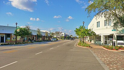
Miami Shores Address: Northeast 96th Street street in Miami
Miami Shores is a village in Miami-Dade County, Florida, United States.Wiki
Attractions near Miami Shores
मायामी शोर्स,میامی شورز، فلوریدا,迈阿密海岸,ميامي شورز,Мајами Шорс,Primal Fit Miami,305 yoga miami shores,Dr. Adam Auster, Podiatry,DermaCosmedics,Dr. Jay G. Stein, MD. , PA,Primal Fit,Miss Moo's Ice Cream Parlor,Mooies Ice Cream Shop,Flower Bar,7,Alvarez & Edmiston MD PA,Miss Jane's Music Studio,Fathers For Equal Rights,Artsy Hive,Real Estate OneHow to get to popular attractions in Miami with public transit
Boca Beach Club, A Waldorf Astoria Resort, Boca Raton,Walmart Supercenter, Hallandale Beach,Deerfield Beach, Deerfield Beach,Buffalo Wild Wings, North Westside,Apple The Galleria, Fort Lauderdale,Target, Fort Lauderdale,Publix, Fort Lauderdale,Bru's Room Sports Grill - Deerfield Beach, Deerfield Beach,The Cheesecake Factory, Miramar-Pembroke Pines,Cinemark Boynton Beach, Boynton Beach-Delray Beach,St. Mary's Medical Center, West Palm Beach,Regal Cinemas Royal Palm Beach 18 RPX, Royal Palm Beach-West Jupiter,Flanigan's Seafood Bar & Grill, North Westside,The Mall at Wellington Green, Sunshine Parkway,Publix, Miami,Walmart Supercenter, Coral Springs-Margate,Costco Wholesale, Pompano Beach,DoubleTree by Hilton Hotel Sunrise - Sawgrass Mills, Plantation,The Cheesecake Factory, North Westside,Aruba Beach Cafe, Fort LauderdaleGet around Miami by public transit!
Traveling around Miami has never been so easy. See step by step directions as you travel to any attraction, street or major public transit station. View bus and train schedules, arrival times, service alerts and detailed routes on a map, so you know exactly how to get to anywhere in Miami.
When traveling to any destination around Miami use Moovit's Live Directions with Get Off Notifications to know exactly where and how far to walk, how long to wait for your line, and how many stops are left. Moovit will alert you when it's time to get off — no need to constantly re-check whether yours is the next stop.
Wondering how to use public transit in Miami or how to pay for public transit in Miami? Moovit public transit app can help you navigate your way with public transit easily, and at minimum cost. It includes public transit fees, ticket prices, and costs. Looking for a map of Miami public transit lines? Moovit public transit app shows all public transit maps in Miami with all Bus, Train, Subway, Light Rail and Ferry routes and stops on an interactive map.
Miami has 5 transit type(s), including: Bus, Train, Subway, Light Rail and Ferry, operated by several transit agencies, including Miami-Dade Transit, Miami Dade Transit-Rail, Tri-Rail, Broward County Transit, Palm Tran, Brightline, MARTY, City of Homestead Trolley, Key West Transit, Treasure Coast Connector, GoLine IRT, Amtrak, Greyhound-us, Megabus, FlixBus-us