Directions to Mice (Cambridge) with public transportation
The following transit lines have routes that pass near Mice
 Bus: 77, 87, 96, 83, RED LINE SHUTTLE.
- Train: FITCHBURG, RED LINE.
- Subway: RED LINE, GREEN LINE B, GREEN LINE C, GREEN LINE E.
How to get to Mice by bus?
Click on the bus route to see step by step directions with maps, line arrival times and updated time schedules.
From Castle Island, Boston
98 minFrom John Hancock Tower, Boston
44 minFrom Amazon Boston, Boston
57 minFrom Uscis Biometrics Office, Revere
76 minFrom Faneuil Hall Marketplace, Boston
60 minFrom The Black Rose, Boston
57 minFrom JFK Federal Building, Boston
44 minFrom Hebrew Rehab Center, Boston
82 minFrom 7F Everett Street, Revere
76 minFrom Comfort Inn & Suites Logan International Airport, Revere
77 min
How to get to Mice by train?
Click on the train route to see step by step directions with maps, line arrival times and updated time schedules.
How to get to Mice by subway?
Click on the subway route to see step by step directions with maps, line arrival times and updated time schedules.
From John Hancock Tower, Boston
34 minFrom Amazon Boston, Boston
37 minFrom Uscis Biometrics Office, Revere
58 minFrom Faneuil Hall Marketplace, Boston
28 minFrom The Black Rose, Boston
29 minFrom JFK Federal Building, Boston
30 minFrom Hebrew Rehab Center, Boston
62 minFrom 7F Everett Street, Revere
57 minFrom Comfort Inn & Suites Logan International Airport, Revere
59 min
Bus stops near Mice in Cambridge
Train station near Mice in Cambridge
- Porter, 3 min walk,VIEW
Subway station near Mice in Cambridge
- Ball Square Station, 20 min walk,VIEW
Bus lines to Mice in Cambridge
- 83, Central Square,VIEW
- RED LINE SHUTTLE, Alewife (Express Shuttle),VIEW
- 77, Harvard - Arlington Heights,VIEW
- 96, Harvard - Medford Square,VIEW
- RED LINE SHUTTLE, Alewife - Park Street,VIEW
- RED LINE SHUTTLE, Alewife - Kendall/MIT,VIEW
- RED LINE SHUTTLE, Alewife - Harvard via Brattle Street,VIEW
- RED LINE SHUTTLE, Alewife - Harvard via Holyoke Street,VIEW
- 87, Arlington Center,VIEW
What are the closest stations to Mice?
The closest stations to Mice are:
- Somerville Ave @ White St (Porter Sq) is 116 yards away, 2 min walk.
- Porter is 178 yards away, 3 min walk.
- Massachusetts Ave @ Porter Red Line Sta is 209 yards away, 3 min walk.
- Elm St @ Hancock St is 211 yards away, 3 min walk.
- Ball Square Station is 1647 yards away, 20 min walk.
Which bus lines stop near Mice?
These bus lines stop near Mice: 77, 87, 96.
Which train line stops near Mice?
FITCHBURG (#409 | Wachusett)
Which subway line stops near Mice?
RED LINE (Alewife)
What’s the nearest subway station to Mice in Cambridge?
The nearest subway station to Mice in Cambridge is Ball Square Station. It’s a 20 min walk away.
What’s the nearest train station to Mice in Cambridge?
The nearest train station to Mice in Cambridge is Porter. It’s a 3 min walk away.
What’s the nearest bus station to Mice in Cambridge?
The nearest bus station to Mice in Cambridge is Somerville Ave @ White St (Porter Sq). It’s a 2 min walk away.
What time is the first subway to Mice in Cambridge?
The GREEN LINE E is the first subway that goes to Mice in Cambridge. It stops nearby at 4:53 AM.
What time is the last subway to Mice in Cambridge?
The GREEN LINE E is the last subway that goes to Mice in Cambridge. It stops nearby at 2:39 AM.
What time is the first train to Mice in Cambridge?
The FITCHBURG is the first train that goes to Mice in Cambridge. It stops nearby at 5:47 AM.
What time is the last train to Mice in Cambridge?
The FITCHBURG is the last train that goes to Mice in Cambridge. It stops nearby at 12:17 AM.
What time is the first bus to Mice in Cambridge?
The 77 is the first bus that goes to Mice in Cambridge. It stops nearby at 5:04 AM.
What time is the last bus to Mice in Cambridge?
The 96 is the last bus that goes to Mice in Cambridge. It stops nearby at 1:30 AM.
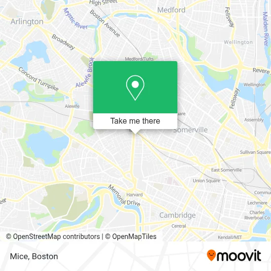
See Mice, Cambridge, on the map
Public Transit to Mice in Cambridge
Wondering how to get to Mice in Cambridge? Moovit helps you find the best way to get to Mice with step-by-step directions from the nearest public transit station.
Moovit provides free maps and live directions to help you navigate through your city. View schedules, routes, timetables, and find out how long does it take to get to Mice in real time.
Looking for the nearest stop or station to Mice? Check out this list of stops closest to your destination: Somerville Ave @ White St (Porter Sq); Porter; Massachusetts Ave @ Porter Red Line Sta; Elm St @ Hancock St; Ball Square Station.
Bus: 77, 87, 96, 83, RED LINE SHUTTLE, RED LINE SHUTTLE, RED LINE SHUTTLE, RED LINE SHUTTLE.Train: FITCHBURG, RED LINE.Subway: RED LINE, GREEN LINE B, GREEN LINE C, GREEN LINE E.
Want to see if there’s another route that gets you there at an earlier time? Moovit helps you find alternative routes or times. Get directions from and directions to Mice easily from the Moovit App or Website.
We make riding to Mice easy, which is why over 1.7 million users, including users in Cambridge, trust Moovit as the best app for public transit. You don’t need to download an individual bus app or train app, Moovit is your all-in-one transit app that helps you find the best bus time or train time available.
For information on prices of subway, bus and train, costs and ride fares to Mice, please check the Moovit app.
Use the app to navigate to popular places including to the airport, hospital, stadium, grocery store, mall, coffee shop, school, college, and university.
Mice Address: 1815 Massachusetts Ave street in Cambridge
- Hair,
- Izakaya Ittoku,
- Vera Bradley,
- Lovell Block,
- Village Falls Condo Trust,
- Luxury Presence,
- Retro Fitness,
- One Medical: Porter Square,
- FedEx,
- Contact US,
- Biospecimen Express,
- M.T.A. Porter Square - Red Line,
- Porter Station MA USA,
- Scott Sylvia, Od,
- Flowers On the Avenue,
- Phinista Cafe,
- Upholstery Cleaning Near Me,
- MBTA-Porter Square,
- Bluefin Restaurant,
- Santander
Places Near Mice (Cambridge)
- Leader Bank Pavilion (Leader Bank Pavillion), Boston,
- Seaport District, Boston,
- Museum Of Science, Boston,
- House Of Blues, Boston,
- North End, Boston,
- Boston Children's Hospital, Boston,
- Quincy Market, Boston,
- Mgm Music Hall, Boston,
- Boston Medical Center, Boston,
- Faneuil Hall, Boston,
- Castle Island, Boston,
- Cheers, Boston,
- Boston Common, Boston,
- Td Garden, Boston,
- Isabella Stewart Gardner Museum, Boston,
- Massachusetts General Hospital, Boston,
- Boston Convention & Exhibition Center, Boston,
- Prudential Center, Boston,
- Wilbur Theatre, Boston,
- Wang Theater, Boston
How to get to popular places in Boston with public transit
Get around Cambridge by public transit!
Traveling around Cambridge has never been so easy. See step by step directions as you travel to any attraction, street or major public transit station. View bus and train schedules, arrival times, service alerts and detailed routes on a map, so you know exactly how to get to anywhere in Cambridge.
When traveling to any destination around Cambridge use Moovit's Live Directions with Get Off Notifications to know exactly where and how far to walk, how long to wait for your line, and how many stops are left. Moovit will alert you when it's time to get off — no need to constantly re-check whether yours is the next stop.
Wondering how to use public transit in Cambridge or how to pay for public transit in Cambridge? Moovit public transit app can help you navigate your way with public transit easily, and at minimum cost. It includes public transit fees, ticket prices, and costs. Looking for a map of Cambridge public transit lines? Moovit public transit app shows all public transit maps in Cambridge with all Bus, Train, Subway and Ferry routes and stops on an interactive map.
Boston has 4 transit type(s), including: Bus, Train, Subway and Ferry, operated by several transit agencies, including MBTA, Southeastern Regional Transit Authority, MetroWest Regional Transit Authority, Rhode Island Public Transit Authority, WRTA, Lowell Regional Transit Authority, Merrimack Valley Transit, Montachusett Regional Transit Authority, Cape Cod Regional Transit Authority, Brockton Area Transit Authority, Martha's Vineyard Transit Authority, the WAVE - Nantucket Regional Transit Authority, GATRA, Cape Ann Transportation Authority and Massport