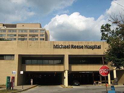
See Michael Reese Hospital and Medical Center, Chicago, on the map
Directions to Michael Reese Hospital and Medical Center (Chicago) with public transportation
The following transit lines have routes that pass near Michael Reese Hospital and Medical Center
 Bus:
Bus: - Train:
- Chicago 'L':
How to get to Michael Reese Hospital and Medical Center by bus?
Click on the bus route to see step by step directions with maps, line arrival times and updated time schedules.
How to get to Michael Reese Hospital and Medical Center by train?
Click on the train route to see step by step directions with maps, line arrival times and updated time schedules.
How to get to Michael Reese Hospital and Medical Center by Chicago 'L'?
Click on the Chicago 'L' route to see step by step directions with maps, line arrival times and updated time schedules.
Bus stations near Michael Reese Hospital and Medical Center in Chicago
- Wentworth & 26th Street (North),4 min walk,
Bus lines to Michael Reese Hospital and Medical Center in Chicago
- 24,Dearborn & Randolph (North),
What are the closest stations to Michael Reese Hospital and Medical Center?
The closest stations to Michael Reese Hospital and Medical Center are:
- Wentworth & 26th Street (North) is 320 yards away, 4 min walk.
Which bus line stops near Michael Reese Hospital and Medical Center?
24
Which train lines stop near Michael Reese Hospital and Medical Center?
These train lines stop near Michael Reese Hospital and Medical Center: ME, RI.
Which Chicago 'L' line stops near Michael Reese Hospital and Medical Center?
RED LINE
What’s the nearest bus stop to Michael Reese Hospital and Medical Center in Chicago?
The nearest bus stop to Michael Reese Hospital and Medical Center in Chicago is Wentworth & 26th Street (North). It’s a 4 min walk away.
See Michael Reese Hospital and Medical Center, Chicago, on the map
Public Transit to Michael Reese Hospital and Medical Center in Chicago
Wondering how to get to Michael Reese Hospital and Medical Center in Chicago, United States? Moovit helps you find the best way to get to Michael Reese Hospital and Medical Center with step-by-step directions from the nearest public transit station.
Moovit provides free maps and live directions to help you navigate through your city. View schedules, routes, timetables, and find out how long does it take to get to Michael Reese Hospital and Medical Center in real time.
Looking for the nearest stop or station to Michael Reese Hospital and Medical Center? Check out this list of stops closest to your destination: Wentworth & 26th Street (North).
Bus:Train:Chicago 'L':
Want to see if there’s another route that gets you there at an earlier time? Moovit helps you find alternative routes or times. Get directions from and directions to Michael Reese Hospital and Medical Center easily from the Moovit App or Website.
We make riding to Michael Reese Hospital and Medical Center easy, which is why over 1.5 million users, including users in Chicago, trust Moovit as the best app for public transit. You don’t need to download an individual bus app or train app, Moovit is your all-in-one transit app that helps you find the best bus time or train time available.
For information on prices of bus, Chicago 'L' and train, costs and ride fares to Michael Reese Hospital and Medical Center, please check the Moovit app.
Use the app to navigate to popular places including to the airport, hospital, stadium, grocery store, mall, coffee shop, school, college, and university.
Location: Chicago
Attractions near Michael Reese Hospital and Medical Center
The Loop Learning Center,Gold Coast Auto Sales & Serv,Foot Locker,Lincoln Perry Apts,1601 Cleaners Ltd,Weiss Leonard MD,Bridgeport Pain Control,Bass Financial Corporation,East Lake Management,Snowaert Rhonda Event Partners,We Plan the Parties,Wechter David MD,Turner Construction,Vegetable Fresh,Mick Bert Construction Company,Economy Folding Box Corp,South La Salle Street,Dan Ryan Express Lane,Spray Pool,Lsd - I-55 - I-94EHow to get to popular attractions in Chicago with public transit
Marian Catholic High School, Chicago Heights,Edison Park, Chicago,191 N. Wacker, Chicago,Ford City Mall, Chicago,Jewel-Osco,Brookdale, Naperville,Garfield Ridge, Chicago,Downtown La Grange, La Grange,Chama Gaucha Brazilian Steakhouse, Downers Grove,Metra - Vernon Hills, Vernon Hills,Advocate Sherman Hospital, Elgin,Chicago Marriott Southwest at Burr Ridge, Burr Ridge,127th St, Cicero Ave & I-294, Alsip,I-355 & 63rd St, Woodridge,Barack Obama House, Chicago,Metra - Blue Island Vermont Street, Blue Island,Zurich North America, Schaumburg,Maggiano's Little Italy, Schaumburg,Chipotle Mexican Grill, Chicago,Manny's Cafeteria & Delicatessen, ChicagoGet around Chicago by public transit!
Traveling around Chicago has never been so easy. See step by step directions as you travel to any attraction, street or major public transit station. View bus and train schedules, arrival times, service alerts and detailed routes on a map, so you know exactly how to get to anywhere in Chicago.
When traveling to any destination around Chicago use Moovit's Live Directions with Get Off Notifications to know exactly where and how far to walk, how long to wait for your line, and how many stops are left. Moovit will alert you when it's time to get off — no need to constantly re-check whether yours is the next stop.
Wondering how to use public transit in Chicago or how to pay for public transit in Chicago? Moovit public transit app can help you navigate your way with public transit easily, and at minimum cost. It includes public transit fees, ticket prices, and costs. Looking for a map of Chicago public transit lines? Moovit public transit app shows all public transit maps in Chicago with all bus, Chicago 'L' or train routes and stops on an interactive map.
Chicago has 3 transit type(s), including: bus, Chicago 'L' or train, operated by several transit agencies, including CTA 'L', Metra, Northern Indiana Commuter Transportation District, CTA, PACE, O'Hare International Airport Shuttle Bus, Gary Public Transit, Amtrak, River Valley Metro, Valpo Transit, DeKalb Public Transit, FlixBus-us, Greyhound-us, Van Galder (Coach USA) and Wisconsin Coach Lines