How to get to Michelle M. Boyle, Md by bus?
Click on the bus route to see step by step directions with maps, line arrival times and updated time schedules.
From B.M.C. Durfee High School, Fall River
99 minFrom Bristol Community College, Fall River
100 minFrom Charlton Memorial Hospital, Fall River
118 minFrom Barahona Express, Providence
105 minFrom Amazon Fulfillment Bos7, Fall River
139 minFrom Lizzy Borden House, Fall River
80 minFrom Walmart Fall River Supercenter, Fall River
113 min
Bus stop near Michelle M. Boyle, Md in Boston
- Aquidneck Corporate Park (Dept Of Human Services), 5 min walk,VIEW
Bus lines to Michelle M. Boyle, Md in Boston
- 68, Aquidneck Corporate Park,VIEW
What are the closest stations to Michelle M. Boyle, Md?
The closest stations to Michelle M. Boyle, Md are:
- Aquidneck Corporate Park (Dept Of Human Services) is 354 yards away, 5 min walk.
Which bus lines stop near Michelle M. Boyle, Md?
These bus lines stop near Michelle M. Boyle, Md: 24L, 60.
What’s the nearest bus station to Michelle M. Boyle, Md in Boston?
The nearest bus station to Michelle M. Boyle, Md in Boston is Aquidneck Corporate Park (Dept Of Human Services). It’s a 5 min walk away.
What time is the first bus to Michelle M. Boyle, Md in Boston?
The 68 is the first bus that goes to Michelle M. Boyle, Md in Boston. It stops nearby at 9:18 AM.
What time is the last bus to Michelle M. Boyle, Md in Boston?
The 68 is the last bus that goes to Michelle M. Boyle, Md in Boston. It stops nearby at 5:36 PM.
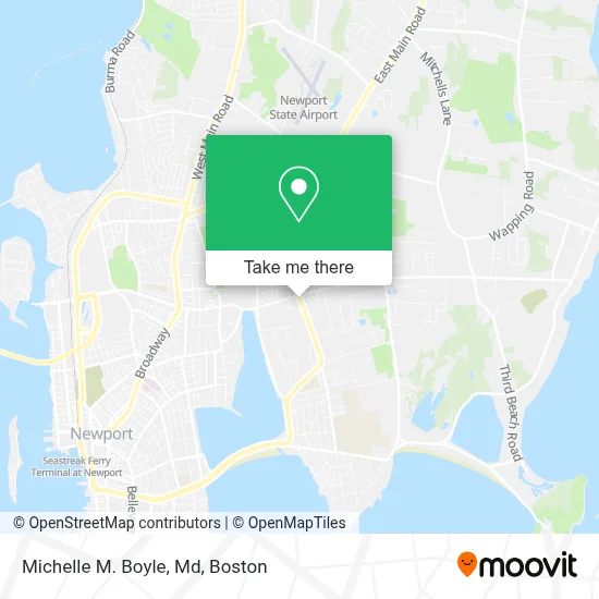
See Michelle M. Boyle, Md, Boston, on the map
Public Transit to Michelle M. Boyle, Md in Boston
Wondering how to get to Michelle M. Boyle, Md in Boston? Moovit helps you find the best way to get to Michelle M. Boyle, Md with step-by-step directions from the nearest public transit station.
Moovit provides free maps and live directions to help you navigate through your city. View schedules, routes, timetables, and find out how long does it take to get to Michelle M. Boyle, Md in real time.
Looking for the nearest stop or station to Michelle M. Boyle, Md? Check out this list of stops closest to your destination: Aquidneck Corporate Park (Dept Of Human Services).
Bus: 24L, 60, 68.
Want to see if there’s another route that gets you there at an earlier time? Moovit helps you find alternative routes or times. Get directions from and directions to Michelle M. Boyle, Md easily from the Moovit App or Website.
We make riding to Michelle M. Boyle, Md easy, which is why over 1.7 million users, including users in Boston, trust Moovit as the best app for public transit. You don’t need to download an individual bus app or train app, Moovit is your all-in-one transit app that helps you find the best bus time or train time available.
For information on prices of bus, costs and ride fares to Michelle M. Boyle, Md, please check the Moovit app.
Use the app to navigate to popular places including to the airport, hospital, stadium, grocery store, mall, coffee shop, school, college, and university.
Michelle M. Boyle, Md Address: 714 Aquidneck Ave street in Boston
- Webster Bank,
- Leilani Dimond Md,
- The Power Of Juice,
- The Lion's Gateway,
- Atm Webster Bank,
- Polo Cleaners,
- Health Street,
- Slim Possible,
- Atm 7eleven-Fcti,
- Atm 7eleven, Inc.,
- Southcoast Health Family Medicine,
- Jennifer Silva, Np,
- 7th Moon Inc.,
- Southcoast Health Orthopedic & Hand Surgery,
- Ivy Rehab Physical Therapy,
- Tara Bronson,
- Viera Photographics,
- Donovan And Sons,
- Advanced Remarketing Services,
- Vincenzo Steven Rossati
Places Near Michelle M. Boyle, Md (Boston)
- Castle Island, Boston,
- Boston Convention & Exhibition Center, Boston,
- Seaport District, Boston,
- Prudential Center, Boston,
- Wilbur Theatre, Boston,
- Museum Of Science, Boston,
- Mgm Music Hall, Boston,
- Wang Theater, Boston,
- Faneuil Hall, Boston,
- Td Garden, Boston,
- Quincy Market, Boston,
- Massachusetts General Hospital, Boston,
- Boston Medical Center, Boston,
- North End, Boston,
- Leader Bank Pavilion (Leader Bank Pavillion), Boston,
- Cheers, Boston,
- Boston Children's Hospital, Boston,
- House Of Blues, Boston,
- Boston Common, Boston,
- Isabella Stewart Gardner Museum, Boston
How to get to popular places in Boston with public transit
Get around Boston by public transit!
Traveling around Boston has never been so easy. See step by step directions as you travel to any attraction, street or major public transit station. View bus and train schedules, arrival times, service alerts and detailed routes on a map, so you know exactly how to get to anywhere in Boston.
When traveling to any destination around Boston use Moovit's Live Directions with Get Off Notifications to know exactly where and how far to walk, how long to wait for your line, and how many stops are left. Moovit will alert you when it's time to get off — no need to constantly re-check whether yours is the next stop.
Wondering how to use public transit in Boston or how to pay for public transit in Boston? Moovit public transit app can help you navigate your way with public transit easily, and at minimum cost. It includes public transit fees, ticket prices, and costs. Looking for a map of Boston public transit lines? Moovit public transit app shows all public transit maps in Boston with all Bus, Train, Subway and Ferry routes and stops on an interactive map.
Boston has 4 transit type(s), including: Bus, Train, Subway and Ferry, operated by several transit agencies, including MBTA, Southeastern Regional Transit Authority, MetroWest Regional Transit Authority, Rhode Island Public Transit Authority, WRTA, Lowell Regional Transit Authority, Merrimack Valley Transit, Montachusett Regional Transit Authority, Cape Cod Regional Transit Authority, Brockton Area Transit Authority, Martha's Vineyard Transit Authority, the WAVE - Nantucket Regional Transit Authority, GATRA, Cape Ann Transportation Authority and Massport