Directions to Michelle Spaziani - Raymond James (Boston) with public transportation
The following transit lines have routes that pass near Michelle Spaziani - Raymond James
 Bus: 21, 31, 32, GREYHOUND US0255S, 23.
- Train: VERMONTER, VALLEY FLYER.
How to get to Michelle Spaziani - Raymond James by bus?
Click on the bus route to see step by step directions with maps, line arrival times and updated time schedules.
How to get to Michelle Spaziani - Raymond James by train?
Click on the train route to see step by step directions with maps, line arrival times and updated time schedules.
Bus stops near Michelle Spaziani - Raymond James in Boston
Train station near Michelle Spaziani - Raymond James in Boston
- Greenfield Amtrak Station, 19 min walk,VIEW
Bus lines to Michelle Spaziani - Raymond James in Boston
What are the closest stations to Michelle Spaziani - Raymond James?
The closest stations to Michelle Spaziani - Raymond James are:
- High St And Wildwood Ave is 267 yards away, 4 min walk.
- Cherry Rum Plaza is 1112 yards away, 14 min walk.
- Greenfield Amtrak Station is 1577 yards away, 19 min walk.
Which bus lines stop near Michelle Spaziani - Raymond James?
These bus lines stop near Michelle Spaziani - Raymond James: 21, 31, 32, GREYHOUND US0255S.
Which train line stops near Michelle Spaziani - Raymond James?
VERMONTER (St Albans)
What’s the nearest train station to Michelle Spaziani - Raymond James in Boston?
The nearest train station to Michelle Spaziani - Raymond James in Boston is Greenfield Amtrak Station. It’s a 19 min walk away.
What’s the nearest bus station to Michelle Spaziani - Raymond James in Boston?
The nearest bus station to Michelle Spaziani - Raymond James in Boston is High St And Wildwood Ave. It’s a 4 min walk away.
What time is the first train to Michelle Spaziani - Raymond James in Boston?
The VALLEY FLYER is the first train that goes to Michelle Spaziani - Raymond James in Boston. It stops nearby at 6:05 AM.
What time is the last train to Michelle Spaziani - Raymond James in Boston?
The VALLEY FLYER is the last train that goes to Michelle Spaziani - Raymond James in Boston. It stops nearby at 10:33 PM.
What time is the first bus to Michelle Spaziani - Raymond James in Boston?
The 23 is the first bus that goes to Michelle Spaziani - Raymond James in Boston. It stops nearby at 6:49 AM.
What time is the last bus to Michelle Spaziani - Raymond James in Boston?
The 23 is the last bus that goes to Michelle Spaziani - Raymond James in Boston. It stops nearby at 7:37 PM.
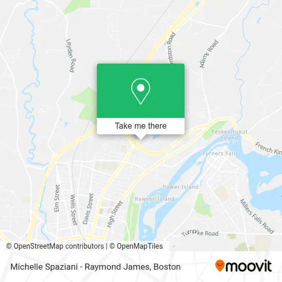
See Michelle Spaziani - Raymond James, Boston, on the map
Public Transit to Michelle Spaziani - Raymond James in Boston
Wondering how to get to Michelle Spaziani - Raymond James in Boston? Moovit helps you find the best way to get to Michelle Spaziani - Raymond James with step-by-step directions from the nearest public transit station.
Moovit provides free maps and live directions to help you navigate through your city. View schedules, routes, timetables, and find out how long does it take to get to Michelle Spaziani - Raymond James in real time.
Looking for the nearest stop or station to Michelle Spaziani - Raymond James? Check out this list of stops closest to your destination: High St And Wildwood Ave; Cherry Rum Plaza; Greenfield Amtrak Station.
Bus: 21, 31, 32, GREYHOUND US0255S, 23, 24.Train: VERMONTER, VALLEY FLYER.
Want to see if there’s another route that gets you there at an earlier time? Moovit helps you find alternative routes or times. Get directions from and directions to Michelle Spaziani - Raymond James easily from the Moovit App or Website.
We make riding to Michelle Spaziani - Raymond James easy, which is why over 1.7 million users, including users in Boston, trust Moovit as the best app for public transit. You don’t need to download an individual bus app or train app, Moovit is your all-in-one transit app that helps you find the best bus time or train time available.
For information on prices of bus and train, costs and ride fares to Michelle Spaziani - Raymond James, please check the Moovit app.
Use the app to navigate to popular places including to the airport, hospital, stadium, grocery store, mall, coffee shop, school, college, and university.
Michelle Spaziani - Raymond James Address: 525 Bernardston Rd Ste 1 street in Boston
- Andrea Bastarache Carr Od,
- Wilson Piper,
- R&M Eyewear,
- Center for Human Development,
- USPS Collection Box - Blue Box,
- Maynard Pond,
- Denny's Pantry,
- Burger King,
- Discovery School at Four Corners,
- Stoneleigh-Burnham School,
- RMP Development,
- Fresenius Medical Care,
- First Congregational Church,
- Agape Moldovian Baptist Church,
- Unity in the Pioneer,
- Wee Care Daycare,
- Auntie Jordans Groomin,
- Autozone,
- Interstate Batteries,
- Optimize Construction
Places Near Michelle Spaziani - Raymond James (Boston)
- Prudential Center, Boston,
- Td Garden, Boston,
- Boston Medical Center, Boston,
- House Of Blues, Boston,
- North End, Boston,
- Mgm Music Hall, Boston,
- Wang Theater, Boston,
- Boston Common, Boston,
- Boston Convention & Exhibition Center, Boston,
- Quincy Market, Boston,
- Cheers, Boston,
- Castle Island, Boston,
- Wilbur Theatre, Boston,
- Isabella Stewart Gardner Museum, Boston,
- Leader Bank Pavilion (Leader Bank Pavillion), Boston,
- Museum Of Science, Boston,
- Faneuil Hall, Boston,
- Seaport District, Boston,
- Boston Children's Hospital, Boston,
- Massachusetts General Hospital, Boston
How to get to popular places in Boston with public transit
Get around Boston by public transit!
Traveling around Boston has never been so easy. See step by step directions as you travel to any attraction, street or major public transit station. View bus and train schedules, arrival times, service alerts and detailed routes on a map, so you know exactly how to get to anywhere in Boston.
When traveling to any destination around Boston use Moovit's Live Directions with Get Off Notifications to know exactly where and how far to walk, how long to wait for your line, and how many stops are left. Moovit will alert you when it's time to get off — no need to constantly re-check whether yours is the next stop.
Wondering how to use public transit in Boston or how to pay for public transit in Boston? Moovit public transit app can help you navigate your way with public transit easily, and at minimum cost. It includes public transit fees, ticket prices, and costs. Looking for a map of Boston public transit lines? Moovit public transit app shows all public transit maps in Boston with all Bus, Train, Subway and Ferry routes and stops on an interactive map.
Boston has 4 transit type(s), including: Bus, Train, Subway and Ferry, operated by several transit agencies, including MBTA, Southeastern Regional Transit Authority, MetroWest Regional Transit Authority, Rhode Island Public Transit Authority, WRTA, Lowell Regional Transit Authority, Merrimack Valley Transit, Montachusett Regional Transit Authority, Cape Cod Regional Transit Authority, Brockton Area Transit Authority, Martha's Vineyard Transit Authority, the WAVE - Nantucket Regional Transit Authority, GATRA, Cape Ann Transportation Authority and Massport