See Microsoft Way, Redmond, on the map
Directions to Microsoft Way (Redmond) with public transportation
The following transit lines have routes that pass near Microsoft Way
 Bus:
Bus:
How to get to Microsoft Way by bus?
Click on the bus route to see step by step directions with maps, line arrival times and updated time schedules.
Bus stations near Microsoft Way in Redmond
- 156th Ave Ne & Ne 36th St,4 min walk,
Bus lines to Microsoft Way in Redmond
- 245,Factoria Crossroads,
- 269,Overlake,
What are the closest stations to Microsoft Way?
The closest stations to Microsoft Way are:
- 156th Ave Ne & Ne 36th St is 284 yards away, 4 min walk.
Which bus lines stop near Microsoft Way?
These bus lines stop near Microsoft Way: 244, 245, 269, 541.
What’s the nearest bus stop to Microsoft Way in Redmond?
The nearest bus stop to Microsoft Way in Redmond is 156th Ave Ne & Ne 36th St. It’s a 4 min walk away.
See Microsoft Way, Redmond, on the map
Public Transit to Microsoft Way in Redmond
Wondering how to get to Microsoft Way in Redmond, United States? Moovit helps you find the best way to get to Microsoft Way with step-by-step directions from the nearest public transit station.
Moovit provides free maps and live directions to help you navigate through your city. View schedules, routes, timetables, and find out how long does it take to get to Microsoft Way in real time.
Looking for the nearest stop or station to Microsoft Way? Check out this list of stops closest to your destination: 156th Ave Ne & Ne 36th St.
Bus:
Want to see if there’s another route that gets you there at an earlier time? Moovit helps you find alternative routes or times. Get directions from and directions to Microsoft Way easily from the Moovit App or Website.
We make riding to Microsoft Way easy, which is why over 1.5 million users, including users in Redmond, trust Moovit as the best app for public transit. You don’t need to download an individual bus app or train app, Moovit is your all-in-one transit app that helps you find the best bus time or train time available.
For information on prices of bus, costs and ride fares to Microsoft Way, please check the Moovit app.
Use the app to navigate to popular places including to the airport, hospital, stadium, grocery store, mall, coffee shop, school, college, and university.
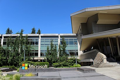
Microsoft Way Address: Microsoft Way, Redmond, WA 98052, USA street in Redmond
Attractions near Microsoft Way
157th Avenue Northeast,Microsoft - Building 24 - Lab 2277,Microsoft Softball Field 4,Microsoft Building 24,CODAPALOOZA,Microsoft Corporation,Microsoft Sports Field,157th Ave NE,MS shuttle To Building 40,Overlake,Microsoft Building 19,Microsoft,3635 156th Avenue Northeast,Microsoft Building 11,Microsoft Building 16,SQL Query Store,The Atrium - MS Building 16,20,Channel 9 Studio,3301 156th Ave NEHow to get to popular attractions in Redmond with public transit
Renton Highlands, Renton,Walmart Supercenter, Puyallup,Ash Way Park and Ride, North Lynnwood,Northgate Mall, Seattle,Walmart Supercenter,Bellevue Transit Center, Bellevue,Fluke Park, Everett,PCC Community Markets - Edmonds, Edmonds,South Seattle College, Seattle,Seattle Premium Outlets,Costco Business Center, Fife,Watertown Hotel, Seattle,Fred Meyer, Everett,Woodinville Park and Ride, Woodinville,Safeway, Seattle,City of Puyallup, Puyallup,Costco Wholesale, Tacoma,Point Defiance Park, Tacoma,Alderwood Mall, Lynnwood,Crossroads Bellevue, BellevueGet around Redmond by public transit!
Traveling around Redmond has never been so easy. See step by step directions as you travel to any attraction, street or major public transit station. View bus and train schedules, arrival times, service alerts and detailed routes on a map, so you know exactly how to get to anywhere in Redmond.
When traveling to any destination around Redmond use Moovit's Live Directions with Get Off Notifications to know exactly where and how far to walk, how long to wait for your line, and how many stops are left. Moovit will alert you when it's time to get off — no need to constantly re-check whether yours is the next stop.
Wondering how to use public transit in Redmond or how to pay for public transit in Redmond? Moovit public transit app can help you navigate your way with public transit easily, and at minimum cost. It includes public transit fees, ticket prices, and costs. Looking for a map of Redmond public transit lines? Moovit public transit app shows all public transit maps in Redmond with all bus routes and stops on an interactive map.
Redmond has 1 transit type(s), including: bus, operated by several transit agencies, including Sound Transit, Seattle Streetcar, Sound Transit, Metro Transit, Metro Transit, Sound Transit, Whatcom Transportation Authority, Mason Transit Authority, Snoqualmie Valley Transportation (SVT), Snoqualmie Valley Transportation, Amtrak, Island Transit, Kitsap Transit, Intercity Transit and Everett Transit