Directions to Middle Collegiate Church (Manhattan) with public transportation
The following transit lines have routes that pass near Middle Collegiate Church
How to get to Middle Collegiate Church by bus?
Click on the bus route to see step by step directions with maps, line arrival times and updated time schedules.
How to get to Middle Collegiate Church by train?
Click on the train route to see step by step directions with maps, line arrival times and updated time schedules.
How to get to Middle Collegiate Church by subway?
Click on the subway route to see step by step directions with maps, line arrival times and updated time schedules.
Bus stations near Middle Collegiate Church in Manhattan
- 2 Av/E 6 St,2 min walk,
- St Marks Pl/2 Av,2 min walk,
- 3 Av/Astor Pl,4 min walk,
- Cooper Sq/E 6 St,4 min walk,
Subway stations near Middle Collegiate Church in Manhattan
- Astor Pl,6 min walk,
- 8 St-Nyu,8 min walk,
- 2 Av,8 min walk,
- 3 Av,10 min walk,
Bus lines to Middle Collegiate Church in Manhattan
- M15,East Harlem 125 St Via 1 Av,
- M8,West St Crosstown,
- M101,3 Av-96 St,
- M102,Harlem 147 St Via 3 Av Via Lenox Av,
- M103,City Hall Via Lex Av,
What are the closest stations to Middle Collegiate Church?
The closest stations to Middle Collegiate Church are:
- 2 Av/E 6 St is 102 yards away, 2 min walk.
- St Marks Pl/2 Av is 113 yards away, 2 min walk.
- 3 Av/Astor Pl is 277 yards away, 4 min walk.
- Cooper Sq/E 6 St is 280 yards away, 4 min walk.
- Astor Pl is 423 yards away, 6 min walk.
- 8 St-Nyu is 581 yards away, 8 min walk.
- 2 Av is 640 yards away, 8 min walk.
- 3 Av is 747 yards away, 10 min walk.
Which bus lines stop near Middle Collegiate Church?
These bus lines stop near Middle Collegiate Church: M1, M101, M102, M15, M2, M8.
Which train lines stop near Middle Collegiate Church?
These train lines stop near Middle Collegiate Church: HUDSON, PATH.
Which subway lines stop near Middle Collegiate Church?
These subway lines stop near Middle Collegiate Church: 6, 6X, F, R, W.
What’s the nearest subway station to Middle Collegiate Church in Manhattan?
The nearest subway station to Middle Collegiate Church in Manhattan is Astor Pl. It’s a 6 min walk away.
What’s the nearest bus stop to Middle Collegiate Church in Manhattan?
The nearest bus stops to Middle Collegiate Church in Manhattan are 2 Av/E 6 St and St Marks Pl/2 Av. The closest one is a 2 min walk away.
What time is the first subway to Middle Collegiate Church in Manhattan?
The F is the first subway that goes to Middle Collegiate Church in Manhattan. It stops nearby at 3:00 AM.
What time is the last subway to Middle Collegiate Church in Manhattan?
The 6 is the last subway that goes to Middle Collegiate Church in Manhattan. It stops nearby at 3:53 AM.
What time is the first bus to Middle Collegiate Church in Manhattan?
The M15 is the first bus that goes to Middle Collegiate Church in Manhattan. It stops nearby at 3:00 AM.
What time is the last bus to Middle Collegiate Church in Manhattan?
The M103 is the last bus that goes to Middle Collegiate Church in Manhattan. It stops nearby at 3:25 AM.
How much is the bus fare to Middle Collegiate Church?
The bus fare to Middle Collegiate Church costs about $2.75.
How much is the subway fare to Middle Collegiate Church?
The subway fare to Middle Collegiate Church costs about $2.75.
How much is the train fare to Middle Collegiate Church?
The train fare to Middle Collegiate Church costs about $3.25 - $23.50.
See Middle Collegiate Church, Manhattan, on the map
Public Transit to Middle Collegiate Church in Manhattan
Wondering how to get to Middle Collegiate Church in Manhattan, United States? Moovit helps you find the best way to get to Middle Collegiate Church with step-by-step directions from the nearest public transit station.
Moovit provides free maps and live directions to help you navigate through your city. View schedules, routes, timetables, and find out how long does it take to get to Middle Collegiate Church in real time.
Looking for the nearest stop or station to Middle Collegiate Church? Check out this list of stops closest to your destination: 2 Av/E 6 St; St Marks Pl/2 Av; 3 Av/Astor Pl; Cooper Sq/E 6 St; Astor Pl; 8 St-Nyu; 2 Av; 3 Av.
Bus:M1M101M102M15M2M8Train:HUDSONPATHSubway:66XFRW4NQFXL
Want to see if there’s another route that gets you there at an earlier time? Moovit helps you find alternative routes or times. Get directions from and directions to Middle Collegiate Church easily from the Moovit App or Website.
We make riding to Middle Collegiate Church easy, which is why over 1.5 million users, including users in Manhattan, trust Moovit as the best app for public transit. You don’t need to download an individual bus app or train app, Moovit is your all-in-one transit app that helps you find the best bus time or train time available.
For information on prices of subway, bus and train, costs and ride fares to Middle Collegiate Church, please check the Moovit app.
Use the app to navigate to popular places including to the airport, hospital, stadium, grocery store, mall, coffee shop, school, college, and university.
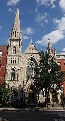
Middle Collegiate Church Address: 2nd Avenue street in Manhattan
Attractions near Middle Collegiate Church
Via Della Pace,7th 7th and 2nd,Uni K Wax-East Village,TAJ,Beetle House,308 E 6th Street,Boulangerie Le Fournil,New Yorkers Food Market,Stomp,2nd Ave (2nd 6th street),E 6th intersection 2nd Ave,6th intersection 2nd Ave,6th St corner 2nd Ave,2nd Ave / E 6th St,306-308 East 6th Street,Orpheum Theatre,Sunny's Florist,Orpheum Theatre,Orpheum Theatre (Manhattan),Nolita PizzaHow to get to popular attractions in Manhattan with public transit
Doughnut Plant, Manhattan,Shake Shack, Manhattan,5 Napkin Burger, Manhattan,Great Lawn, Manhattan,Joe's Shanghai 鹿嗚春, Manhattan,Barrage, Manhattan,NJT - New Brunswick Station (NEC), New Brunswick, Nj,The Stanton Social, Manhattan,The Dead Rabbit, Manhattan,MTA Subway - 42nd St / Bryant Park (B / D/F / M/7), Manhattan,MTA Subway - Coney Island / Stillwell Ave (D / F/N / Q),Caesars Atlantic City Hotel and Casino, Atlantic City, Nj,The 13th Step, Manhattan,The Dutch, Manhattan,Ritz Bar & Lounge, Manhattan,The Grey Dog, Manhattan,Nassau Community College, East Garden City, Ny,Central Park SummerStage, Manhattan,Culture Espresso, Manhattan,Starbucks, East Brunswick, NjGet around Manhattan by public transit!
Traveling around Manhattan has never been so easy. See step by step directions as you travel to any attraction, street or major public transit station. View bus and train schedules, arrival times, service alerts and detailed routes on a map, so you know exactly how to get to anywhere in Manhattan.
When traveling to any destination around Manhattan use Moovit's Live Directions with Get Off Notifications to know exactly where and how far to walk, how long to wait for your line, and how many stops are left. Moovit will alert you when it's time to get off — no need to constantly re-check whether yours is the next stop.
Wondering how to use public transit in Manhattan or how to pay for public transit in Manhattan? Moovit public transit app can help you navigate your way with public transit easily, and at minimum cost. It includes public transit fees, ticket prices, and costs. Looking for a map of Manhattan public transit lines? Moovit public transit app shows all public transit maps in Manhattan with all subway, bus or train routes and stops on an interactive map.
Manhattan has 3 transit type(s), including: subway, bus or train, operated by several transit agencies, including MTA Subway, Metro-North Railroad, LIRR, PATH, Shore Line East, MTA Bus Company, MTA New York City Transit - Express routes, MTA Bus, NJ Transit, NYC Ferry, NICE bus, Bee-Line Bus, NJ Transit Rail, NJ Transit Rail and Norwalk Transit District