Directions to Miguel's Empanadas (Everett) with public transportation
The following transit lines have routes that pass near Miguel's Empanadas
 Bus: 104, 105, 106, 109, 99.
- Train: NEWBURYPORT/ROCKPORT.
- Subway: ORANGE LINE.
How to get to Miguel's Empanadas by bus?
Click on the bus route to see step by step directions with maps, line arrival times and updated time schedules.
From Black Falcon Cruise Terminal, Boston
57 minFrom MSPCA Angell Animal Medical Center, Boston
83 minFrom Angell Animal Medical Center (Mspca Angell), Boston
82 minFrom Mspca, Boston
82 minFrom Hotel Hilton Boston/Woburn, Boston
84 minFrom Boston Latin Academy, Boston
78 minFrom Childrens Museum, Boston
79 minFrom Hotel Aka Back Bay (Hotel Back Bay), Boston
71 minFrom Element Boston Seaport, Boston
55 minFrom Simmons College, Boston
47 min
How to get to Miguel's Empanadas by subway?
Click on the subway route to see step by step directions with maps, line arrival times and updated time schedules.
From MSPCA Angell Animal Medical Center, Boston
65 minFrom Angell Animal Medical Center (Mspca Angell), Boston
64 minFrom Mspca, Boston
64 minFrom Hotel Hilton Boston/Woburn, Boston
57 minFrom Boston Latin Academy, Boston
69 minFrom Childrens Museum, Boston
67 minFrom Hotel Aka Back Bay (Hotel Back Bay), Boston
44 minFrom Element Boston Seaport, Boston
62 minFrom Simmons College, Boston
69 min
Bus stops near Miguel's Empanadas in Everett
Train station near Miguel's Empanadas in Everett
- Chelsea, 9 min walk,VIEW
Subway station near Miguel's Empanadas in Everett
- Sullivan Square, 38 min walk,VIEW
Bus lines to Miguel's Empanadas in Everett
What are the closest stations to Miguel's Empanadas?
The closest stations to Miguel's Empanadas are:
- 202 Main St is 10 yards away, 1 min walk.
- Second St @ Revere St is 101 yards away, 2 min walk.
- Broadway Opp Second St is 374 yards away, 5 min walk.
- Chelsea is 546 yards away, 9 min walk.
- Sullivan Square is 3218 yards away, 38 min walk.
Which bus lines stop near Miguel's Empanadas?
These bus lines stop near Miguel's Empanadas: 104, 105, 106, 109, 99.
Which subway line stops near Miguel's Empanadas?
ORANGE LINE (Oak Grove)
What’s the nearest train station to Miguel's Empanadas in Everett?
The nearest train station to Miguel's Empanadas in Everett is Chelsea. It’s a 9 min walk away.
What’s the nearest bus station to Miguel's Empanadas in Everett?
The nearest bus station to Miguel's Empanadas in Everett is 202 Main St. It’s a 1 min walk away.
What time is the first subway to Miguel's Empanadas in Everett?
The ORANGE LINE is the first subway that goes to Miguel's Empanadas in Everett. It stops nearby at 5:19 AM.
What time is the last subway to Miguel's Empanadas in Everett?
The ORANGE LINE is the last subway that goes to Miguel's Empanadas in Everett. It stops nearby at 1:53 AM.
What time is the first train to Miguel's Empanadas in Everett?
The NEWBURYPORT/ROCKPORT is the first train that goes to Miguel's Empanadas in Everett. It stops nearby at 5:40 AM.
What time is the last train to Miguel's Empanadas in Everett?
The NEWBURYPORT/ROCKPORT is the last train that goes to Miguel's Empanadas in Everett. It stops nearby at 12:06 AM.
What time is the first bus to Miguel's Empanadas in Everett?
The 104 is the first bus that goes to Miguel's Empanadas in Everett. It stops nearby at 4:36 AM.
What time is the last bus to Miguel's Empanadas in Everett?
The 110 is the last bus that goes to Miguel's Empanadas in Everett. It stops nearby at 2:08 AM.
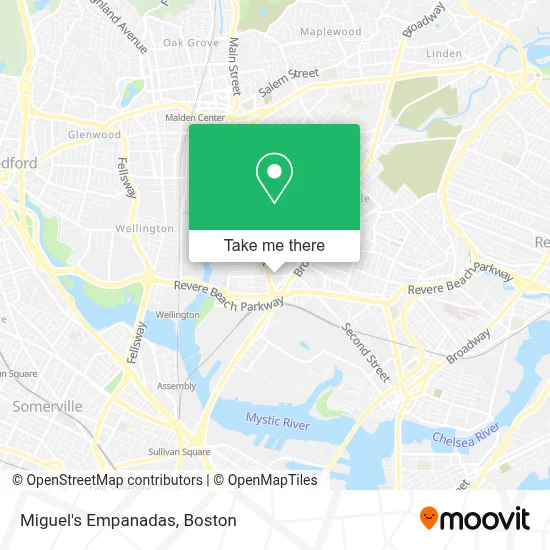
See Miguel's Empanadas, Everett, on the map
Public Transit to Miguel's Empanadas in Everett
Wondering how to get to Miguel's Empanadas in Everett? Moovit helps you find the best way to get to Miguel's Empanadas with step-by-step directions from the nearest public transit station.
Moovit provides free maps and live directions to help you navigate through your city. View schedules, routes, timetables, and find out how long does it take to get to Miguel's Empanadas in real time.
Looking for the nearest stop or station to Miguel's Empanadas? Check out this list of stops closest to your destination: 202 Main St; Second St @ Revere St; Broadway Opp Second St; Chelsea; Sullivan Square.
Bus: 104, 105, 106, 109, 99, 97, 110, 112.Train: NEWBURYPORT/ROCKPORT.Subway: ORANGE LINE.
Want to see if there’s another route that gets you there at an earlier time? Moovit helps you find alternative routes or times. Get directions from and directions to Miguel's Empanadas easily from the Moovit App or Website.
We make riding to Miguel's Empanadas easy, which is why over 1.7 million users, including users in Everett, trust Moovit as the best app for public transit. You don’t need to download an individual bus app or train app, Moovit is your all-in-one transit app that helps you find the best bus time or train time available.
For information on prices of bus and subway, costs and ride fares to Miguel's Empanadas, please check the Moovit app.
Use the app to navigate to popular places including to the airport, hospital, stadium, grocery store, mall, coffee shop, school, college, and university.
Miguel's Empanadas Address: 22 Oakes St street in Everett
- Mass Bay Movers,
- Cooperative for Human Services,
- Vitally Studio,
- Paradise Healing Center,
- Junk Car,
- Gerson Auto Repair,
- Angeles Family Child Care,
- Buteco do Tigrin,
- Papa's Ponytime Palace,
- Tileston St Plumbing,
- Xeno,
- Boston Orthopedic,
- Igreja Catolica de Everett,
- Masse, Mackenson,
- Super Petroleum,
- Brazuka Store,
- Turn-Key Petroleum,
- Constantino & Sons,
- Leandro Lemos,
- Berta's Restaurant
Places Near Miguel's Empanadas (Everett)
- Faneuil Hall, Boston,
- Boston Convention & Exhibition Center, Boston,
- Seaport District, Boston,
- Prudential Center, Boston,
- Quincy Market, Boston,
- House Of Blues, Boston,
- Td Garden, Boston,
- Museum Of Science, Boston,
- Castle Island, Boston,
- Cheers, Boston,
- Mgm Music Hall, Boston,
- Boston Children's Hospital, Boston,
- Boston Common, Boston,
- Wilbur Theatre, Boston,
- North End, Boston,
- Leader Bank Pavilion (Leader Bank Pavillion), Boston,
- Boston Medical Center, Boston,
- Isabella Stewart Gardner Museum, Boston,
- Wang Theater, Boston,
- Massachusetts General Hospital, Boston
How to get to popular places in Boston with public transit
Get around Everett by public transit!
Traveling around Everett has never been so easy. See step by step directions as you travel to any attraction, street or major public transit station. View bus and train schedules, arrival times, service alerts and detailed routes on a map, so you know exactly how to get to anywhere in Everett.
When traveling to any destination around Everett use Moovit's Live Directions with Get Off Notifications to know exactly where and how far to walk, how long to wait for your line, and how many stops are left. Moovit will alert you when it's time to get off — no need to constantly re-check whether yours is the next stop.
Wondering how to use public transit in Everett or how to pay for public transit in Everett? Moovit public transit app can help you navigate your way with public transit easily, and at minimum cost. It includes public transit fees, ticket prices, and costs. Looking for a map of Everett public transit lines? Moovit public transit app shows all public transit maps in Everett with all Bus, Train, Subway and Ferry routes and stops on an interactive map.
Boston has 4 transit type(s), including: Bus, Train, Subway and Ferry, operated by several transit agencies, including MBTA, Southeastern Regional Transit Authority, MetroWest Regional Transit Authority, Rhode Island Public Transit Authority, WRTA, Lowell Regional Transit Authority, Merrimack Valley Transit, Montachusett Regional Transit Authority, Cape Cod Regional Transit Authority, Brockton Area Transit Authority, Martha's Vineyard Transit Authority, the WAVE - Nantucket Regional Transit Authority, GATRA, Cape Ann Transportation Authority and Massport