Directions to Mile Marker One Restaurant & Igloo Dining (Gloucester) with public transportation
The following transit lines have routes that pass near Mile Marker One Restaurant & Igloo Dining
How to get to Mile Marker One Restaurant & Igloo Dining by bus?
Click on the bus route to see step by step directions with maps, line arrival times and updated time schedules.
How to get to Mile Marker One Restaurant & Igloo Dining by train?
Click on the train route to see step by step directions with maps, line arrival times and updated time schedules.
Bus stops near Mile Marker One Restaurant & Igloo Dining in Gloucester
Train station near Mile Marker One Restaurant & Igloo Dining in Gloucester
- Gloucester, 51 min walk,VIEW
Bus lines to Mile Marker One Restaurant & Igloo Dining in Gloucester
- GLOUCESTER - WEST GLOUCESTER - ESSEX, Rose Baker Senior Center,VIEW
- MAGNOLIA, Lexington Ave & Flume Rd,VIEW
- GLOUCESTER CROSSING/BLACKBURN EXPRESS, Rose Baker Senior Center,VIEW
- LANESVILLE, Washington St & Railroad Ave,VIEW
- GLOUCESTER - ROCKPORT VIA THATCHER ROAD, Gloucester High School,VIEW
- GLOUCESTER CROSSING/BUSINESS EXPRESS, Senior Center - Dunkin' Donuts,VIEW
What are the closest stations to Mile Marker One Restaurant & Igloo Dining?
The closest stations to Mile Marker One Restaurant & Igloo Dining are:
- Heights at Cape Ann is 521 yards away, 7 min walk.
- Western Ave & Stage Fort Park is 912 yards away, 11 min walk.
- Washington St & Railroad Ave is 962 yards away, 12 min walk.
- Gloucester High School is 1179 yards away, 14 min walk.
- Gloucester is 4397 yards away, 51 min walk.
Which bus lines stop near Mile Marker One Restaurant & Igloo Dining?
These bus lines stop near Mile Marker One Restaurant & Igloo Dining: BEVERLY COMMUTER, CITY OF BEVERLY SHUTTLE, MAGNOLIA.
Which train line stops near Mile Marker One Restaurant & Igloo Dining?
NEWBURYPORT/ROCKPORT (#27 | Rockport)
What’s the nearest bus station to Mile Marker One Restaurant & Igloo Dining in Gloucester?
The nearest bus station to Mile Marker One Restaurant & Igloo Dining in Gloucester is Heights at Cape Ann. It’s a 7 min walk away.
What time is the first train to Mile Marker One Restaurant & Igloo Dining in Gloucester?
The NEWBURYPORT/ROCKPORT is the first train that goes to Mile Marker One Restaurant & Igloo Dining in Gloucester. It stops nearby at 5:14 AM.
What time is the last train to Mile Marker One Restaurant & Igloo Dining in Gloucester?
The NEWBURYPORT/ROCKPORT is the last train that goes to Mile Marker One Restaurant & Igloo Dining in Gloucester. It stops nearby at 12:47 AM.
What time is the first bus to Mile Marker One Restaurant & Igloo Dining in Gloucester?
The LANESVILLE is the first bus that goes to Mile Marker One Restaurant & Igloo Dining in Gloucester. It stops nearby at 6:15 AM.
What time is the last bus to Mile Marker One Restaurant & Igloo Dining in Gloucester?
The LANESVILLE is the last bus that goes to Mile Marker One Restaurant & Igloo Dining in Gloucester. It stops nearby at 6:16 PM.
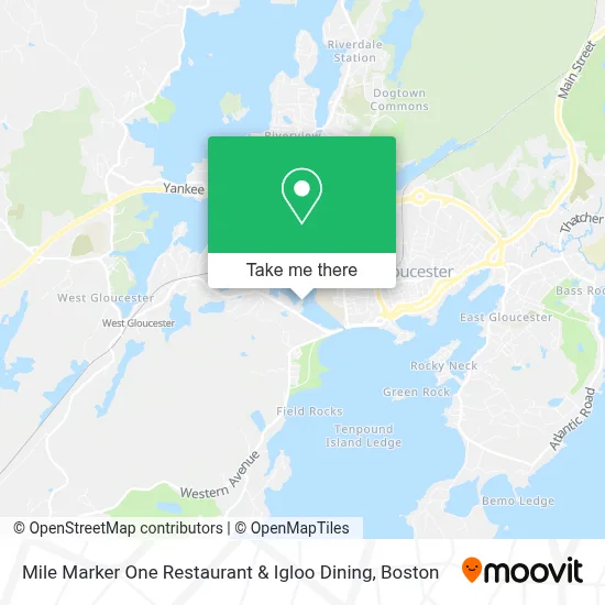
See Mile Marker One Restaurant & Igloo Dining, Gloucester, on the map
Public Transit to Mile Marker One Restaurant & Igloo Dining in Gloucester
Wondering how to get to Mile Marker One Restaurant & Igloo Dining in Gloucester? Moovit helps you find the best way to get to Mile Marker One Restaurant & Igloo Dining with step-by-step directions from the nearest public transit station.
Moovit provides free maps and live directions to help you navigate through your city. View schedules, routes, timetables, and find out how long does it take to get to Mile Marker One Restaurant & Igloo Dining in real time.
Looking for the nearest stop or station to Mile Marker One Restaurant & Igloo Dining? Check out this list of stops closest to your destination: Heights at Cape Ann; Western Ave & Stage Fort Park; Washington St & Railroad Ave; Gloucester High School; Gloucester.
Bus: BEVERLY COMMUTER, CITY OF BEVERLY SHUTTLE, MAGNOLIA, GLOUCESTER - WEST GLOUCESTER - ESSEX, GLOUCESTER CROSSING/BLACKBURN EXPRESS, LANESVILLE, GLOUCESTER - ROCKPORT VIA THATCHER ROAD, GLOUCESTER CROSSING/BUSINESS EXPRESS.Train: NEWBURYPORT/ROCKPORT.
Want to see if there’s another route that gets you there at an earlier time? Moovit helps you find alternative routes or times. Get directions from and directions to Mile Marker One Restaurant & Igloo Dining easily from the Moovit App or Website.
We make riding to Mile Marker One Restaurant & Igloo Dining easy, which is why over 1.7 million users, including users in Gloucester, trust Moovit as the best app for public transit. You don’t need to download an individual bus app or train app, Moovit is your all-in-one transit app that helps you find the best bus time or train time available.
For information on prices of bus and train, costs and ride fares to Mile Marker One Restaurant & Igloo Dining, please check the Moovit app.
Use the app to navigate to popular places including to the airport, hospital, stadium, grocery store, mall, coffee shop, school, college, and university.
Mile Marker One Restaurant & Igloo Dining Address: 75 Essex Ave street in Gloucester
- Julia Nicole Charters,
- Stanslist,
- First Light Anglers,
- DUNKIN',
- Libertyx Bitcoin ATM,
- ATM,
- George Hardscaping,
- Dan's Tree World,
- Division of Marine Fisheries,
- New Balance Field at Newell Stadium,
- Drug Rehab Gloucester,
- Asphalt,
- Sanborn Shawna & Scott,
- Hashley Construction,
- Boudreau Field,
- Gloucester Visitor Welcoming Center,
- Crab Beach,
- Benco Precision Machining,
- Gloucester Garden Tour,
- Blynman Bridge
Places Near Mile Marker One Restaurant & Igloo Dining (Gloucester)
- Seaport District, Boston,
- Boston Medical Center, Boston,
- Boston Children's Hospital, Boston,
- Quincy Market, Boston,
- Mgm Music Hall, Boston,
- Cheers, Boston,
- House Of Blues, Boston,
- Leader Bank Pavilion (Leader Bank Pavillion), Boston,
- Massachusetts General Hospital, Boston,
- Castle Island, Boston,
- Museum Of Science, Boston,
- Boston Common, Boston,
- Faneuil Hall, Boston,
- North End, Boston,
- Isabella Stewart Gardner Museum, Boston,
- Boston Convention & Exhibition Center, Boston,
- Wang Theater, Boston,
- Prudential Center, Boston,
- Td Garden, Boston,
- Wilbur Theatre, Boston
How to get to popular places in Boston with public transit
Get around Gloucester by public transit!
Traveling around Gloucester has never been so easy. See step by step directions as you travel to any attraction, street or major public transit station. View bus and train schedules, arrival times, service alerts and detailed routes on a map, so you know exactly how to get to anywhere in Gloucester.
When traveling to any destination around Gloucester use Moovit's Live Directions with Get Off Notifications to know exactly where and how far to walk, how long to wait for your line, and how many stops are left. Moovit will alert you when it's time to get off — no need to constantly re-check whether yours is the next stop.
Wondering how to use public transit in Gloucester or how to pay for public transit in Gloucester? Moovit public transit app can help you navigate your way with public transit easily, and at minimum cost. It includes public transit fees, ticket prices, and costs. Looking for a map of Gloucester public transit lines? Moovit public transit app shows all public transit maps in Gloucester with all Bus, Train, Subway and Ferry routes and stops on an interactive map.
Boston has 4 transit type(s), including: Bus, Train, Subway and Ferry, operated by several transit agencies, including MBTA, Southeastern Regional Transit Authority, MetroWest Regional Transit Authority, Rhode Island Public Transit Authority, WRTA, Lowell Regional Transit Authority, Merrimack Valley Transit, Montachusett Regional Transit Authority, Cape Cod Regional Transit Authority, Brockton Area Transit Authority, Martha's Vineyard Transit Authority, the WAVE - Nantucket Regional Transit Authority, GATRA, Cape Ann Transportation Authority and Massport