Directions to Milenium (Duque De Caxias) with public transportation
The following transit lines have routes that pass near Milenium
 Bus: 1904T, 444L, 470C, 603I, PETRÓPOLIS - MADUREIRA.
- Train: RAMAL SARACURUNA.
How to get to Milenium by bus?
Click on the bus route to see step by step directions with maps, line arrival times and updated time schedules.
From Figueira, Duque De Caxias
32 minFrom Linha 915 - Bonsucesso / Aeroporto Internacional do Rio de Janeiro, Maré
39 minFrom Hospital Municipal Nossa Senhora do Loreto, Galeão
44 minFrom BRT - Estação Cardoso de Moraes (Viúva Garcia), Ramos
41 minFrom BRT - Estação Galeão - Tom Jobim 2, Galeão
43 minFrom Ponto de ônibus - Passarela 10 - Av. Brasil, Maré
39 minFrom Hospital Estadual Getúlio Vargas-PS, Penha
36 minFrom Hospital Municipal Ronaldo Gazolla, Acari
37 minFrom Estação BRT Santa Luzia, Ramos
44 minFrom Hegv - Hospital Estadual Getúlio Vargas, Penha
35 min
How to get to Milenium by train?
Click on the train route to see step by step directions with maps, line arrival times and updated time schedules.
Bus stops near Milenium in Duque De Caxias
- Rod. Washington Luíz 3292 - Parque Sarapuí Duque De Caxias, 1 min walk,VIEW
- Rua Frei Caneca, 90, 6 min walk,VIEW
- Rua Frei Caneca, 45, 6 min walk,VIEW
- Rodovia Washington Luiz (Sentido Petrópolis) | Carvalhão, 6 min walk,VIEW
- Rodovia Washington Luíz, 5049, 7 min walk,VIEW
- Carrefour, 9 min walk,VIEW
- R. Aldo Conceição 4565 - Vila Ouro Preto Duque De Caxias, 13 min walk,VIEW
Train station near Milenium in Duque De Caxias
- Duque De Caxias, 22 min walk,VIEW
Bus lines to Milenium in Duque De Caxias
- TZ07, Jardim Gramacho ↔ Hospital Moacyr do Carmo,VIEW
- 603I, Nova Iguaçú,VIEW
- 018, Cohab,VIEW
- 016, Jardim Gramacho (Via R. Marechal Deodoro),VIEW
- 422C, Jardim Gramacho (via Caxias Shopping),VIEW
- EXECUTIVO, Piabetá - Penha,VIEW
- PETRÓPOLIS - CAXIAS (PARADOR), Petrópolis - Caxias (Parador),VIEW
- 01, Caxias - Xerém,VIEW
- 02, Caxias - Capivari (Via Figueira / São Lourenço),VIEW
- 09, Bela Vista - Chacrinha,VIEW
- 11, Caxias - Bom Retiro (Via W. Luiz),VIEW
- MB16, Caxias - Guapimirim (Via Parada Modelo),VIEW
- TZ16, Parque das Missões - Hospital Moacyr do Carmo (Circular),VIEW
- 017, Variante - Periquitos (Via Itatiaia),VIEW
- 018, Caxias - Parada Angélica (Via Vila Ema),VIEW
- 022, Centenário - Carrefour (Via 25 de Agosto / Corte 8),VIEW
- 023, Caxias - Nova Campinas,VIEW
- 23M, Caxias - Imbariê (Via Maracanã),VIEW
- 025, Caxias - Parque Independência (Via Maracanã / Jardim Primavera),VIEW
- 025A, Cangulo - Caxias (Via Maracanã / Saracuruna),VIEW
What are the closest stations to Milenium?
The closest stations to Milenium are:
- Rod. Washington Luíz 3292 - Parque Sarapuí Duque De Caxias is 8 meters away, 1 min walk.
- Rua Frei Caneca, 90 is 396 meters away, 6 min walk.
- Rua Frei Caneca, 45 is 396 meters away, 6 min walk.
- Rodovia Washington Luiz (Sentido Petrópolis) | Carvalhão is 401 meters away, 6 min walk.
- Rodovia Washington Luíz, 5049 is 515 meters away, 7 min walk.
- Carrefour is 648 meters away, 9 min walk.
- R. Aldo Conceição 4565 - Vila Ouro Preto Duque De Caxias is 971 meters away, 13 min walk.
- Duque De Caxias is 1676 meters away, 22 min walk.
Which bus lines stop near Milenium?
These bus lines stop near Milenium: 1904T, 444L, 470C, 603I, PETRÓPOLIS - MADUREIRA.
Which train line stops near Milenium?
RAMAL SARACURUNA (Gramacho)
What’s the nearest train station to Milenium in Duque De Caxias?
The nearest train station to Milenium in Duque De Caxias is Duque De Caxias. It’s a 22 min walk away.
What’s the nearest bus station to Milenium in Duque De Caxias?
The nearest bus station to Milenium in Duque De Caxias is Rod. Washington Luíz 3292 - Parque Sarapuí Duque De Caxias. It’s a 1 min walk away.
What time is the first train to Milenium in Duque De Caxias?
The RAMAL SARACURUNA is the first train that goes to Milenium in Duque De Caxias. It stops nearby at 4:22 AM.
What time is the last train to Milenium in Duque De Caxias?
The RAMAL SARACURUNA is the last train that goes to Milenium in Duque De Caxias. It stops nearby at 11:24 PM.
What time is the first bus to Milenium in Duque De Caxias?
The 416C is the first bus that goes to Milenium in Duque De Caxias. It stops nearby at 4:01 AM.
What time is the last bus to Milenium in Duque De Caxias?
The 022 is the last bus that goes to Milenium in Duque De Caxias. It stops nearby at 2:30 AM.
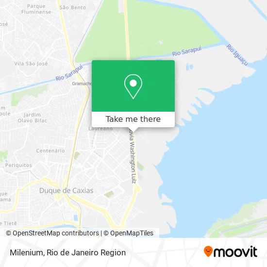
See Milenium, Duque De Caxias, on the map
Public Transit to Milenium in Duque De Caxias
Wondering how to get to Milenium in Duque De Caxias? Moovit helps you find the best way to get to Milenium with step-by-step directions from the nearest public transit station.
Moovit provides free maps and live directions to help you navigate through your city. View schedules, routes, timetables, and find out how long does it take to get to Milenium in real time.
Looking for the nearest stop or station to Milenium? Check out this list of stops closest to your destination: Rod. Washington Luíz 3292 - Parque Sarapuí Duque De Caxias; Rua Frei Caneca; Rua Frei Caneca; Rodovia Washington Luiz (Sentido Petrópolis) | Carvalhão; Rodovia Washington Luíz; Carrefour; R. Aldo Conceição 4565 - Vila Ouro Preto Duque De Caxias; Duque De Caxias.
Bus: 1904T, 444L, 470C, 603I, PETRÓPOLIS - MADUREIRA, TZ07, 018, 016, 422C, EXECUTIVO, PETRÓPOLIS - CAXIAS (PARADOR), 01, 02, 09, 2195C (EXECUTIVO).Train: RAMAL SARACURUNA.
Want to see if there’s another route that gets you there at an earlier time? Moovit helps you find alternative routes or times. Get directions from and directions to Milenium easily from the Moovit App or Website.
We make riding to Milenium easy, which is why over 1.5 million users, including users in Duque De Caxias, trust Moovit as the best app for public transit. You don’t need to download an individual bus app or train app, Moovit is your all-in-one transit app that helps you find the best bus time or train time available.
For information on prices of bus and train, costs and ride fares to Milenium, please check the Moovit app.
Use the app to navigate to popular places including to the airport, hospital, stadium, grocery store, mall, coffee shop, school, college, and university.
Milenium Address: Rodovia Washington Luíz, 1308 Parque Sarapuí Duque de Caxias-RJ street in Duque De Caxias
- Pipoca,
- Rodovia Washington Luíz 1308 - Jardim Variante,
- Parrô Lounge,
- A Vantajosa,
- Feirão de Malhas - Lojas & Informações,
- Karen Vicius,
- Mdv,
- Deliriyou,
- I9 Jeans,
- Rd & Kl Radical Sports,
- Feirão Azul - Atacado e Varejo,
- Diana Calcados,
- Feirão Moda Rio,
- Rodovia Washington Luíz 2500,
- São Vicente X Passeio | União - Executivo,
- Polo Moveleiro RJ,
- Quality in Tabacos,
- Rua Guaicurus, 90,
- Rua Salutaris,
- Nobre (Motel Nobre)
Places Near Milenium (Duque De Caxias)
- Hospital Pedro Ernesto, Vila Isabel,
- Shopping Rio Sul, Botafogo,
- Hospital Federal Cardoso Fontes, Jacarepaguá,
- Rodoviária Novo Rio (Rodoviária do Rio de Janeiro), Santo Cristo,
- Rua Ulysses Guimarães 16, Cidade Nova,
- Hospital Federal Do Andaraí, Andaraí,
- Niterói, Niterói,
- Rio De Janeiro,
- Feirão De Malhas, Duque De Caxias,
- Rua Licínio Cardoso, São Francisco Xavier,
- Shopping Nova América, Del Castilho,
- Shopping Downtown, Barra Da Tijuca,
- Avenida Rio Branco, Centro,
- Norte Shopping, Cachambi,
- Feira Livre da Gloria, Glória,
- Museu Do Amanhã, Centro,
- Praia do Arpoador, Ipanema,
- Hospital Municipal Ronaldo Gazolla, Acari,
- Avenida Venezuela 134, Saúde,
- Shopping RioSul, Botafogo
How to get to popular places in Rio de Janeiro Region with public transit
Get around Duque De Caxias by public transit!
Traveling around Duque De Caxias has never been so easy. See step by step directions as you travel to any attraction, street or major public transit station. View bus and train schedules, arrival times, service alerts and detailed routes on a map, so you know exactly how to get to anywhere in Duque De Caxias.
When traveling to any destination around Duque De Caxias use Moovit's Live Directions with Get Off Notifications to know exactly where and how far to walk, how long to wait for your line, and how many stops are left. Moovit will alert you when it's time to get off — no need to constantly re-check whether yours is the next stop.
Wondering how to use public transit in Duque De Caxias or how to pay for public transit in Duque De Caxias? Moovit public transit app can help you navigate your way with public transit easily, and at minimum cost. It includes public transit fees, ticket prices, and costs. Looking for a map of Duque De Caxias public transit lines? Moovit public transit app shows all public transit maps in Duque De Caxias with all Bus, Train, Metro, Light Rail, Ferry, Cable Car, Gondola and Funicular routes and stops on an interactive map.
Rio de Janeiro Region has 8 transit type(s), including: Bus, Train, Metro, Light Rail, Ferry, Cable Car, Gondola and Funicular, operated by several transit agencies, including TrensRJ, Metrô Rio, VLT Carioca, Barcas Rio, BRT MOBI-Rio, Auto Viação Alpha, Auto Viação Tijuca, Gire Transportes, Transurb, Viação Nossa Senhora das Graças, Consórcio INTERSUL, Braso Lisboa (Municipal), Caprichosa Auto Ônibus, Auto Viação Três Amigos and Rodoviária Âncora Matias