How to get to Milford Podiatry by bus?
Click on the bus route to see step by step directions with maps, line arrival times and updated time schedules.
Bus stops near Milford Podiatry
What are the closest stations to Milford Podiatry?
The closest stations to Milford Podiatry are:
- East Main St Shelter at Beech St is 514 yards away, 7 min walk.
- Spruce St is 1108 yards away, 14 min walk.
Which bus line stops near Milford Podiatry?
14 (Milford Crossing→Milford Regional Medical Center)
What’s the nearest bus station to Milford Podiatry?
The nearest bus station to Milford Podiatry is East Main St Shelter at Beech St. It’s a 7 min walk away.
What time is the first bus to Milford Podiatry?
The 06 is the first bus that goes to Milford Podiatry. It stops nearby at 6:25 AM.
What time is the last bus to Milford Podiatry?
The 14 is the last bus that goes to Milford Podiatry. It stops nearby at 10:12 PM.
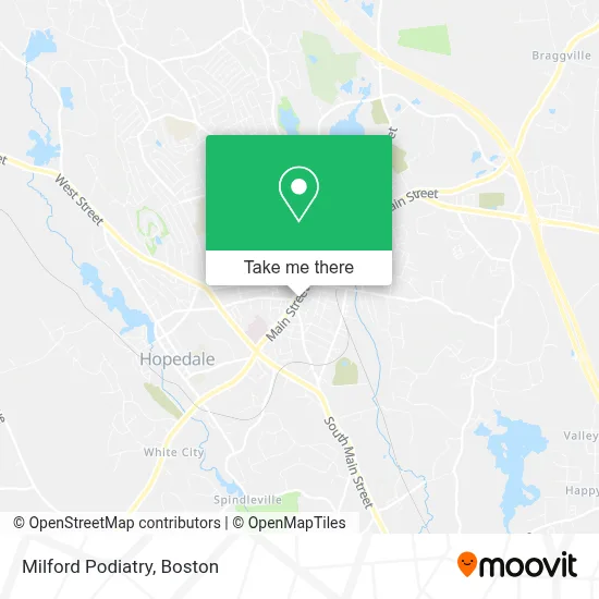
See Milford Podiatry on the map
Public Transportation to Milford Podiatry
Wondering how to get to Milford Podiatry? Moovit helps you find the best way to get to Milford Podiatry with step-by-step directions from the nearest public transit station.
Moovit provides free maps and live directions to help you navigate through your city. View schedules, routes, timetables, and find out how long does it take to get to Milford Podiatry in real time.
Looking for the nearest stop or station to Milford Podiatry? Check out this list of stops closest to your destination: East Main St Shelter at Beech St; Spruce St.
Bus: 14, 06.
Want to see if there’s another route that gets you there at an earlier time? Moovit helps you find alternative routes or times. Get directions from and directions to Milford Podiatry easily from the Moovit App or Website.
We make riding to Milford Podiatry easy, which is why over 1.7 million users, including users in Milford, trust Moovit as the best app for public transit. You don’t need to download an individual bus app or train app, Moovit is your all-in-one transit app that helps you find the best bus time or train time available.
For information on prices of bus, costs and ride fares to Milford Podiatry, please check the Moovit app.
Use the app to navigate to popular places including to the airport, hospital, stadium, grocery store, mall, coffee shop, school, college, and university.
Milford Podiatry Address: 258 Main St street in Milford
- Crystal Hair Extension,
- M2c Aerospace, Inc.,
- Elementary School Building Committee,
- Ashley Elizabeth Peters - Financial Advisor, Ameriprise Financial Services,
- Seraphic Springs Health Care Agency, Inc.,
- Agentry Staffing Services,
- Caracas Construction,
- Yara Limousine Services,
- Law Office of Teresa Persico,
- A P S Dental Laboratory,
- Representative Richard Neal,
- Well Brain,
- USPS,
- Silvas Art Construction,
- Peppercorns Deli,
- Patsos Theodore J Surg,
- RMV Services,
- Arbor One Tree Service,
- Toco Express,
- Jill McLauglin, Realtor
Places Near Milford Podiatry
- Massachusetts General Hospital, Boston,
- North End, Boston,
- House Of Blues, Boston,
- Quincy Market, Boston,
- Wilbur Theatre, Boston,
- Mgm Music Hall, Boston,
- Td Garden, Boston,
- Wang Theater, Boston,
- Isabella Stewart Gardner Museum, Boston,
- Prudential Center, Boston,
- Castle Island, Boston,
- Museum Of Science, Boston,
- Boston Convention & Exhibition Center, Boston,
- Cheers, Boston,
- Faneuil Hall, Boston,
- Seaport District, Boston,
- Boston Medical Center, Boston,
- Boston Common, Boston,
- Leader Bank Pavilion (Leader Bank Pavillion), Boston,
- Boston Children's Hospital, Boston
How to get to popular places in Boston with public transit
Get around Milford by public transit!
Traveling around Milford has never been so easy. See step by step directions as you travel to any attraction, street or major public transit station. View bus and train schedules, arrival times, service alerts and detailed routes on a map, so you know exactly how to get to anywhere in Milford.
When traveling to any destination around Milford use Moovit's Live Directions with Get Off Notifications to know exactly where and how far to walk, how long to wait for your line, and how many stops are left. Moovit will alert you when it's time to get off — no need to constantly re-check whether yours is the next stop.
Wondering how to use public transit in Milford or how to pay for public transit in Milford? Moovit public transit app can help you navigate your way with public transit easily, and at minimum cost. It includes public transit fees, ticket prices, and costs. Looking for a map of Milford public transit lines? Moovit public transit app shows all public transit maps in Milford with all Bus, Train, Subway and Ferry routes and stops on an interactive map.
Boston has 4 transit type(s), including: Bus, Train, Subway and Ferry, operated by several transit agencies, including MBTA, Southeastern Regional Transit Authority, MetroWest Regional Transit Authority, Rhode Island Public Transit Authority, WRTA, Lowell Regional Transit Authority, Merrimack Valley Transit, Montachusett Regional Transit Authority, Cape Cod Regional Transit Authority, Brockton Area Transit Authority, Martha's Vineyard Transit Authority, the WAVE - Nantucket Regional Transit Authority, GATRA, Cape Ann Transportation Authority and Massport