Directions to Milton Shade Tree Advisory Committee with public transportation
The following transit lines have routes that pass near Milton Shade Tree Advisory Committee
 Bus: 240, 245, 12.
- Train: FAIRMOUNT.
- Subway: MATTAPAN LINE.
How to get to Milton Shade Tree Advisory Committee by bus?
Click on the bus route to see step by step directions with maps, line arrival times and updated time schedules.
From 1 Brookline Place
74 minFrom Brigham and Women's
59 minFrom Jamaica Plain V.A.
55 minFrom Cyclorama
69 minFrom Spaulding Rehab
61 minFrom J.J. Foley's Cafe
71 minFrom Christian Science Plaza
75 minFrom Beth Israel Deaconess Medical Center, West Campus - Farr Building
68 minFrom Boston Temple
69 minFrom Myers + Chang (Myers & Chang)
70 min
How to get to Milton Shade Tree Advisory Committee by train?
Click on the train route to see step by step directions with maps, line arrival times and updated time schedules.
How to get to Milton Shade Tree Advisory Committee by subway?
Click on the subway route to see step by step directions with maps, line arrival times and updated time schedules.
From 1 Brookline Place
87 minFrom Brigham and Women's
85 minFrom Jamaica Plain V.A.
97 minFrom Cyclorama
77 minFrom Spaulding Rehab
103 minFrom J.J. Foley's Cafe
68 minFrom Christian Science Plaza
76 minFrom Beth Israel Deaconess Medical Center, West Campus - Farr Building
91 minFrom Boston Temple
87 minFrom Myers + Chang (Myers & Chang)
70 min
Bus stops near Milton Shade Tree Advisory Committee
Subway station near Milton Shade Tree Advisory Committee
- Valley Road, 10 min walk,VIEW
Bus lines to Milton Shade Tree Advisory Committee
What are the closest stations to Milton Shade Tree Advisory Committee?
The closest stations to Milton Shade Tree Advisory Committee are:
- Opp 202 Reedsdale Rd @ Milton Hospital is 381 yards away, 5 min walk.
- Reedsdale Rd @ Walnut St is 478 yards away, 6 min walk.
- Valley Road is 839 yards away, 10 min walk.
Which bus line stops near Milton Shade Tree Advisory Committee?
240 (Holbrook/Randolph Via Crawford Square)
Which train line stops near Milton Shade Tree Advisory Committee?
FAIRMOUNT (#1619 | Fairmount)
Which subway line stops near Milton Shade Tree Advisory Committee?
MATTAPAN LINE (Mattapan)
What’s the nearest subway station to Milton Shade Tree Advisory Committee?
The nearest subway station to Milton Shade Tree Advisory Committee is Valley Road. It’s a 10 min walk away.
What’s the nearest bus station to Milton Shade Tree Advisory Committee?
The nearest bus station to Milton Shade Tree Advisory Committee is Opp 202 Reedsdale Rd @ Milton Hospital. It’s a 5 min walk away.
What time is the first subway to Milton Shade Tree Advisory Committee?
The MATTAPAN LINE is the first subway that goes to Milton Shade Tree Advisory Committee. It stops nearby at 5:00 AM.
What time is the last subway to Milton Shade Tree Advisory Committee?
The MATTAPAN LINE is the last subway that goes to Milton Shade Tree Advisory Committee. It stops nearby at 2:40 AM.
What time is the first bus to Milton Shade Tree Advisory Committee?
The 240 is the first bus that goes to Milton Shade Tree Advisory Committee. It stops nearby at 4:55 AM.
What time is the last bus to Milton Shade Tree Advisory Committee?
The 240 is the last bus that goes to Milton Shade Tree Advisory Committee. It stops nearby at 1:03 AM.
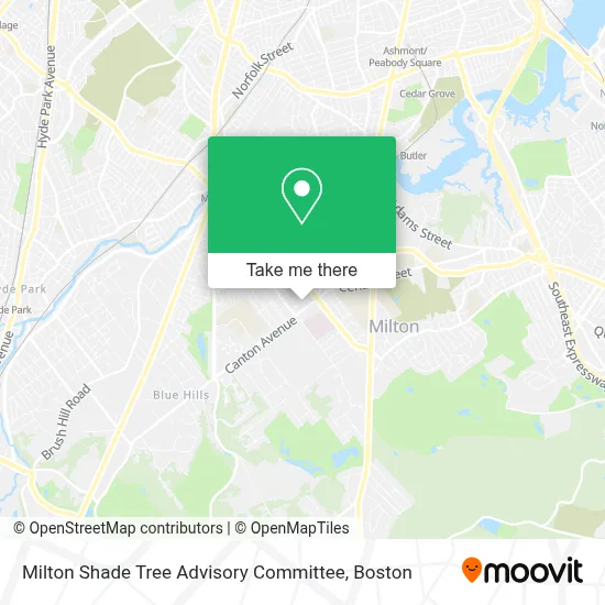
See Milton Shade Tree Advisory Committee on the map
Public Transportation to Milton Shade Tree Advisory Committee
Wondering how to get to Milton Shade Tree Advisory Committee? Moovit helps you find the best way to get to Milton Shade Tree Advisory Committee with step-by-step directions from the nearest public transit station.
Moovit provides free maps and live directions to help you navigate through your city. View schedules, routes, timetables, and find out how long does it take to get to Milton Shade Tree Advisory Committee in real time.
Looking for the nearest stop or station to Milton Shade Tree Advisory Committee? Check out this list of stops closest to your destination: Opp 202 Reedsdale Rd @ Milton Hospital; Reedsdale Rd @ Walnut St; Valley Road.
Bus: 240, 245, 12.Train: FAIRMOUNT.Subway: MATTAPAN LINE.
Want to see if there’s another route that gets you there at an earlier time? Moovit helps you find alternative routes or times. Get directions from and directions to Milton Shade Tree Advisory Committee easily from the Moovit App or Website.
We make riding to Milton Shade Tree Advisory Committee easy, which is why over 1.7 million users, including users in Milton, trust Moovit as the best app for public transit. You don’t need to download an individual bus app or train app, Moovit is your all-in-one transit app that helps you find the best bus time or train time available.
For information on prices of bus, subway and train, costs and ride fares to Milton Shade Tree Advisory Committee, please check the Moovit app.
Use the app to navigate to popular places including to the airport, hospital, stadium, grocery store, mall, coffee shop, school, college, and university.
Milton Shade Tree Advisory Committee Address: 525 Canton Ave street in Milton
- Mullen James G Jr,
- Milton Fire Department,
- The Ministerial Search Committee,
- Milton Public Library,
- Beth Israel Deaconess Hospital-Milton,
- Kneaded Therapy,
- Milton, Massachusetts,
- Medical Center Orthotics & Prosthetics,
- Cynthia H. Demarest, SLP,
- To Life Coach,
- Beth Israel Deaconess Milton,
- Shazzys Sweets,
- Edward Reardon, MD,
- CWB Foundation,
- Apranta D Patel MD,
- Beth Israel Deaconess Healthcare - Milton Group,
- Valentine Partners,
- Apex Medical Associates,
- Birkenfeld Ronald,
- Gluck Clifford
Places Near Milton Shade Tree Advisory Committee
- North End, Boston,
- House Of Blues, Boston,
- Seaport District, Boston,
- Prudential Center, Boston,
- Castle Island, Boston,
- Td Garden, Boston,
- Massachusetts General Hospital, Boston,
- Cheers, Boston,
- Museum Of Science, Boston,
- Boston Medical Center, Boston,
- Wilbur Theatre, Boston,
- Isabella Stewart Gardner Museum, Boston,
- Leader Bank Pavilion (Leader Bank Pavillion), Boston,
- Boston Common, Boston,
- Boston Children's Hospital, Boston,
- Mgm Music Hall, Boston,
- Faneuil Hall, Boston,
- Wang Theater, Boston,
- Boston Convention & Exhibition Center, Boston,
- Quincy Market, Boston
How to get to popular places in Boston with public transit
Get around Milton by public transit!
Traveling around Milton has never been so easy. See step by step directions as you travel to any attraction, street or major public transit station. View bus and train schedules, arrival times, service alerts and detailed routes on a map, so you know exactly how to get to anywhere in Milton.
When traveling to any destination around Milton use Moovit's Live Directions with Get Off Notifications to know exactly where and how far to walk, how long to wait for your line, and how many stops are left. Moovit will alert you when it's time to get off — no need to constantly re-check whether yours is the next stop.
Wondering how to use public transit in Milton or how to pay for public transit in Milton? Moovit public transit app can help you navigate your way with public transit easily, and at minimum cost. It includes public transit fees, ticket prices, and costs. Looking for a map of Milton public transit lines? Moovit public transit app shows all public transit maps in Milton with all Bus, Train, Subway and Ferry routes and stops on an interactive map.
Boston has 4 transit type(s), including: Bus, Train, Subway and Ferry, operated by several transit agencies, including MBTA, Southeastern Regional Transit Authority, MetroWest Regional Transit Authority, Rhode Island Public Transit Authority, WRTA, Lowell Regional Transit Authority, Merrimack Valley Transit, Montachusett Regional Transit Authority, Cape Cod Regional Transit Authority, Brockton Area Transit Authority, Martha's Vineyard Transit Authority, the WAVE - Nantucket Regional Transit Authority, GATRA, Cape Ann Transportation Authority and Massport