Directions to Mindful Action Network (Boston) with public transportation
The following transit lines have routes that pass near Mindful Action Network
 Bus: ACTON/CONCORD COMMUTER.
- Train: FITCHBURG.
How to get to Mindful Action Network by bus?
Click on the bus route to see step by step directions with maps, line arrival times and updated time schedules.
How to get to Mindful Action Network by train?
Click on the train route to see step by step directions with maps, line arrival times and updated time schedules.
Train station near Mindful Action Network in Boston
- Lincoln, 25 min walk,VIEW
What are the closest stations to Mindful Action Network?
The closest stations to Mindful Action Network are:
- Lincoln is 2045 yards away, 25 min walk.
Which bus line stops near Mindful Action Network?
ACTON/CONCORD COMMUTER (Concord)
Which train line stops near Mindful Action Network?
FITCHBURG (#413 | Wachusett)
What’s the nearest train station to Mindful Action Network in Boston?
The nearest train station to Mindful Action Network in Boston is Lincoln. It’s a 25 min walk away.
What time is the first train to Mindful Action Network in Boston?
The FITCHBURG is the first train that goes to Mindful Action Network in Boston. It stops nearby at 5:15 AM.
What time is the last train to Mindful Action Network in Boston?
The FITCHBURG is the last train that goes to Mindful Action Network in Boston. It stops nearby at 12:29 AM.
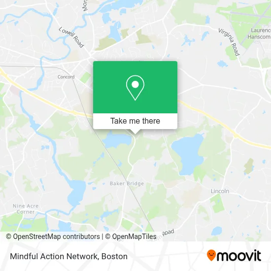
See Mindful Action Network, Boston, on the map
Public Transit to Mindful Action Network in Boston
Wondering how to get to Mindful Action Network in Boston? Moovit helps you find the best way to get to Mindful Action Network with step-by-step directions from the nearest public transit station.
Moovit provides free maps and live directions to help you navigate through your city. View schedules, routes, timetables, and find out how long does it take to get to Mindful Action Network in real time.
Looking for the nearest stop or station to Mindful Action Network? Check out this list of stops closest to your destination: Lincoln.
Bus: ACTON/CONCORD COMMUTER.Train: FITCHBURG.
Want to see if there’s another route that gets you there at an earlier time? Moovit helps you find alternative routes or times. Get directions from and directions to Mindful Action Network easily from the Moovit App or Website.
We make riding to Mindful Action Network easy, which is why over 1.7 million users, including users in Boston, trust Moovit as the best app for public transit. You don’t need to download an individual bus app or train app, Moovit is your all-in-one transit app that helps you find the best bus time or train time available.
For information on prices of bus, train and subway, costs and ride fares to Mindful Action Network, please check the Moovit app.
Use the app to navigate to popular places including to the airport, hospital, stadium, grocery store, mall, coffee shop, school, college, and university.
Mindful Action Network Address: 915 Walden St street in Boston
- Walden Pond State Reservation,
- Walden Pond,
- Walden Lake,
- Inward Bound Mindfulness,
- אגם וולדן,
- Bristers Hill,
- Henry David Thoreau Cabin Site,
- Concord-Carlisle High School,
- Frog Pond,
- The Commons In Lincoln,
- American Painting,
- Sam Hiersteiner For Concord Select Board,
- Visitor Parking,
- 4drive,
- Xavier High School - Concord MA,
- Alltown,
- Blue Rhino Propane Exchange,
- Stem Academy,
- Benchmark Senior Living at the Commons,
- Cchs Pa - Class Of 2019
Places Near Mindful Action Network (Boston)
- Boston Children's Hospital, Boston,
- Boston Common, Boston,
- Td Garden, Boston,
- Castle Island, Boston,
- Museum Of Science, Boston,
- North End, Boston,
- Leader Bank Pavilion (Leader Bank Pavillion), Boston,
- Boston Medical Center, Boston,
- Wilbur Theatre, Boston,
- Prudential Center, Boston,
- Wang Theater, Boston,
- Boston Convention & Exhibition Center, Boston,
- Massachusetts General Hospital, Boston,
- House Of Blues, Boston,
- Seaport District, Boston,
- Faneuil Hall, Boston,
- Quincy Market, Boston,
- Cheers, Boston,
- Isabella Stewart Gardner Museum, Boston,
- Mgm Music Hall, Boston
How to get to popular places in Boston with public transit
Get around Boston by public transit!
Traveling around Boston has never been so easy. See step by step directions as you travel to any attraction, street or major public transit station. View bus and train schedules, arrival times, service alerts and detailed routes on a map, so you know exactly how to get to anywhere in Boston.
When traveling to any destination around Boston use Moovit's Live Directions with Get Off Notifications to know exactly where and how far to walk, how long to wait for your line, and how many stops are left. Moovit will alert you when it's time to get off — no need to constantly re-check whether yours is the next stop.
Wondering how to use public transit in Boston or how to pay for public transit in Boston? Moovit public transit app can help you navigate your way with public transit easily, and at minimum cost. It includes public transit fees, ticket prices, and costs. Looking for a map of Boston public transit lines? Moovit public transit app shows all public transit maps in Boston with all Bus, Train, Subway and Ferry routes and stops on an interactive map.
Boston has 4 transit type(s), including: Bus, Train, Subway and Ferry, operated by several transit agencies, including MBTA, Southeastern Regional Transit Authority, MetroWest Regional Transit Authority, Rhode Island Public Transit Authority, WRTA, Lowell Regional Transit Authority, Merrimack Valley Transit, Montachusett Regional Transit Authority, Cape Cod Regional Transit Authority, Brockton Area Transit Authority, Martha's Vineyard Transit Authority, the WAVE - Nantucket Regional Transit Authority, GATRA, Cape Ann Transportation Authority and Massport