See Ministerstvo Pro Místní Rozvoj, Praha 1, on the map
Directions to Ministerstvo Pro Místní Rozvoj (Praha 1) with public transportation
The following transit lines have routes that pass near Ministerstvo Pro Místní Rozvoj
 Bus:
Bus: - Train:
- Subway:
- Light Rail:
How to get to Ministerstvo Pro Místní Rozvoj by bus?
Click on the bus route to see step by step directions with maps, line arrival times and updated time schedules.
How to get to Ministerstvo Pro Místní Rozvoj by train?
Click on the train route to see step by step directions with maps, line arrival times and updated time schedules.
How to get to Ministerstvo Pro Místní Rozvoj by subway?
Click on the subway route to see step by step directions with maps, line arrival times and updated time schedules.
Light Rail stations near Ministerstvo Pro Místní Rozvoj in Praha 1
- Malostranská (C),4 min walk,
- Čechův Most (B),12 min walk,
- Hellichova (B),12 min walk,
Bus stations near Ministerstvo Pro Místní Rozvoj in Praha 1
- Nemocnice POD Petřínem (A),15 min walk,
- Hradčanská (E),17 min walk,
Train stations near Ministerstvo Pro Místní Rozvoj in Praha 1
- Praha-Dejvice,22 min walk,
Bus lines to Ministerstvo Pro Místní Rozvoj in Praha 1
- 194,Nemocnice POD Petřínem,
- 131,Hradčanská,
- 907,Karlovo Náměstí,
What are the closest stations to Ministerstvo Pro Místní Rozvoj?
The closest stations to Ministerstvo Pro Místní Rozvoj are:
- Malostranská (C) is 239 meters away, 4 min walk.
- Čechův Most (B) is 865 meters away, 12 min walk.
- Hellichova (B) is 916 meters away, 12 min walk.
- Nemocnice POD Petřínem (A) is 1122 meters away, 15 min walk.
- Hradčanská (E) is 1238 meters away, 17 min walk.
- Praha-Dejvice is 1628 meters away, 22 min walk.
Which bus lines stop near Ministerstvo Pro Místní Rozvoj?
These bus lines stop near Ministerstvo Pro Místní Rozvoj: 120, 149, 180, 190, 194, 207.
Which train lines stop near Ministerstvo Pro Místní Rozvoj?
These train lines stop near Ministerstvo Pro Místní Rozvoj: 5808, 8823, R24, S65, S8.
Which subway line stops near Ministerstvo Pro Místní Rozvoj?
A
Which light rail lines stop near Ministerstvo Pro Místní Rozvoj?
These light rail lines stop near Ministerstvo Pro Místní Rozvoj: 12, 15, 17, 20.
What’s the nearest light rail station to Ministerstvo Pro Místní Rozvoj in Praha 1?
The nearest light rail station to Ministerstvo Pro Místní Rozvoj in Praha 1 is Malostranská (C). It’s a 4 min walk away.
What’s the nearest train station to Ministerstvo Pro Místní Rozvoj in Praha 1?
The nearest train station to Ministerstvo Pro Místní Rozvoj in Praha 1 is Praha-Dejvice. It’s a 22 min walk away.
What’s the nearest bus stop to Ministerstvo Pro Místní Rozvoj in Praha 1?
The nearest bus stop to Ministerstvo Pro Místní Rozvoj in Praha 1 is Nemocnice POD Petřínem (A). It’s a 15 min walk away.
See Ministerstvo Pro Místní Rozvoj, Praha 1, on the map
Public Transit to Ministerstvo Pro Místní Rozvoj in Praha 1
Wondering how to get to Ministerstvo Pro Místní Rozvoj in Praha 1, Czech Republic? Moovit helps you find the best way to get to Ministerstvo Pro Místní Rozvoj with step-by-step directions from the nearest public transit station.
Moovit provides free maps and live directions to help you navigate through your city. View schedules, routes, timetables, and find out how long does it take to get to Ministerstvo Pro Místní Rozvoj in real time.
Looking for the nearest stop or station to Ministerstvo Pro Místní Rozvoj? Check out this list of stops closest to your destination: Malostranská (C); Čechův Most (B); Hellichova (B); Nemocnice POD Petřínem (A); Hradčanská (E); Praha-Dejvice.
Bus:Train:Subway:Light Rail:
Want to see if there’s another route that gets you there at an earlier time? Moovit helps you find alternative routes or times. Get directions from and directions to Ministerstvo Pro Místní Rozvoj easily from the Moovit App or Website.
We make riding to Ministerstvo Pro Místní Rozvoj easy, which is why over 1.5 million users, including users in Praha 1, trust Moovit as the best app for public transit. You don’t need to download an individual bus app or train app, Moovit is your all-in-one transit app that helps you find the best bus time or train time available.
For information on prices of bus, light rail, subway and train, costs and ride fares to Ministerstvo Pro Místní Rozvoj, please check the Moovit app.
Use the app to navigate to popular places including to the airport, hospital, stadium, grocery store, mall, coffee shop, school, college, and university.
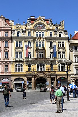
Ministerstvo Pro Místní Rozvoj Address: Letenská street in Praha 1
The Ministry of Regional Development of the Czech Republic (Czech: Ministerstvo pro místní rozvoj České republiky) is a government ministry, which was established in 1996.Wiki
Attractions near Ministerstvo Pro Místní Rozvoj
Anglo-American University (Anglo-americká vysoká škola),Ministerstvo pro místní rozvoj – odbor územního plánování,ISIC Point,Asociace českých cestovních kanceláří a agentur (AČCKA),U Bílé Košile,Malostranská,U-Bahn =A= Malostranská (Metro =A= Malostranská),Valdštejnská Jízdárna,Metro =A= Malostranská,Na Opyši,Spazio 33,Klárov,Darky Gifts,#7 A co kdyby to byla pravda | Signal Festival 2019,Fun Explosive,Fontány v zahradě stanice metra Malostranská,Vojanovy sady,Вояновы сады (Vojanovy sady),Picadero de Wallenstein (Valdštejnská jízdárna),Valdštejnská zahrada | Waldstein GardenHow to get to popular attractions in Praha 1 with public transit
Sportcentrum Sluneta, Ústí Nad Labem,Dalejské údolí, Praha-Řeporyje,Disco Ballagio, Praha - Východ,Pohořelec (tram), Praha 6,Restaurace Dvan, Praha 12,Pražská správa sociálního zabezpečení, Praha 8,Autobusové nádraží Benešov, Benešov,Skleník Fata Morgana, Praha-Troja,Tupolevova (bus), Praha 18,Pod Kavalírkou, Praha 5,Na Planině (bus), Praha 4,Panorama Kyje, Praha 14,Knovíz, Kladno,Praha Hlavní Nádraží, Praha 2,Zličín Business Center, Praha-Zličín,JNJ GBS, Praha 5,Rezidence Topolova, Praha 10,U Kaštanu (tram), Praha 6,Čertův vršek, Praha 8,Mírové náměstí (bus), Ústí Nad LabemGet around Praha 1 by public transit!
Traveling around Praha 1 has never been so easy. See step by step directions as you travel to any attraction, street or major public transit station. View bus and train schedules, arrival times, service alerts and detailed routes on a map, so you know exactly how to get to anywhere in Praha 1.
When traveling to any destination around Praha 1 use Moovit's Live Directions with Get Off Notifications to know exactly where and how far to walk, how long to wait for your line, and how many stops are left. Moovit will alert you when it's time to get off — no need to constantly re-check whether yours is the next stop.
Wondering how to use public transit in Praha 1 or how to pay for public transit in Praha 1? Moovit public transit app can help you navigate your way with public transit easily, and at minimum cost. It includes public transit fees, ticket prices, and costs. Looking for a map of Praha 1 public transit lines? Moovit public transit app shows all public transit maps in Praha 1 with all bus, light rail, subway or train routes and stops on an interactive map.
Praha 1 has 4 transit type(s), including: bus, light rail, subway or train, operated by several transit agencies, including Dopravní podnik měst Liberce a Jablonce nad Nisou, a.s., Dopravní podnik měst Liberce a Jablonce nad Nisou, a.s., BusLine jižní Čechy s.r.o., Railway Capital a.s., Dopravní společnost Ústeckého kraje, příspěvková organizace, DPP, DPP, DPP, DPP, Dopravní podnik hl. m. Prahy, akciová společnost, České dráhy, a.s., KŽC Doprava,s.r.o., ARRIVA vlaky s.r.o., KAD BUS spol. s r.o. and ARRIVA PRAHA s.r.o