Directions to Mintz (Boston) with public transportation
The following transit lines have routes that pass near Mintz
 Bus: 450, 504, 92, SL3, SL4.
- Train: FITCHBURG, FRAMINGHAM/WORCESTER, LOWELL, NEEDHAM.
- Subway: BLUE LINE, ORANGE LINE, RED LINE, GREEN LINE B, GREEN LINE C.
- Ferry: HINGHAM FERRY.
How to get to Mintz by bus?
Click on the bus route to see step by step directions with maps, line arrival times and updated time schedules.
From Regent Theatre, Arlington
72 minFrom Hilton Garden Inn, Brookline
43 minFrom Arnold Arboretum, Boston
61 minFrom Revere Beach, Revere
70 minFrom Harvard Upper Busway, Cambridge
53 minFrom FOUR POINTS BY SHERATON Boston Newton, Newton
27 minFrom Hilton Garden Inn Boston Logan Airport, Boston
38 minFrom Harvard Museum Of Natural History, Cambridge
60 minFrom The Mall At Chestnut Hill, Newton
71 minFrom Milton Academy, Milton
96 min
How to get to Mintz by train?
Click on the train route to see step by step directions with maps, line arrival times and updated time schedules.
How to get to Mintz by subway?
Click on the subway route to see step by step directions with maps, line arrival times and updated time schedules.
From Hilton Garden Inn, Brookline
37 minFrom Arnold Arboretum, Boston
41 minFrom Revere Beach, Revere
48 minFrom Harvard Upper Busway, Cambridge
17 minFrom Hilton Garden Inn Boston Logan Airport, Boston
33 minFrom Harvard Museum Of Natural History, Cambridge
26 minFrom The Mall At Chestnut Hill, Newton
64 minFrom Milton Academy, Milton
50 min
Bus stops near Mintz in Boston
- South Station Bus Terminal, 2 min walk,VIEW
- Essex St @ Atlantic Ave, 4 min walk,VIEW
- South Station Boston, 4 min walk,VIEW
- Chinatown Gate, 4 min walk,VIEW
- Otis St @ Summer St, 5 min walk,VIEW
- Summer St @ South Station - Red Line Entrance, 5 min walk,VIEW
- Summer St @ Atlantic Ave, 5 min walk,VIEW
- Boston-South Station, 5 min walk,VIEW
- Chauncy St @ Summer St, 7 min walk,VIEW
Ferry station near Mintz in Boston
- Rowes Wharf, 16 min walk,VIEW
Bus lines to Mintz in Boston
- FLIXBUS 2610, NYC - Boston,VIEW
- FLIXBUS 2611, NYC Chinatown - Boston,VIEW
- FLIXBUS 2612, NYC Queens - Boston,VIEW
- FLIXBUS 2614, Newark - Boston,VIEW
- FLIXBUS 2619, Boston - NYC - Philadelphia,VIEW
- FLIXBUS 2691, Boston - Albany - Ithaca,VIEW
- FLIXBUS 2693, Boston - Albany,VIEW
- FLIXBUS N2605, Boston - NYC - Richmond,VIEW
- FLIXBUS N2610, NYC - Boston,VIEW
- FLIXBUS N2615, NYC - Boston - Portland - Bangor,VIEW
- GREYHOUND US0171, Cleveland - Buffalo - Boston,VIEW
- GREYHOUND US0230, Boston - New York (Express Service),VIEW
- GREYHOUND US0231, Boston - New York (Weekend Service),VIEW
- GREYHOUND US0235, Boston - Philadelphia - Washington,VIEW
- GREYHOUND US0240, New York - Hartford - Boston,VIEW
- GREYHOUND US0260, Boston - Burlington - Montréal,VIEW
- GREYHOUND US0270, Boston - Albany - Syracuse,VIEW
- GREYHOUND US0230D, Boston / New York: Bus Moves,VIEW
- GREYHOUND US0256S, Boston - Fitchburg - New York,VIEW
- GREYHOUND US0265S, Boston - Portland - Bangor,VIEW
What are the closest stations to Mintz?
The closest stations to Mintz are:
- South Station Bus Terminal is 142 yards away, 2 min walk.
- Chinatown is 205 yards away, 3 min walk.
- Essex St @ Atlantic Ave is 258 yards away, 4 min walk.
- South Station Boston is 283 yards away, 4 min walk.
- Park Street is 285 yards away, 4 min walk.
- Chinatown Gate is 289 yards away, 4 min walk.
- Otis St @ Summer St is 354 yards away, 5 min walk.
- Summer St @ South Station - Red Line Entrance is 413 yards away, 5 min walk.
- Summer St @ Atlantic Ave is 417 yards away, 5 min walk.
- Boston-South Station is 420 yards away, 5 min walk.
- Chauncy St @ Summer St is 550 yards away, 7 min walk.
- Rowes Wharf is 1277 yards away, 16 min walk.
Which bus lines stop near Mintz?
These bus lines stop near Mintz: 450, 504, 92, SL3, SL4.
Which train lines stop near Mintz?
These train lines stop near Mintz: FITCHBURG, FRAMINGHAM/WORCESTER, LOWELL, NEEDHAM.
Which subway lines stop near Mintz?
These subway lines stop near Mintz: BLUE LINE, ORANGE LINE, RED LINE.
What’s the nearest subway station to Mintz in Boston?
The nearest subway station to Mintz in Boston is Chinatown. It’s a 3 min walk away.
What’s the nearest bus station to Mintz in Boston?
The nearest bus station to Mintz in Boston is South Station Bus Terminal. It’s a 2 min walk away.
What’s the nearest ferry station to Mintz in Boston?
The nearest ferry station to Mintz in Boston is Rowes Wharf. It’s a 16 min walk away.
What time is the first subway to Mintz in Boston?
The GREEN LINE E is the first subway that goes to Mintz in Boston. It stops nearby at 5:07 AM.
What time is the last subway to Mintz in Boston?
The GREEN LINE E is the last subway that goes to Mintz in Boston. It stops nearby at 2:18 AM.
What time is the first bus to Mintz in Boston?
The BOSTON EXPRESS 93 is the first bus that goes to Mintz in Boston. It stops nearby at 4:55 AM.
What time is the last bus to Mintz in Boston?
The FLIXBUS N2605 is the last bus that goes to Mintz in Boston. It stops nearby at 9:25 AM.
What time is the first ferry to Mintz in Boston?
The HINGHAM FERRY is the first ferry that goes to Mintz in Boston. It stops nearby at 6:30 AM.
What time is the last ferry to Mintz in Boston?
The HINGHAM FERRY is the last ferry that goes to Mintz in Boston. It stops nearby at 8:30 PM.
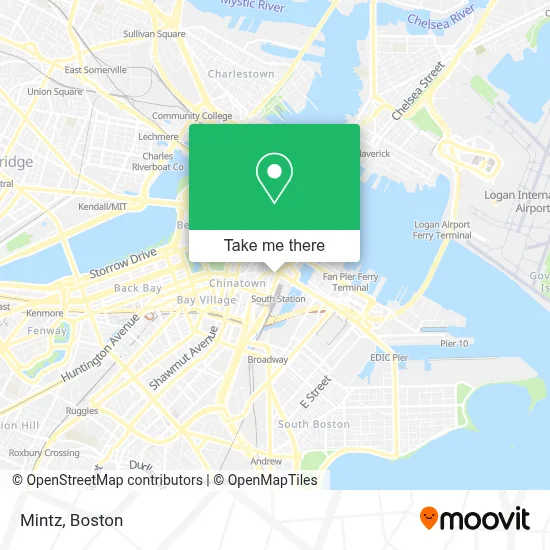
See Mintz, Boston, on the map
Public Transit to Mintz in Boston
Wondering how to get to Mintz in Boston? Moovit helps you find the best way to get to Mintz with step-by-step directions from the nearest public transit station.
Moovit provides free maps and live directions to help you navigate through your city. View schedules, routes, timetables, and find out how long does it take to get to Mintz in real time.
Looking for the nearest stop or station to Mintz? Check out this list of stops closest to your destination: South Station Bus Terminal; Chinatown; Essex St @ Atlantic Ave; South Station Boston; Park Street; Chinatown Gate; Otis St @ Summer St; Summer St @ South Station - Red Line Entrance; Summer St @ Atlantic Ave; Boston-South Station; Chauncy St @ Summer St; Rowes Wharf.
Bus: 450, 504, 92, SL3, SL4, FLIXBUS 2610, FLIXBUS 2611, FLIXBUS 2612, FLIXBUS 2614, FLIXBUS 2619, PETER PAN, PETER PAN, PETER PAN, PETER PAN, PETER PAN.Train: FITCHBURG, FRAMINGHAM/WORCESTER, LOWELL, NEEDHAM.Subway: BLUE LINE, ORANGE LINE, RED LINE, GREEN LINE B, GREEN LINE C, GREEN LINE D, GREEN LINE E.Ferry: HINGHAM FERRY.
Want to see if there’s another route that gets you there at an earlier time? Moovit helps you find alternative routes or times. Get directions from and directions to Mintz easily from the Moovit App or Website.
We make riding to Mintz easy, which is why over 1.7 million users, including users in Boston, trust Moovit as the best app for public transit. You don’t need to download an individual bus app or train app, Moovit is your all-in-one transit app that helps you find the best bus time or train time available.
For information on prices of subway, bus and train, costs and ride fares to Mintz, please check the Moovit app.
Use the app to navigate to popular places including to the airport, hospital, stadium, grocery store, mall, coffee shop, school, college, and university.
Mintz Address: One Financial Center, 675 Atlantic Ave street in Boston
- Daley and Associates,
- One Financial Center,
- South Station Concierge Tourist Info & City Maps,
- Brooke B Sugaski Attorney (Jerome B Tichner Attorney),
- Dennis T Dougherty Attorney (Gregory T Arnold Lawyer),
- Teddy Ballgames,
- Amtrak-Boston South Station,
- Long Distance Movers and Interstate Moving Companies,
- General Shoe & Luggage Repair ,
- Keystone Associates,
- Greyhound Bus Lines,
- Windmill Point (historical),
- Dewey Square,
- Well Coffee House Boston,
- 700 Atlantic Ave-South Station,
- Peter Pan Bus Lines at South Station,
- Stoked Wood Fired Pizza Co.,
- 600 Atlantic Federal Credit Union,
- Boston Federal Reserve Bank,
- Plymouth Rock Building
Places Near Mintz (Boston)
- Seaport District, Boston,
- Museum Of Science, Boston,
- Boston Children's Hospital, Boston,
- Faneuil Hall, Boston,
- Leader Bank Pavilion (Leader Bank Pavillion), Boston,
- Wilbur Theatre, Boston,
- House Of Blues, Boston,
- North End, Boston,
- Boston Medical Center, Boston,
- Castle Island, Boston,
- Boston Convention & Exhibition Center, Boston,
- Quincy Market, Boston,
- Boston Common, Boston,
- Td Garden, Boston,
- Wang Theater, Boston,
- Massachusetts General Hospital, Boston,
- Cheers, Boston,
- Mgm Music Hall, Boston,
- Prudential Center, Boston,
- Isabella Stewart Gardner Museum, Boston
How to get to popular places in Boston with public transit
Get around Boston by public transit!
Traveling around Boston has never been so easy. See step by step directions as you travel to any attraction, street or major public transit station. View bus and train schedules, arrival times, service alerts and detailed routes on a map, so you know exactly how to get to anywhere in Boston.
When traveling to any destination around Boston use Moovit's Live Directions with Get Off Notifications to know exactly where and how far to walk, how long to wait for your line, and how many stops are left. Moovit will alert you when it's time to get off — no need to constantly re-check whether yours is the next stop.
Wondering how to use public transit in Boston or how to pay for public transit in Boston? Moovit public transit app can help you navigate your way with public transit easily, and at minimum cost. It includes public transit fees, ticket prices, and costs. Looking for a map of Boston public transit lines? Moovit public transit app shows all public transit maps in Boston with all Bus, Train, Subway and Ferry routes and stops on an interactive map.
Boston has 4 transit type(s), including: Bus, Train, Subway and Ferry, operated by several transit agencies, including MBTA, Southeastern Regional Transit Authority, MetroWest Regional Transit Authority, Rhode Island Public Transit Authority, WRTA, Lowell Regional Transit Authority, Merrimack Valley Transit, Montachusett Regional Transit Authority, Cape Cod Regional Transit Authority, Brockton Area Transit Authority, Martha's Vineyard Transit Authority, the WAVE - Nantucket Regional Transit Authority, GATRA, Cape Ann Transportation Authority and Massport