Directions to Minute Key (Lynn) with public transportation
The following transit lines have routes that pass near Minute Key
 Bus: 426, 441, 442, 439, 441/442.
- Train: NEWBURYPORT/ROCKPORT.
- Ferry: LYNN FERRY.
How to get to Minute Key by bus?
Click on the bus route to see step by step directions with maps, line arrival times and updated time schedules.
From Salem Witch Museum, Salem
71 minFrom East Boston, Boston
53 minFrom Walmart, Saugus
77 minFrom Constitution Beach, Boston
78 minFrom Rino's Place, Boston
64 minFrom Massport Security Badge Office, Boston
70 minFrom Terminal E- Logan International Airport, Boston
70 minFrom Melrose, MA, Melrose
88 minFrom Rental Car Center - Logan Airport, Boston
52 minFrom Hilton Garden Inn Boston Logan Airport, Boston
52 min
How to get to Minute Key by train?
Click on the train route to see step by step directions with maps, line arrival times and updated time schedules.
Bus stop near Minute Key in Lynn
- 777 Lynnway, 8 min walk,VIEW
Train station near Minute Key in Lynn
- Swampscott, 43 min walk,VIEW
Ferry station near Minute Key in Lynn
- Blossom Street Pier, 53 min walk,VIEW
Bus lines to Minute Key in Lynn
What are the closest stations to Minute Key?
The closest stations to Minute Key are:
- 777 Lynnway is 681 yards away, 8 min walk.
- Swampscott is 3655 yards away, 43 min walk.
- Blossom Street Pier is 4516 yards away, 53 min walk.
Which bus lines stop near Minute Key?
These bus lines stop near Minute Key: 426, 441, 442.
Which train line stops near Minute Key?
NEWBURYPORT/ROCKPORT (#120 | North Station)
What’s the nearest bus station to Minute Key in Lynn?
The nearest bus station to Minute Key in Lynn is 777 Lynnway. It’s a 8 min walk away.
What time is the first train to Minute Key in Lynn?
The NEWBURYPORT/ROCKPORT is the first train that goes to Minute Key in Lynn. It stops nearby at 5:27 AM.
What time is the last train to Minute Key in Lynn?
The NEWBURYPORT/ROCKPORT is the last train that goes to Minute Key in Lynn. It stops nearby at 12:20 AM.
What time is the first bus to Minute Key in Lynn?
The 441/442 is the first bus that goes to Minute Key in Lynn. It stops nearby at 5:41 AM.
What time is the last bus to Minute Key in Lynn?
The 441/442 is the last bus that goes to Minute Key in Lynn. It stops nearby at 1:28 AM.
What time is the first ferry to Minute Key in Lynn?
The LYNN FERRY is the first ferry that goes to Minute Key in Lynn. It stops nearby at 6:00 AM.
What time is the last ferry to Minute Key in Lynn?
The LYNN FERRY is the last ferry that goes to Minute Key in Lynn. It stops nearby at 7:55 PM.
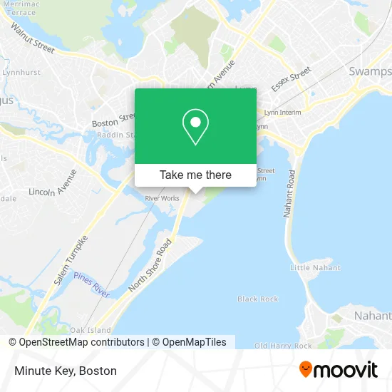
See Minute Key, Lynn, on the map
Public Transit to Minute Key in Lynn
Wondering how to get to Minute Key in Lynn? Moovit helps you find the best way to get to Minute Key with step-by-step directions from the nearest public transit station.
Moovit provides free maps and live directions to help you navigate through your city. View schedules, routes, timetables, and find out how long does it take to get to Minute Key in real time.
Looking for the nearest stop or station to Minute Key? Check out this list of stops closest to your destination: 777 Lynnway; Swampscott; Blossom Street Pier.
Bus: 426, 441, 442, 439, 441/442.Train: NEWBURYPORT/ROCKPORT.Ferry: LYNN FERRY.
Want to see if there’s another route that gets you there at an earlier time? Moovit helps you find alternative routes or times. Get directions from and directions to Minute Key easily from the Moovit App or Website.
We make riding to Minute Key easy, which is why over 1.7 million users, including users in Lynn, trust Moovit as the best app for public transit. You don’t need to download an individual bus app or train app, Moovit is your all-in-one transit app that helps you find the best bus time or train time available.
For information on prices of bus, subway and train, costs and ride fares to Minute Key, please check the Moovit app.
Use the app to navigate to popular places including to the airport, hospital, stadium, grocery store, mall, coffee shop, school, college, and university.
Minute Key Address: 780 Lynnway street in Lynn
- Western Union,
- Verizon Wireless,
- Minutekey,
- Seajay,
- Walmart,
- Em Lash Studio Lynn,
- Walmart Vision & Glasses,
- Walmart Wireless Services,
- H&R Block,
- Blue Rhino Propane Exchange,
- Walmart Parking Lot,
- General Needs Center,
- Action Sales And Leasing,
- Bd's Discount Stores And Furniture,
- Simoniz Car Wash,
- Building 19-7 8,
- Lynnway Mart Indoor Mall,
- Massachusetts Merchandise Mart,
- Mcgovern Hyundai Of Lynn Service,
- The Shipwright
Places Near Minute Key (Lynn)
- Boston Medical Center, Boston,
- Leader Bank Pavilion (Leader Bank Pavillion), Boston,
- House Of Blues, Boston,
- Mgm Music Hall, Boston,
- Museum Of Science, Boston,
- Castle Island, Boston,
- Boston Convention & Exhibition Center, Boston,
- Isabella Stewart Gardner Museum, Boston,
- Td Garden, Boston,
- Wang Theater, Boston,
- Massachusetts General Hospital, Boston,
- Quincy Market, Boston,
- Boston Common, Boston,
- North End, Boston,
- Wilbur Theatre, Boston,
- Seaport District, Boston,
- Cheers, Boston,
- Faneuil Hall, Boston,
- Boston Children's Hospital, Boston,
- Prudential Center, Boston
How to get to popular places in Boston with public transit
Get around Lynn by public transit!
Traveling around Lynn has never been so easy. See step by step directions as you travel to any attraction, street or major public transit station. View bus and train schedules, arrival times, service alerts and detailed routes on a map, so you know exactly how to get to anywhere in Lynn.
When traveling to any destination around Lynn use Moovit's Live Directions with Get Off Notifications to know exactly where and how far to walk, how long to wait for your line, and how many stops are left. Moovit will alert you when it's time to get off — no need to constantly re-check whether yours is the next stop.
Wondering how to use public transit in Lynn or how to pay for public transit in Lynn? Moovit public transit app can help you navigate your way with public transit easily, and at minimum cost. It includes public transit fees, ticket prices, and costs. Looking for a map of Lynn public transit lines? Moovit public transit app shows all public transit maps in Lynn with all Bus, Train, Subway and Ferry routes and stops on an interactive map.
Boston has 4 transit type(s), including: Bus, Train, Subway and Ferry, operated by several transit agencies, including MBTA, Southeastern Regional Transit Authority, MetroWest Regional Transit Authority, Rhode Island Public Transit Authority, WRTA, Lowell Regional Transit Authority, Merrimack Valley Transit, Montachusett Regional Transit Authority, Cape Cod Regional Transit Authority, Brockton Area Transit Authority, Martha's Vineyard Transit Authority, the WAVE - Nantucket Regional Transit Authority, GATRA, Cape Ann Transportation Authority and Massport