How to get to Minute Key by bus?
Click on the bus route to see step by step directions with maps, line arrival times and updated time schedules.
From Amazon Fulfillment Center - MIA1, Miami
53 minFrom Calle Ocho, Miami
53 minFrom Opa-Locka, FL, Miami
50 minFrom Dinner Key Picnic Islands Park, Miami
77 minFrom Miami Escorts, Miami Beach
67 minFrom W 49th St / NW 103rd St, Hialeah
50 minFrom 2 Fast 2 Furious Filming Location, Miami
56 minFrom Allapattah, Miami
38 minFrom Hialeah Gardens, Hialeah
94 minFrom Life Time, Miami
48 min
How to get to Minute Key by train?
Click on the train route to see step by step directions with maps, line arrival times and updated time schedules.
Bus stops near Minute Key in Hialeah
Light Rail stations near Minute Key in Hialeah
- Mia@Lower Level Ramp, 20 min walk,VIEW
Train stations near Minute Key in Hialeah
Bus lines to Minute Key in Hialeah
What are the closest stations to Minute Key?
The closest stations to Minute Key are:
- Hialeah Market Tri-Rail Station is 369 yards away, 5 min walk.
- Nw 36 St & Okeechobee Rd is 608 yards away, 8 min walk.
- Se 8 Av & Se 11 Pl is 641 yards away, 8 min walk.
- Nw 36 St & Coolidge Dr is 1015 yards away, 13 min walk.
- Eb Hotel is 1117 yards away, 14 min walk.
- Mia@Lower Level Ramp is 1657 yards away, 20 min walk.
- Hialeah Market Station is 2635 yards away, 31 min walk.
- Brownsville Station Rail Northbound is 2982 yards away, 35 min walk.
Which bus lines stop near Minute Key?
These bus lines stop near Minute Key: 20, 36, 37, 42.
Which train line stops near Minute Key?
TRIRAIL (Southbound To Miami Airport)
What’s the nearest light rail station to Minute Key in Hialeah?
The nearest light rail station to Minute Key in Hialeah is Mia@Lower Level Ramp. It’s a 20 min walk away.
What’s the nearest bus station to Minute Key in Hialeah?
The nearest bus station to Minute Key in Hialeah is Hialeah Market Tri-Rail Station. It’s a 5 min walk away.
What time is the first light rail to Minute Key in Hialeah?
The MIA is the first light rail that goes to Minute Key in Hialeah. It stops nearby at 3:03 AM.
What time is the last light rail to Minute Key in Hialeah?
The MIA is the last light rail that goes to Minute Key in Hialeah. It stops nearby at 2:59 AM.
What time is the first train to Minute Key in Hialeah?
The TRIRAIL is the first train that goes to Minute Key in Hialeah. It stops nearby at 3:50 AM.
What time is the last train to Minute Key in Hialeah?
The GREEN is the last train that goes to Minute Key in Hialeah. It stops nearby at 12:46 AM.
What time is the first bus to Minute Key in Hialeah?
The 36 is the first bus that goes to Minute Key in Hialeah. It stops nearby at 4:07 AM.
What time is the last bus to Minute Key in Hialeah?
The 37 is the last bus that goes to Minute Key in Hialeah. It stops nearby at 1:15 AM.
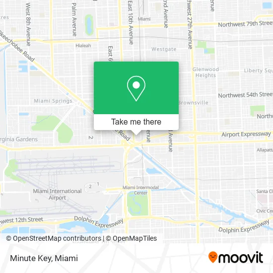
See Minute Key, Hialeah, on the map
Public Transit to Minute Key in Hialeah
Wondering how to get to Minute Key in Hialeah? Moovit helps you find the best way to get to Minute Key with step-by-step directions from the nearest public transit station.
Moovit provides free maps and live directions to help you navigate through your city. View schedules, routes, timetables, and find out how long does it take to get to Minute Key in real time.
Looking for the nearest stop or station to Minute Key? Check out this list of stops closest to your destination: Hialeah Market Tri-Rail Station; Nw 36 St & Okeechobee Rd; Se 8 Av & Se 11 Pl; Nw 36 St & Coolidge Dr; Eb Hotel; Mia@Lower Level Ramp; Hialeah Market Station; Brownsville Station Rail Northbound.
Bus: 20, 36, 37, 42, 132, 95.Train: TRIRAIL, GREEN.
Want to see if there’s another route that gets you there at an earlier time? Moovit helps you find alternative routes or times. Get directions from and directions to Minute Key easily from the Moovit App or Website.
We make riding to Minute Key easy, which is why over 1.5 million users, including users in Hialeah, trust Moovit as the best app for public transit. You don’t need to download an individual bus app or train app, Moovit is your all-in-one transit app that helps you find the best bus time or train time available.
For information on prices of bus and train, costs and ride fares to Minute Key, please check the Moovit app.
Use the app to navigate to popular places including to the airport, hospital, stadium, grocery store, mall, coffee shop, school, college, and university.
Minute Key Address: 950 SE 12th St Hialeah, FL 33010 street in Hialeah
- 950 SE 12th St Parking,
- Penske Auto Center,
- Depot,
- Home Depot E Hialeah,
- The Home Depot,
- Leo S House,
- Tri-Rail - Hialeah Market Station,
- Tri Rail,
- Fl,
- BOS Transport,
- Minerva Bunker Gear Cleaners,
- Ace Fire Sprinklers,
- La Fuente Hialeah151 E Okeechobee Rd,
- City of Hialeah Parks,
- Irent Car Rental,
- Holiday Inn Miami-International Airport, An Ihg Hotel,
- Ornamental Fish Imports,
- Pepiteria13,
- Sapibon Creol,
- People's Plumbing
Places Near Minute Key (Hialeah)
- Sawgrass Mall, Miami,
- Dolphin Mall, Miami,
- Miami-Dade County Courthouse, Miami,
- 1351 NW 12th St, Miami,
- Bayside Marketplace, Miami,
- Little Havana, Miami,
- Sawgrass mall ( FL ), Miami Beach,
- Hard Rock Stadium, Miami Gardens,
- Marlins Park, Miami,
- Aventura Mall, Miami,
- Miami Freedom Park, Miami,
- Wynwood, Miami,
- Port of Miami Cruise Terminal, Miami,
- Miami Design District, Miami,
- Brickell City Centre, Miami,
- Richard E. Gerstein Justice Building, Miami,
- Dolphin Mall Bus, Miami,
- Aventura Mall, Miami Beach,
- Zoo Miami, Miami,
- Keiser University Flagship Campus, West Palm Beach
How to get to popular places in Miami with public transit
Get around Hialeah by public transit!
Traveling around Hialeah has never been so easy. See step by step directions as you travel to any attraction, street or major public transit station. View bus and train schedules, arrival times, service alerts and detailed routes on a map, so you know exactly how to get to anywhere in Hialeah.
When traveling to any destination around Hialeah use Moovit's Live Directions with Get Off Notifications to know exactly where and how far to walk, how long to wait for your line, and how many stops are left. Moovit will alert you when it's time to get off — no need to constantly re-check whether yours is the next stop.
Wondering how to use public transit in Hialeah or how to pay for public transit in Hialeah? Moovit public transit app can help you navigate your way with public transit easily, and at minimum cost. It includes public transit fees, ticket prices, and costs. Looking for a map of Hialeah public transit lines? Moovit public transit app shows all public transit maps in Hialeah with all Bus, Train, Light Rail and Ferry routes and stops on an interactive map.
Miami has 4 transit type(s), including: Bus, Train, Light Rail and Ferry, operated by several transit agencies, including Broward County Transit, Miami-Dade Transit, Metrorail, Palm Tran, Tri-Rail, Brightline, MARTY, City of Homestead Trolley, Key West Transit, Treasure Coast Connector, GoLine IRT, Amtrak, Greyhound-us, FlixBus-us and Aventura Express Shuttle Bus