How to get to Minute Key by bus?
Click on the bus route to see step by step directions with maps, line arrival times and updated time schedules.
From Hippodrome Theatre, Baltimore
46 minFrom Walmart, Baltimore
43 minFrom Lexington Market, Baltimore
41 minFrom Oriole Park At Camden Yards, Baltimore
52 minFrom Ravens Walk @ M&T Bank Stadium, Baltimore
56 minFrom Mondawmin Mall, Baltimore
39 minFrom Saint Agnes Hospital, Baltimore
55 minFrom Hilton Baltimore, Baltimore
51 minFrom The Maryland Zoo In Baltimore, Baltimore
45 minFrom M&T Bank Stadium, Baltimore
59 min
Bus stops near Minute Key in Baltimore County
Bus lines to Minute Key in Baltimore County
What are the closest stations to Minute Key?
The closest stations to Minute Key are:
- Ingleside Ave & Chrysler Ln Nb is 23 yards away, 1 min walk.
- Baltimore National Pike & Ingleside Ave FS Wb is 179 yards away, 3 min walk.
- Craigmont Rd & Westview Mall Eb is 447 yards away, 6 min walk.
Which bus lines stop near Minute Key?
These bus lines stop near Minute Key: 34, 78.
What’s the nearest bus station to Minute Key in Baltimore County?
The nearest bus station to Minute Key in Baltimore County is Ingleside Ave & Chrysler Ln Nb. It’s a 1 min walk away.
What time is the first bus to Minute Key in Baltimore County?
The 78 is the first bus that goes to Minute Key in Baltimore County. It stops nearby at 4:10 AM.
What time is the last bus to Minute Key in Baltimore County?
The 78 is the last bus that goes to Minute Key in Baltimore County. It stops nearby at 2:29 AM.
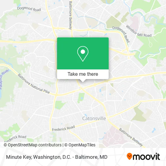
See Minute Key, Baltimore County, on the map
Public Transit to Minute Key in Baltimore County
Wondering how to get to Minute Key in Baltimore County? Moovit helps you find the best way to get to Minute Key with step-by-step directions from the nearest public transit station.
Moovit provides free maps and live directions to help you navigate through your city. View schedules, routes, timetables, and find out how long does it take to get to Minute Key in real time.
Looking for the nearest stop or station to Minute Key? Check out this list of stops closest to your destination: Ingleside Ave & Chrysler Ln Nb; Baltimore National Pike & Ingleside Ave FS Wb; Craigmont Rd & Westview Mall Eb.
Bus: 34, 78, 37, 150.
Want to see if there’s another route that gets you there at an earlier time? Moovit helps you find alternative routes or times. Get directions from and directions to Minute Key easily from the Moovit App or Website.
We make riding to Minute Key easy, which is why over 1.5 million users, including users in Baltimore County, trust Moovit as the best app for public transit. You don’t need to download an individual bus app or train app, Moovit is your all-in-one transit app that helps you find the best bus time or train time available.
For information on prices of bus and light rail, costs and ride fares to Minute Key, please check the Moovit app.
Use the app to navigate to popular places including to the airport, hospital, stadium, grocery store, mall, coffee shop, school, college, and university.
Minute Key Address: 5900 Baltimore National Pike Catonsville, MD 21228 street in Baltimore County
- Lowe's Home Improvement,
- Westview Mall Assoc,
- JP Carpet & Flooring,
- Marshalls,
- Accent Remodeling,
- Conway,
- Catonsville Sam's Club,
- Addy's Barbeque,
- Safeway Food & Drug,
- Ross,
- Griffin Properties,
- Amazon Locker-Adobe,
- Ross Dress for Less,
- Ashley Stewart,
- I-695 Exit 15 (Baltimore National Pike - US 40),
- Sleepy's, The Mattress Professionals,
- Kay’S Beauty,
- Gallo Clothing,
- Staff Max Corp,
- Madrag
Places Near Minute Key (Baltimore County)
- Pennsylvania Ave NW (3rd st and pennsylvania), Washington,
- Amazon Hq2, Arlington County,
- Westfield Montgomery Mall, Montgomery County,
- PG Mall, Prince George's County,
- Camden Yards, Baltimore,
- Warner Theatre, Washington,
- Museum Of The Bible, Washington,
- Washington DC VA Medical Center, Washington,
- Sibley Memorial Hospital, Washington,
- M&T Bank Stadium, Baltimore,
- National Mall, Washington,
- Marriott Marquis Washington, DC, Washington,
- Georgetown, Washington,
- National Museum of African American History and Culture, Washington,
- Capital One Arena, Washington,
- Basilica of the National Shrine, Washington,
- Rock Creek Tennis Center, Washington,
- The Anthem, Washington,
- Washington National Cathedral, Washington,
- National Zoo, Washington
How to get to popular places in Washington, D.C. - Baltimore, MD with public transit
Get around Baltimore County by public transit!
Traveling around Baltimore County has never been so easy. See step by step directions as you travel to any attraction, street or major public transit station. View bus and train schedules, arrival times, service alerts and detailed routes on a map, so you know exactly how to get to anywhere in Baltimore County.
When traveling to any destination around Baltimore County use Moovit's Live Directions with Get Off Notifications to know exactly where and how far to walk, how long to wait for your line, and how many stops are left. Moovit will alert you when it's time to get off — no need to constantly re-check whether yours is the next stop.
Wondering how to use public transit in Baltimore County or how to pay for public transit in Baltimore County? Moovit public transit app can help you navigate your way with public transit easily, and at minimum cost. It includes public transit fees, ticket prices, and costs. Looking for a map of Baltimore County public transit lines? Moovit public transit app shows all public transit maps in Baltimore County with all Bus, Train, Metro, Light Rail and Ferry routes and stops on an interactive map.
Washington, D.C. - Baltimore, MD has 5 transit type(s), including: Bus, Train, Metro, Light Rail and Ferry, operated by several transit agencies, including WMATA, Montgomery County Ride On, Fairfax Connector, TheBus, PRTC, DASH - Alexandria, Arlington Transit (ART), RTA of Central Maryland, MDOT MTA, MDOT MTA Light RailLink, MDOT MTA Commuter Bus, MDOT MTA Local Bus, FXBGO!, Virginia Railway Express (VRE) and MARC