How to get to Mirafarma by bus?
Click on the bus route to see step by step directions with maps, line arrival times and updated time schedules.
From Lar de Frei Luiz, Taquara
53 minFrom Estrada Dos Tres Rios, Freguesia (Jacarepaguá)
55 minFrom Caxias x Central - Parador, Duque De Caxias
39 minFrom Rua Araguaia, Freguesia (Jacarepaguá)
54 minFrom BRT - Estação André Rocha, Taquara
45 minFrom Avenida Paris, Bonsucesso
51 minFrom Estrada do Tindiba, Taquara
44 minFrom Rua Arquias Cordeiro S/N, Méier
47 minFrom Tanque (Jacarepaguá), Tanque
45 minFrom BRT - Estação Galeão - Tom Jobim 2, Galeão
52 min
How to get to Mirafarma by train?
Click on the train route to see step by step directions with maps, line arrival times and updated time schedules.
Bus stops near Mirafarma in Rocha Miranda
Metro station near Mirafarma in Rocha Miranda
- Colégio, 13 min walk,VIEW
Train station near Mirafarma in Rocha Miranda
- Rocha Miranda, 20 min walk,VIEW
Bus lines to Mirafarma in Rocha Miranda
- 298, Acari - Castelo (Brs 4 - Via Norte Shopping),VIEW
- SN 298, Acari - Castelo (Brs 4 - Via Norte Shopping / Terminal Gentileza),VIEW
- 349, Rocha Miranda - Castelo (Brs 4 - Via Vista Alegre / Av. Pres. Vargas),VIEW
- 551, Nova Iguaçu - Penha (Via Rocha Miranda),VIEW
- 562, Caxias - Pau-Ferro (via Rocha Miranda),VIEW
- 563, Caxias - Rocha Miranda,VIEW
- 569, Caxias - Madureira (via Rocha Miranda),VIEW
- 639, Jardim América - Saens Peña (Brs 6 - Via Rocha Miranda / Madureira / Méier),VIEW
- SN 639, Jardim América - Saens Peña (Brs 6 - Via Rocha Miranda / Madureira / Méier),VIEW
- 734L, Vila Norma - Cascadura (Via Vila Tiradentes),VIEW
- 736L, Jardim Botânico - Cascadura (Via Praça da Bandeira),VIEW
- 737, Santíssimo - Cascadura (Via Coelho Neto / Rocha Miranda),VIEW
- 738L, Jardim Metrópoles - Cascadura (Via Prefeitura),VIEW
- 926, Penha,VIEW
- 711, Rio Comprido,VIEW
- 785, Marechal Hermes,VIEW
What are the closest stations to Mirafarma?
The closest stations to Mirafarma are:
- Estrada Do Barro Vermelho, 1695 is 195 meters away, 3 min walk.
- Estrada Do Barro Vermelho, 1835 is 307 meters away, 5 min walk.
- Estrada Do Barro Vermelho, 1196 is 325 meters away, 5 min walk.
- Rua Lageado, 65 is 345 meters away, 5 min walk.
- Colégio is 990 meters away, 13 min walk.
- Rocha Miranda is 1559 meters away, 20 min walk.
Which bus lines stop near Mirafarma?
These bus lines stop near Mirafarma: 551, 562, 639, 926.
Which train line stops near Mirafarma?
RAMAL BELFORD ROXO (Belford Roxo)
What’s the nearest metro station to Mirafarma in Rocha Miranda?
The nearest metro station to Mirafarma in Rocha Miranda is Colégio. It’s a 13 min walk away.
What’s the nearest train station to Mirafarma in Rocha Miranda?
The nearest train station to Mirafarma in Rocha Miranda is Rocha Miranda. It’s a 20 min walk away.
What’s the nearest bus station to Mirafarma in Rocha Miranda?
The nearest bus station to Mirafarma in Rocha Miranda is Estrada Do Barro Vermelho, 1695. It’s a 3 min walk away.
What time is the first metro to Mirafarma in Rocha Miranda?
The L2 is the first metro that goes to Mirafarma in Rocha Miranda. It stops nearby at 5:05 AM.
What time is the last metro to Mirafarma in Rocha Miranda?
The L2 is the last metro that goes to Mirafarma in Rocha Miranda. It stops nearby at 12:45 AM.
What time is the first train to Mirafarma in Rocha Miranda?
The RAMAL BELFORD ROXO is the first train that goes to Mirafarma in Rocha Miranda. It stops nearby at 5:03 AM.
What time is the last train to Mirafarma in Rocha Miranda?
The RAMAL BELFORD ROXO is the last train that goes to Mirafarma in Rocha Miranda. It stops nearby at 10:05 PM.
What time is the first bus to Mirafarma in Rocha Miranda?
The SN 298 is the first bus that goes to Mirafarma in Rocha Miranda. It stops nearby at 3:01 AM.
What time is the last bus to Mirafarma in Rocha Miranda?
The SN 639 is the last bus that goes to Mirafarma in Rocha Miranda. It stops nearby at 3:29 AM.
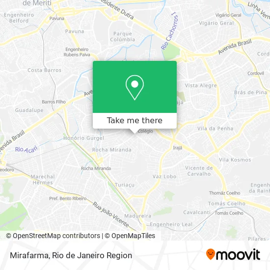
See Mirafarma, Rocha Miranda, on the map
Public Transit to Mirafarma in Rocha Miranda
Wondering how to get to Mirafarma in Rocha Miranda? Moovit helps you find the best way to get to Mirafarma with step-by-step directions from the nearest public transit station.
Moovit provides free maps and live directions to help you navigate through your city. View schedules, routes, timetables, and find out how long does it take to get to Mirafarma in real time.
Looking for the nearest stop or station to Mirafarma? Check out this list of stops closest to your destination: Estrada Do Barro Vermelho; Estrada Do Barro Vermelho; Estrada Do Barro Vermelho; Rua Lageado; Colégio; Rocha Miranda.
Bus: 551, 562, 639, 926, 298, SN 298, 349, 711, 785.Metro: L2.Train: RAMAL BELFORD ROXO.
Want to see if there’s another route that gets you there at an earlier time? Moovit helps you find alternative routes or times. Get directions from and directions to Mirafarma easily from the Moovit App or Website.
We make riding to Mirafarma easy, which is why over 1.5 million users, including users in Rocha Miranda, trust Moovit as the best app for public transit. You don’t need to download an individual bus app or train app, Moovit is your all-in-one transit app that helps you find the best bus time or train time available.
For information on prices of bus and train, costs and ride fares to Mirafarma, please check the Moovit app.
Use the app to navigate to popular places including to the airport, hospital, stadium, grocery store, mall, coffee shop, school, college, and university.
Mirafarma Address: Estrada do Barro Vermelho, Rocha Miranda Rio de Janeiro-RJ 21540-499 street in Rocha Miranda
- Mendes Silk-Screen,
- Rua Guiraréia / Estrada do Barro Vermelho,
- Rua Toriba Próximo ao 10-02,
- Estrada do Barro Vermelho / Rua Toriba,
- Construguia Materiais de Construcao,
- Chopp Boll Societ,
- Multimarket,
- Colégio Euclides Da Cunha,
- Escola Municipal Luiz De Camões,
- Supermercado Multimarket,
- Espaço Ventura,
- Rua Toriba 22,
- Cachorro-Quente do Neném,
- Lokos Por Açaí,
- Estrada do Barro Vermelho 1388,
- Estrada do Barro Vermelho Próximo ao 1413,
- Lokos Por Acai 3000,
- Escola Municipal Amapá,
- Caldos e Sopas Tudo de Bom,
- B de Baleia
Places Near Mirafarma (Rocha Miranda)
- Feirão De Malhas, Duque De Caxias,
- Avenida Venezuela 134, Saúde,
- Avenida Rio Branco, Centro,
- Museu Do Amanhã, Centro,
- Niterói, Niterói,
- Shopping Downtown, Barra Da Tijuca,
- Shopping RioSul, Botafogo,
- Shopping Nova América, Del Castilho,
- Hospital Federal Do Andaraí, Andaraí,
- Norte Shopping, Cachambi,
- Hospital Municipal Ronaldo Gazolla, Acari,
- Rio De Janeiro,
- Rodoviária Novo Rio (Rodoviária do Rio de Janeiro), Santo Cristo,
- Shopping Rio Sul, Botafogo,
- Rua Licínio Cardoso, São Francisco Xavier,
- Feira Livre da Gloria, Glória,
- Rua Ulysses Guimarães 16, Cidade Nova,
- Praia do Arpoador, Ipanema,
- Hospital Pedro Ernesto, Vila Isabel,
- Hospital Federal Cardoso Fontes, Jacarepaguá
How to get to popular places in Rio de Janeiro Region with public transit
Get around Rocha Miranda by public transit!
Traveling around Rocha Miranda has never been so easy. See step by step directions as you travel to any attraction, street or major public transit station. View bus and train schedules, arrival times, service alerts and detailed routes on a map, so you know exactly how to get to anywhere in Rocha Miranda.
When traveling to any destination around Rocha Miranda use Moovit's Live Directions with Get Off Notifications to know exactly where and how far to walk, how long to wait for your line, and how many stops are left. Moovit will alert you when it's time to get off — no need to constantly re-check whether yours is the next stop.
Wondering how to use public transit in Rocha Miranda or how to pay for public transit in Rocha Miranda? Moovit public transit app can help you navigate your way with public transit easily, and at minimum cost. It includes public transit fees, ticket prices, and costs. Looking for a map of Rocha Miranda public transit lines? Moovit public transit app shows all public transit maps in Rocha Miranda with all Bus, Train, Metro, Light Rail, Ferry, Cable Car, Gondola and Funicular routes and stops on an interactive map.
Rio de Janeiro Region has 8 transit type(s), including: Bus, Train, Metro, Light Rail, Ferry, Cable Car, Gondola and Funicular, operated by several transit agencies, including TrensRJ, Metrô Rio, VLT Carioca, Barcas Rio, BRT MOBI-Rio, Auto Viação Alpha, Auto Viação Tijuca, Gire Transportes, Transurb, Viação Nossa Senhora das Graças, Consórcio INTERSUL, Braso Lisboa (Municipal), Caprichosa Auto Ônibus, Auto Viação Três Amigos and Rodoviária Âncora Matias