Directions to Mission Christian Community Outreach Church (Boston) with public transportation
The following transit lines have routes that pass near Mission Christian Community Outreach Church
 Bus: 22, 28, 29, 14.
- Train: FAIRMOUNT, FRANKLIN/FOXBORO, FAIRMOUNT LINE SHUTTLE, PROVIDENCE/STOUGHTON.
- Subway: RED LINE.
How to get to Mission Christian Community Outreach Church by bus?
Click on the bus route to see step by step directions with maps, line arrival times and updated time schedules.
From Schrafft's Center Shuttle, Boston
91 minFrom Salem St, Boston
67 minFrom Costco, Dedham
61 minFrom Beth Israel Deaconess Medical Center, West Campus - Farr Building, Boston
46 minFrom Archbishop Williams High School, Braintree Town
57 minFrom Rental Car Center - Logan Airport, Boston
79 minFrom Brookline High School (Brookline Town High School), Brookline
52 minFrom Cathedral High School, Boston
36 minFrom Boston Latin School, Boston
41 minFrom Terminal E- Logan International Airport, Boston
56 min
How to get to Mission Christian Community Outreach Church by train?
Click on the train route to see step by step directions with maps, line arrival times and updated time schedules.
How to get to Mission Christian Community Outreach Church by subway?
Click on the subway route to see step by step directions with maps, line arrival times and updated time schedules.
From Schrafft's Center Shuttle, Boston
55 minFrom Salem St, Boston
54 minFrom Beth Israel Deaconess Medical Center, West Campus - Farr Building, Boston
78 minFrom Archbishop Williams High School, Braintree Town
62 minFrom Rental Car Center - Logan Airport, Boston
57 minFrom Terminal E- Logan International Airport, Boston
67 minFrom Brookline High School (Brookline Town High School), Brookline
78 minFrom Cathedral High School, Boston
57 minFrom Boston Latin School, Boston
74 min
Bus stops near Mission Christian Community Outreach Church in Boston
Train stations near Mission Christian Community Outreach Church in Boston
- Morton Street, 12 min walk,VIEW
Bus lines to Mission Christian Community Outreach Church in Boston
What are the closest stations to Mission Christian Community Outreach Church?
The closest stations to Mission Christian Community Outreach Church are:
- Blue Hill Ave @ Angell St is 183 yards away, 3 min walk.
- Blue Hill Ave @ Wales St is 435 yards away, 6 min walk.
- Morton Street is 1013 yards away, 12 min walk.
Which bus lines stop near Mission Christian Community Outreach Church?
These bus lines stop near Mission Christian Community Outreach Church: 22, 28.
Which train lines stop near Mission Christian Community Outreach Church?
These train lines stop near Mission Christian Community Outreach Church: FAIRMOUNT, FRANKLIN/FOXBORO.
Which subway line stops near Mission Christian Community Outreach Church?
RED LINE (Ashmont/Braintree)
What’s the nearest train station to Mission Christian Community Outreach Church in Boston?
The nearest train station to Mission Christian Community Outreach Church in Boston is Morton Street. It’s a 12 min walk away.
What’s the nearest bus station to Mission Christian Community Outreach Church in Boston?
The nearest bus station to Mission Christian Community Outreach Church in Boston is Blue Hill Ave @ Angell St. It’s a 3 min walk away.
What time is the first train to Mission Christian Community Outreach Church in Boston?
The FAIRMOUNT is the first train that goes to Mission Christian Community Outreach Church in Boston. It stops nearby at 4:38 AM.
What time is the last train to Mission Christian Community Outreach Church in Boston?
The FAIRMOUNT is the last train that goes to Mission Christian Community Outreach Church in Boston. It stops nearby at 12:06 AM.
What time is the first bus to Mission Christian Community Outreach Church in Boston?
The 28 is the first bus that goes to Mission Christian Community Outreach Church in Boston. It stops nearby at 3:13 AM.
What time is the last bus to Mission Christian Community Outreach Church in Boston?
The 28 is the last bus that goes to Mission Christian Community Outreach Church in Boston. It stops nearby at 2:19 AM.
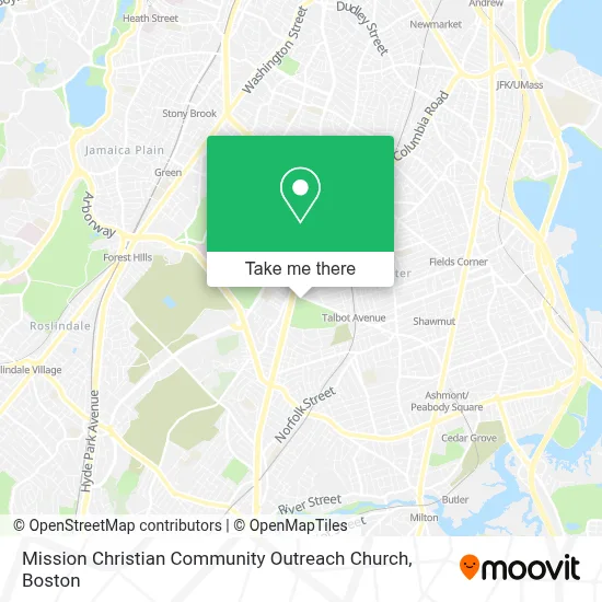
See Mission Christian Community Outreach Church, Boston, on the map
Public Transit to Mission Christian Community Outreach Church in Boston
Wondering how to get to Mission Christian Community Outreach Church in Boston? Moovit helps you find the best way to get to Mission Christian Community Outreach Church with step-by-step directions from the nearest public transit station.
Moovit provides free maps and live directions to help you navigate through your city. View schedules, routes, timetables, and find out how long does it take to get to Mission Christian Community Outreach Church in real time.
Looking for the nearest stop or station to Mission Christian Community Outreach Church? Check out this list of stops closest to your destination: Blue Hill Ave @ Angell St; Blue Hill Ave @ Wales St; Morton Street.
Bus: 22, 28, 29, 14.Train: FAIRMOUNT, FRANKLIN/FOXBORO, FAIRMOUNT LINE SHUTTLE, PROVIDENCE/STOUGHTON.Subway: RED LINE.
Want to see if there’s another route that gets you there at an earlier time? Moovit helps you find alternative routes or times. Get directions from and directions to Mission Christian Community Outreach Church easily from the Moovit App or Website.
We make riding to Mission Christian Community Outreach Church easy, which is why over 1.7 million users, including users in Boston, trust Moovit as the best app for public transit. You don’t need to download an individual bus app or train app, Moovit is your all-in-one transit app that helps you find the best bus time or train time available.
For information on prices of bus, subway and train, costs and ride fares to Mission Christian Community Outreach Church, please check the Moovit app.
Use the app to navigate to popular places including to the airport, hospital, stadium, grocery store, mall, coffee shop, school, college, and university.
Mission Christian Community Outreach Church Address: 776 Blue Hill Ave street in Boston
- Boys & Girls Club-Blue Hill Club,
- Boys & Girls Club (Boy's & Girl's Club-Blue Hill),
- Car Locksmith,
- The Peoples Church of God in Christ,
- Free Pentecostal Church of God's Youth Group,
- Free Pentecost Church of God,
- Heating Repair Seven Days,
- El Dugout Autobody,
- Junior's Tire Services,
- Hailron Security,
- Sportsmen's Tennis Club (Sportsmen's Tennis & Enrichment Center),
- USPS Collection Box - Blue Box,
- Mommaspicetheartis,
- Massachusetts Chiropractic Center,
- DDC Nadine Unisex Beauty Salon,
- Franklin Field,
- Studio 844 Unisex Hair Salon,
- Daisy's Hair Studio,
- Franklin Hill Boys & Girls Club,
- Simina Hair Braiding
Places Near Mission Christian Community Outreach Church (Boston)
- Prudential Center, Boston,
- Wilbur Theatre, Boston,
- Mgm Music Hall, Boston,
- North End, Boston,
- Td Garden, Boston,
- Boston Children's Hospital, Boston,
- Seaport District, Boston,
- Cheers, Boston,
- Castle Island, Boston,
- Boston Convention & Exhibition Center, Boston,
- Massachusetts General Hospital, Boston,
- House Of Blues, Boston,
- Isabella Stewart Gardner Museum, Boston,
- Boston Common, Boston,
- Wang Theater, Boston,
- Boston Medical Center, Boston,
- Leader Bank Pavilion (Leader Bank Pavillion), Boston,
- Faneuil Hall, Boston,
- Museum Of Science, Boston,
- Quincy Market, Boston
How to get to popular places in Boston with public transit
Get around Boston by public transit!
Traveling around Boston has never been so easy. See step by step directions as you travel to any attraction, street or major public transit station. View bus and train schedules, arrival times, service alerts and detailed routes on a map, so you know exactly how to get to anywhere in Boston.
When traveling to any destination around Boston use Moovit's Live Directions with Get Off Notifications to know exactly where and how far to walk, how long to wait for your line, and how many stops are left. Moovit will alert you when it's time to get off — no need to constantly re-check whether yours is the next stop.
Wondering how to use public transit in Boston or how to pay for public transit in Boston? Moovit public transit app can help you navigate your way with public transit easily, and at minimum cost. It includes public transit fees, ticket prices, and costs. Looking for a map of Boston public transit lines? Moovit public transit app shows all public transit maps in Boston with all Bus, Train, Subway and Ferry routes and stops on an interactive map.
Boston has 4 transit type(s), including: Bus, Train, Subway and Ferry, operated by several transit agencies, including MBTA, Southeastern Regional Transit Authority, MetroWest Regional Transit Authority, Rhode Island Public Transit Authority, WRTA, Lowell Regional Transit Authority, Merrimack Valley Transit, Montachusett Regional Transit Authority, Cape Cod Regional Transit Authority, Brockton Area Transit Authority, Martha's Vineyard Transit Authority, the WAVE - Nantucket Regional Transit Authority, GATRA, Cape Ann Transportation Authority and Massport