Directions to Mjj Construction Inc (Worcester) with public transportation
The following transit lines have routes that pass near Mjj Construction Inc
 Bus: 14, 23, 26, GREYHOUND US0230, 24.
How to get to Mjj Construction Inc by bus?
Click on the bus route to see step by step directions with maps, line arrival times and updated time schedules.
Bus stops near Mjj Construction Inc in Worcester
Bus lines to Mjj Construction Inc in Worcester
What are the closest stations to Mjj Construction Inc?
The closest stations to Mjj Construction Inc are:
- Lincoln St at Foresdale is 281 yards away, 4 min walk.
- Hooper St at Kendall is 301 yards away, 4 min walk.
Which bus lines stop near Mjj Construction Inc?
These bus lines stop near Mjj Construction Inc: 14, 23, 26, GREYHOUND US0230.
What’s the nearest bus station to Mjj Construction Inc in Worcester?
The nearest bus stations to Mjj Construction Inc in Worcester are Lincoln St at Foresdale and Hooper St at Kendall. The closest one is a 4 min walk away.
What time is the first bus to Mjj Construction Inc in Worcester?
The 26 is the first bus that goes to Mjj Construction Inc in Worcester. It stops nearby at 5:28 AM.
What time is the last bus to Mjj Construction Inc in Worcester?
The 26 is the last bus that goes to Mjj Construction Inc in Worcester. It stops nearby at 11:37 PM.
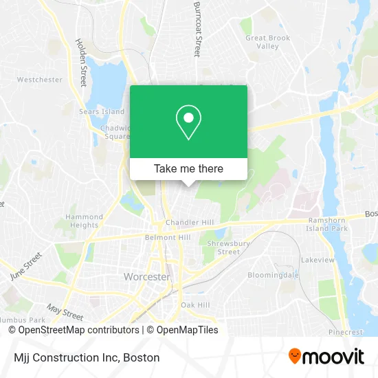
See Mjj Construction Inc, Worcester, on the map
Public Transit to Mjj Construction Inc in Worcester
Wondering how to get to Mjj Construction Inc in Worcester? Moovit helps you find the best way to get to Mjj Construction Inc with step-by-step directions from the nearest public transit station.
Moovit provides free maps and live directions to help you navigate through your city. View schedules, routes, timetables, and find out how long does it take to get to Mjj Construction Inc in real time.
Looking for the nearest stop or station to Mjj Construction Inc? Check out this list of stops closest to your destination: Lincoln St at Foresdale; Hooper St at Kendall.
Bus: 14, 23, 26, GREYHOUND US0230, 24.
Want to see if there’s another route that gets you there at an earlier time? Moovit helps you find alternative routes or times. Get directions from and directions to Mjj Construction Inc easily from the Moovit App or Website.
We make riding to Mjj Construction Inc easy, which is why over 1.7 million users, including users in Worcester, trust Moovit as the best app for public transit. You don’t need to download an individual bus app or train app, Moovit is your all-in-one transit app that helps you find the best bus time or train time available.
For information on prices of bus and train, costs and ride fares to Mjj Construction Inc, please check the Moovit app.
Use the app to navigate to popular places including to the airport, hospital, stadium, grocery store, mall, coffee shop, school, college, and university.
Mjj Construction Inc Address: 26 Orne St street in Worcester
- Efficiency Pro Plumbing, Heating, Cooling & Drain Cleaning,
- Soho Cottage,
- Lincoln Metro,
- Evans Classic Cars,
- The Check Place,
- Dogfather Vending,
- Kids' Smiles on Lincoln,
- Return-To-Work Program Physical Therapy,
- PG Sadhujan MD,
- Mark T. Shea, NMLS #46892,
- Family Services of Central Massachusetts,
- Evert Gullberg Three-Decker,
- Alexandra Day Care,
- Style & Grace Beauty Studio,
- Total by Verizon,
- Elizabeth Austin,
- Grafton Electrolysis and Skin Center,
- Greenhill Apartments,
- Venerini Sisters,
- Marie Anne Center
Places Near Mjj Construction Inc (Worcester)
- Boston Convention & Exhibition Center, Boston,
- Wilbur Theatre, Boston,
- House Of Blues, Boston,
- North End, Boston,
- Isabella Stewart Gardner Museum, Boston,
- Mgm Music Hall, Boston,
- Boston Medical Center, Boston,
- Castle Island, Boston,
- Td Garden, Boston,
- Quincy Market, Boston,
- Leader Bank Pavilion (Leader Bank Pavillion), Boston,
- Museum Of Science, Boston,
- Prudential Center, Boston,
- Boston Children's Hospital, Boston,
- Faneuil Hall, Boston,
- Massachusetts General Hospital, Boston,
- Wang Theater, Boston,
- Seaport District, Boston,
- Boston Common, Boston,
- Cheers, Boston
How to get to popular places in Boston with public transit
Get around Worcester by public transit!
Traveling around Worcester has never been so easy. See step by step directions as you travel to any attraction, street or major public transit station. View bus and train schedules, arrival times, service alerts and detailed routes on a map, so you know exactly how to get to anywhere in Worcester.
When traveling to any destination around Worcester use Moovit's Live Directions with Get Off Notifications to know exactly where and how far to walk, how long to wait for your line, and how many stops are left. Moovit will alert you when it's time to get off — no need to constantly re-check whether yours is the next stop.
Wondering how to use public transit in Worcester or how to pay for public transit in Worcester? Moovit public transit app can help you navigate your way with public transit easily, and at minimum cost. It includes public transit fees, ticket prices, and costs. Looking for a map of Worcester public transit lines? Moovit public transit app shows all public transit maps in Worcester with all Bus, Train, Subway and Ferry routes and stops on an interactive map.
Boston has 4 transit type(s), including: Bus, Train, Subway and Ferry, operated by several transit agencies, including MBTA, Southeastern Regional Transit Authority, MetroWest Regional Transit Authority, Rhode Island Public Transit Authority, WRTA, Lowell Regional Transit Authority, Merrimack Valley Transit, Montachusett Regional Transit Authority, Cape Cod Regional Transit Authority, Brockton Area Transit Authority, Martha's Vineyard Transit Authority, the WAVE - Nantucket Regional Transit Authority, GATRA, Cape Ann Transportation Authority and Massport