Directions to Mld Lighting (Wakefield) with public transportation
The following transit lines have routes that pass near Mld Lighting
How to get to Mld Lighting by bus?
Click on the bus route to see step by step directions with maps, line arrival times and updated time schedules.
From Hyatt Place Medford, Medford
68 minFrom Chevalier Theatre (Chevalier Theater Show Line), Medford
71 minFrom Malden Catholic High School, Malden
79 minFrom 200 Trade Center, Woburn
118 minFrom Winchester, MA, Winchester
100 minFrom Crowne Plaza Boston - Woburn, Woburn
118 minFrom Medford Square, Medford
69 minFrom Melrose Wakefield Hospital, Malden
37 minFrom Chevalier Theater, Medford
71 min
How to get to Mld Lighting by train?
Click on the train route to see step by step directions with maps, line arrival times and updated time schedules.
Bus stops near Mld Lighting in Wakefield
Bus lines to Mld Lighting in Wakefield
- HAVERHILL LINE SHUTTLE, Ballardvale - Malden Center,VIEW
- HAVERHILL LINE SHUTTLE, Reading - Oak Grove,VIEW
- HAVERHILL LINE SHUTTLE, Haverhill - Malden Center,VIEW
- HAVERHILL LINE SHUTTLE, Haverhill - North Station,VIEW
- HAVERHILL LINE SHUTTLE, Ballardvale - North Station,VIEW
- HAVERHILL, Haverhill,VIEW
- 137, Malden,VIEW
What are the closest stations to Mld Lighting?
The closest stations to Mld Lighting are:
- Wakefield is 616 yards away, 8 min walk.
- North Ave @ Chestnut St - Commuter Rail Station is 616 yards away, 8 min walk.
Which bus line stops near Mld Lighting?
137 (Reading Depot)
Which train line stops near Mld Lighting?
HAVERHILL (#229 | Haverhill)
What’s the nearest bus station to Mld Lighting in Wakefield?
The nearest bus stations to Mld Lighting in Wakefield are Wakefield and North Ave @ Chestnut St - Commuter Rail Station. The closest one is a 8 min walk away.
What time is the first train to Mld Lighting in Wakefield?
The HAVERHILL is the first train that goes to Mld Lighting in Wakefield. It stops nearby at 5:18 AM.
What time is the last train to Mld Lighting in Wakefield?
The HAVERHILL is the last train that goes to Mld Lighting in Wakefield. It stops nearby at 12:13 AM.
What time is the first bus to Mld Lighting in Wakefield?
The 137 is the first bus that goes to Mld Lighting in Wakefield. It stops nearby at 5:09 AM.
What time is the last bus to Mld Lighting in Wakefield?
The 137 is the last bus that goes to Mld Lighting in Wakefield. It stops nearby at 10:46 PM.
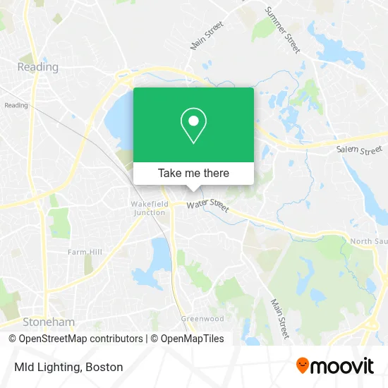
See Mld Lighting, Wakefield, on the map
Public Transit to Mld Lighting in Wakefield
Wondering how to get to Mld Lighting in Wakefield? Moovit helps you find the best way to get to Mld Lighting with step-by-step directions from the nearest public transit station.
Moovit provides free maps and live directions to help you navigate through your city. View schedules, routes, timetables, and find out how long does it take to get to Mld Lighting in real time.
Looking for the nearest stop or station to Mld Lighting? Check out this list of stops closest to your destination: Wakefield; North Ave @ Chestnut St - Commuter Rail Station.
Bus: 137, HAVERHILL LINE SHUTTLE, HAVERHILL LINE SHUTTLE, HAVERHILL LINE SHUTTLE, HAVERHILL LINE SHUTTLE, HAVERHILL LINE SHUTTLE.Train: HAVERHILL.
Want to see if there’s another route that gets you there at an earlier time? Moovit helps you find alternative routes or times. Get directions from and directions to Mld Lighting easily from the Moovit App or Website.
We make riding to Mld Lighting easy, which is why over 1.7 million users, including users in Wakefield, trust Moovit as the best app for public transit. You don’t need to download an individual bus app or train app, Moovit is your all-in-one transit app that helps you find the best bus time or train time available.
For information on prices of bus, subway and train, costs and ride fares to Mld Lighting, please check the Moovit app.
Use the app to navigate to popular places including to the airport, hospital, stadium, grocery store, mall, coffee shop, school, college, and university.
Mld Lighting Address: 62 Foundry St street in Wakefield
- Maggio Custom Refinishing,
- NRT Bus,
- Margarets Psychic Readings,
- Pedro's Judo Center (Pedro's Wrestling Club),
- Apple Massage Therapy& Bodywork,
- Town Taxi of Stoneham,
- Benedetto S & Sons Inc Contrs,
- Romero's Landscaping,
- Commonwealth Business Solutions,
- Direct Women's Health,
- FedEx,
- Guida Law Associates, PC,
- Dick's Foreign Car Sales & Services,
- Green Solutions Carpet Cleaning,
- Student Loan Counselors,
- Asm Associate,
- Shred Nations,
- Rockwell Investigations,
- Designs by Amy,
- Winchester Remodeling Group
Places Near Mld Lighting (Wakefield)
- Td Garden, Boston,
- Prudential Center, Boston,
- Boston Medical Center, Boston,
- Quincy Market, Boston,
- Boston Convention & Exhibition Center, Boston,
- Castle Island, Boston,
- Boston Children's Hospital, Boston,
- Faneuil Hall, Boston,
- Seaport District, Boston,
- Leader Bank Pavilion (Leader Bank Pavillion), Boston,
- North End, Boston,
- Mgm Music Hall, Boston,
- Cheers, Boston,
- Wang Theater, Boston,
- Isabella Stewart Gardner Museum, Boston,
- Boston Common, Boston,
- Wilbur Theatre, Boston,
- Massachusetts General Hospital, Boston,
- House Of Blues, Boston,
- Museum Of Science, Boston
How to get to popular places in Boston with public transit
Get around Wakefield by public transit!
Traveling around Wakefield has never been so easy. See step by step directions as you travel to any attraction, street or major public transit station. View bus and train schedules, arrival times, service alerts and detailed routes on a map, so you know exactly how to get to anywhere in Wakefield.
When traveling to any destination around Wakefield use Moovit's Live Directions with Get Off Notifications to know exactly where and how far to walk, how long to wait for your line, and how many stops are left. Moovit will alert you when it's time to get off — no need to constantly re-check whether yours is the next stop.
Wondering how to use public transit in Wakefield or how to pay for public transit in Wakefield? Moovit public transit app can help you navigate your way with public transit easily, and at minimum cost. It includes public transit fees, ticket prices, and costs. Looking for a map of Wakefield public transit lines? Moovit public transit app shows all public transit maps in Wakefield with all Bus, Train, Subway and Ferry routes and stops on an interactive map.
Boston has 4 transit type(s), including: Bus, Train, Subway and Ferry, operated by several transit agencies, including MBTA, Southeastern Regional Transit Authority, MetroWest Regional Transit Authority, Rhode Island Public Transit Authority, WRTA, Lowell Regional Transit Authority, Merrimack Valley Transit, Montachusett Regional Transit Authority, Cape Cod Regional Transit Authority, Brockton Area Transit Authority, Martha's Vineyard Transit Authority, the WAVE - Nantucket Regional Transit Authority, GATRA, Cape Ann Transportation Authority and Massport