How to get to Mobile Snap by bus?
Click on the bus route to see step by step directions with maps, line arrival times and updated time schedules.
From Garneau, Edmonton
41 minFrom University of Alberta Hospital - Emergency, Edmonton
46 minFrom Butterdome Craft Sale, Edmonton
44 minFrom Radisson Hotel and Convention Center Edmonton, Edmonton
61 minFrom Motorcycle Parking Zone, Edmonton
28 minFrom Norquest College, Edmonton
34 minFrom Four Points by Sheraton Edmonton South, Edmonton
74 minFrom Centennial Centre for Interdisciplinary Science (CCIS), Edmonton
52 minFrom University of Alberta - Medical Sciences Building, Edmonton
45 minFrom The Allin Clinic, Edmonton
56 min
Bus stops near Mobile Snap in Edmonton
Light Rail stations near Mobile Snap in Edmonton
- Belvedere Station, 12 min walk,VIEW
Bus lines to Mobile Snap in Edmonton
What are the closest stations to Mobile Snap?
The closest stations to Mobile Snap are:
- 70 Street & 137 Avenue is 81 meters away, 2 min walk.
- 66 Street & 137 Avenue is 483 meters away, 7 min walk.
- Belvedere Station is 898 meters away, 12 min walk.
Which bus line stops near Mobile Snap?
054 (West Edmonton Mall Transit Centre→West Clareview Transit Centre)
What’s the nearest light rail station to Mobile Snap in Edmonton?
The nearest light rail station to Mobile Snap in Edmonton is Belvedere Station. It’s a 12 min walk away.
What’s the nearest bus station to Mobile Snap in Edmonton?
The nearest bus station to Mobile Snap in Edmonton is 70 Street & 137 Avenue. It’s a 2 min walk away.
What time is the first bus to Mobile Snap in Edmonton?
The 054 is the first bus that goes to Mobile Snap in Edmonton. It stops nearby at 7:09 AM.
What time is the last bus to Mobile Snap in Edmonton?
The 054 is the last bus that goes to Mobile Snap in Edmonton. It stops nearby at 12:41 AM.
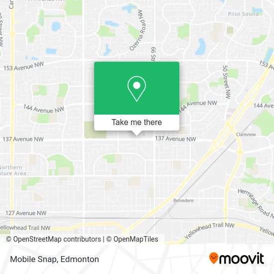
See Mobile Snap, Edmonton, on the map
Public Transit to Mobile Snap in Edmonton
Wondering how to get to Mobile Snap in Edmonton? Moovit helps you find the best way to get to Mobile Snap with step-by-step directions from the nearest public transit station.
Moovit provides free maps and live directions to help you navigate through your city. View schedules, routes, timetables, and find out how long does it take to get to Mobile Snap in real time.
Looking for the nearest stop or station to Mobile Snap? Check out this list of stops closest to your destination: 70 Street & 137 Avenue; 66 Street & 137 Avenue; Belvedere Station.
Bus: 054, 128, 107, 626.
Want to see if there’s another route that gets you there at an earlier time? Moovit helps you find alternative routes or times. Get directions from and directions to Mobile Snap easily from the Moovit App or Website.
We make riding to Mobile Snap easy, which is why over 1.5 million users, including users in Edmonton, trust Moovit as the best app for public transit. You don’t need to download an individual bus app or train app, Moovit is your all-in-one transit app that helps you find the best bus time or train time available.
For information on prices of bus, costs and ride fares to Mobile Snap, please check the Moovit app.
Use the app to navigate to popular places including to the airport, hospital, stadium, grocery store, mall, coffee shop, school, college, and university.
Mobile Snap Address: 13717 70 St NW Edmonton, AB T5C street in Edmonton
- Secret Garden Flow,
- Freedom Mobile,
- HOM Photo,
- save on foods,
- Edo of Japan,
- Nyf,
- Canada Business Loan,
- Buster's Pizza,
- Available Electric Mot,
- Iris 696 Londonderry,
- Londonderry Dental,
- Alberta Fun Money Casinos Ltd,
- Kiddie Corner,
- Urban Kids,
- Thrifty's,
- Rickis Londonderry Mall,
- Company's Coming Bakery Cafe,
- Herbalife Products Skryko M Hrblfe,
- Shefield Express,
- Koodo
Places Near Mobile Snap (Edmonton)
- Northgate Centre, Edmonton,
- Kaye Edmonton Clinic, Edmonton,
- Alberta Legislature Building, Edmonton,
- Edmonton Commonwealth Stadium, Edmonton,
- Grey Nuns Community Hospital, Edmonton,
- Kingsway Mall, Edmonton,
- University of Alberta, Edmonton,
- Fort Edmonton Park, Edmonton,
- Rogers Place, Edmonton,
- Whyte Avenue, Edmonton,
- MacEwan University, Edmonton,
- West Edmonton Mall, Edmonton,
- Edmonton EXPO Centre, Edmonton,
- Cross Cancer Institute, Edmonton,
- Canada Place Service Canada Centre, Edmonton,
- Edmonton VIA Rail Station, Edmonton,
- Londonderry Mall, Edmonton,
- Edmonton Valley Zoo, Edmonton,
- Borden Park, Edmonton,
- Royal Alexandra Hospital, Edmonton
How to get to popular places in Edmonton with public transit
Get around Edmonton by public transit!
Traveling around Edmonton has never been so easy. See step by step directions as you travel to any attraction, street or major public transit station. View bus and train schedules, arrival times, service alerts and detailed routes on a map, so you know exactly how to get to anywhere in Edmonton.
When traveling to any destination around Edmonton use Moovit's Live Directions with Get Off Notifications to know exactly where and how far to walk, how long to wait for your line, and how many stops are left. Moovit will alert you when it's time to get off — no need to constantly re-check whether yours is the next stop.
Wondering how to use public transit in Edmonton or how to pay for public transit in Edmonton? Moovit public transit app can help you navigate your way with public transit easily, and at minimum cost. It includes public transit fees, ticket prices, and costs. Looking for a map of Edmonton public transit lines? Moovit public transit app shows all public transit maps in Edmonton with all Bus and Light Rail routes and stops on an interactive map.
Edmonton has 2 transit type(s), including: Bus and Light Rail, operated by several transit agencies, including ETS LRT, ETS, Strathcona County Transit, St. Albert Transit, Spruce Grove Transit, Fort Saskatchewan Transit, Beaumont Transit and Leduc Transit