Directions to Mod20 Gallery (Belmont) with public transportation
The following transit lines have routes that pass near Mod20 Gallery
 Bus: 74, 75, FITCHBURG LINE SHUTTLE.
- Train: FITCHBURG.
- Subway: RED LINE.
How to get to Mod20 Gallery by bus?
Click on the bus route to see step by step directions with maps, line arrival times and updated time schedules.
From Harvard Business School, Boston
56 minFrom Prudential Center South Garden, Boston
72 minFrom Jordan Hall, Boston
72 minFrom Boston Scientific Shuttle: Prudential Center Stop, Boston
71 minFrom Verb Hotel, Boston
87 minFrom Christian A Herter Park, Boston
66 minFrom Lolita Cocina & Tequila Bar, Boston
75 minFrom New Balance, Boston
65 minFrom Courtyard Tea Room (The Courtyard Restaurant), Boston
75 minFrom MGH Bigelow 11 - General Medicine, Boston
87 min
How to get to Mod20 Gallery by train?
Click on the train route to see step by step directions with maps, line arrival times and updated time schedules.
Train station near Mod20 Gallery in Belmont
- Belmont, 21 min walk,VIEW
Subway station near Mod20 Gallery in Belmont
- Alewife, 25 min walk,VIEW
Bus lines to Mod20 Gallery in Belmont
What are the closest stations to Mod20 Gallery?
The closest stations to Mod20 Gallery are:
- Belmont is 608 yards away, 8 min walk.
- 396 Concord Ave is 727 yards away, 9 min walk.
- Alewife is 2090 yards away, 25 min walk.
Which bus lines stop near Mod20 Gallery?
These bus lines stop near Mod20 Gallery: 74, 75.
Which train line stops near Mod20 Gallery?
FITCHBURG (#409 | Wachusett)
What’s the nearest subway station to Mod20 Gallery in Belmont?
The nearest subway station to Mod20 Gallery in Belmont is Alewife. It’s a 25 min walk away.
What’s the nearest train station to Mod20 Gallery in Belmont?
The nearest train station to Mod20 Gallery in Belmont is Belmont. It’s a 21 min walk away.
What’s the nearest bus station to Mod20 Gallery in Belmont?
The nearest bus station to Mod20 Gallery in Belmont is Belmont. It’s a 8 min walk away.
What time is the first subway to Mod20 Gallery in Belmont?
The RED LINE is the first subway that goes to Mod20 Gallery in Belmont. It stops nearby at 5:15 AM.
What time is the last subway to Mod20 Gallery in Belmont?
The RED LINE is the last subway that goes to Mod20 Gallery in Belmont. It stops nearby at 2:06 AM.
What time is the first train to Mod20 Gallery in Belmont?
The FITCHBURG is the first train that goes to Mod20 Gallery in Belmont. It stops nearby at 5:39 AM.
What time is the last train to Mod20 Gallery in Belmont?
The FITCHBURG is the last train that goes to Mod20 Gallery in Belmont. It stops nearby at 12:11 AM.
What time is the first bus to Mod20 Gallery in Belmont?
The 74 is the first bus that goes to Mod20 Gallery in Belmont. It stops nearby at 5:10 AM.
What time is the last bus to Mod20 Gallery in Belmont?
The 74 is the last bus that goes to Mod20 Gallery in Belmont. It stops nearby at 1:28 AM.
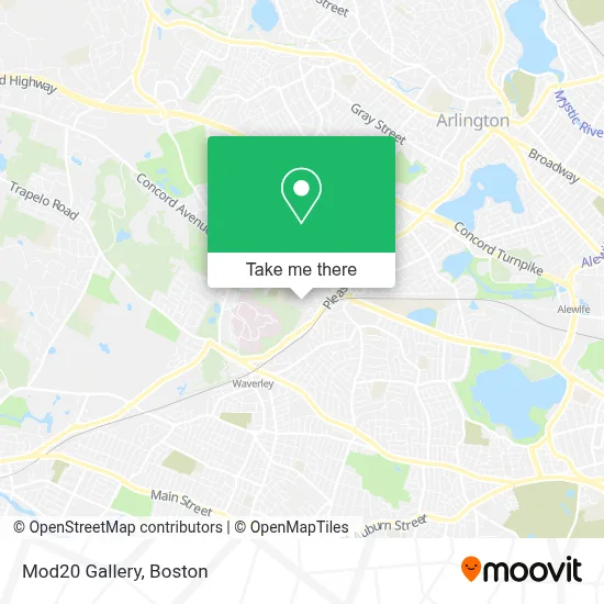
See Mod20 Gallery, Belmont, on the map
Public Transit to Mod20 Gallery in Belmont
Wondering how to get to Mod20 Gallery in Belmont? Moovit helps you find the best way to get to Mod20 Gallery with step-by-step directions from the nearest public transit station.
Moovit provides free maps and live directions to help you navigate through your city. View schedules, routes, timetables, and find out how long does it take to get to Mod20 Gallery in real time.
Looking for the nearest stop or station to Mod20 Gallery? Check out this list of stops closest to your destination: Belmont; 396 Concord Ave; Alewife.
Bus: 74, 75, FITCHBURG LINE SHUTTLE.Train: FITCHBURG.Subway: RED LINE.
Want to see if there’s another route that gets you there at an earlier time? Moovit helps you find alternative routes or times. Get directions from and directions to Mod20 Gallery easily from the Moovit App or Website.
We make riding to Mod20 Gallery easy, which is why over 1.7 million users, including users in Belmont, trust Moovit as the best app for public transit. You don’t need to download an individual bus app or train app, Moovit is your all-in-one transit app that helps you find the best bus time or train time available.
For information on prices of bus, subway and train, costs and ride fares to Mod20 Gallery, please check the Moovit app.
Use the app to navigate to popular places including to the airport, hospital, stadium, grocery store, mall, coffee shop, school, college, and university.
Mod20 Gallery Address: 4 Trapelo Rd street in Belmont
- Like My House,
- CJ Car Wash,
- Belmont MA USA,
- Elliot Daniels Electrician,
- Cityside Subaru,
- Afcea Lexington-Concor,
- Belmont Food Pantry,
- Belmont High School,
- Joan E Horgan, DMD,
- Waverly MBTA station,
- Avantguard Locksmith,
- Presidential Carpet Cleaning,
- Luke Secura Locksmith,
- Emergency Locksmith Available 24 7,
- Smith Donald F,
- Craft Beer Cellar Belmont,
- Adt,
- Koca Hair Design,
- Cheeky Monkey Home,
- Kabloom
Places Near Mod20 Gallery (Belmont)
- Boston Children's Hospital, Boston,
- Museum Of Science, Boston,
- Cheers, Boston,
- Boston Common, Boston,
- Boston Medical Center, Boston,
- House Of Blues, Boston,
- Quincy Market, Boston,
- North End, Boston,
- Mgm Music Hall, Boston,
- Seaport District, Boston,
- Td Garden, Boston,
- Faneuil Hall, Boston,
- Boston Convention & Exhibition Center, Boston,
- Wang Theater, Boston,
- Leader Bank Pavilion (Leader Bank Pavillion), Boston,
- Castle Island, Boston,
- Isabella Stewart Gardner Museum, Boston,
- Massachusetts General Hospital, Boston,
- Wilbur Theatre, Boston,
- Prudential Center, Boston
How to get to popular places in Boston with public transit
Get around Belmont by public transit!
Traveling around Belmont has never been so easy. See step by step directions as you travel to any attraction, street or major public transit station. View bus and train schedules, arrival times, service alerts and detailed routes on a map, so you know exactly how to get to anywhere in Belmont.
When traveling to any destination around Belmont use Moovit's Live Directions with Get Off Notifications to know exactly where and how far to walk, how long to wait for your line, and how many stops are left. Moovit will alert you when it's time to get off — no need to constantly re-check whether yours is the next stop.
Wondering how to use public transit in Belmont or how to pay for public transit in Belmont? Moovit public transit app can help you navigate your way with public transit easily, and at minimum cost. It includes public transit fees, ticket prices, and costs. Looking for a map of Belmont public transit lines? Moovit public transit app shows all public transit maps in Belmont with all Bus, Train, Subway and Ferry routes and stops on an interactive map.
Boston has 4 transit type(s), including: Bus, Train, Subway and Ferry, operated by several transit agencies, including MBTA, Southeastern Regional Transit Authority, MetroWest Regional Transit Authority, Rhode Island Public Transit Authority, WRTA, Lowell Regional Transit Authority, Merrimack Valley Transit, Montachusett Regional Transit Authority, Cape Cod Regional Transit Authority, Brockton Area Transit Authority, Martha's Vineyard Transit Authority, the WAVE - Nantucket Regional Transit Authority, GATRA, Cape Ann Transportation Authority and Massport