Directions to Mod 28b (Boston) with public transportation
The following transit lines have routes that pass near Mod 28b
 Bus: 501, 57, 86, GREEN LINE B SHUTTLE, SHUTTLE.
- Train: FRAMINGHAM/WORCESTER.
- Subway: GREEN LINE B, GREEN LINE D.
How to get to Mod 28b by bus?
Click on the bus route to see step by step directions with maps, line arrival times and updated time schedules.
From John Joseph Moakley Us Courthouse, Boston
75 minFrom Beacon Hill, Boston
56 minFrom USS Constitution, Boston
96 minFrom Omni Parker House, Boston
58 minFrom Orpheum Theatre, Boston
54 minFrom MBTA Kenmore Station, Boston
41 minFrom Sanofi-Genzyme, Waltham
92 minFrom Battery Wharf Hotel, Boston
85 minFrom Outlets at Assembly Row, Boston
55 minFrom Element Boston Seaport, Boston
76 min
How to get to Mod 28b by train?
Click on the train route to see step by step directions with maps, line arrival times and updated time schedules.
How to get to Mod 28b by subway?
Click on the subway route to see step by step directions with maps, line arrival times and updated time schedules.
From John Joseph Moakley Us Courthouse, Boston
70 minFrom Beacon Hill, Boston
61 minFrom USS Constitution, Boston
78 minFrom Omni Parker House, Boston
54 minFrom Orpheum Theatre, Boston
52 minFrom MBTA Kenmore Station, Boston
38 minFrom Battery Wharf Hotel, Boston
68 minFrom Outlets at Assembly Row, Boston
54 minFrom Element Boston Seaport, Boston
76 min
Bus stops near Mod 28b in Boston
Subway stations near Mod 28b in Boston
Bus lines to Mod 28b in Boston
- GREEN LINE B SHUTTLE, Back Bay (Shuttle),VIEW
- SHUTTLE, Kenmore (Shuttle),VIEW
- GREEN LINE B SHUTTLE, Boston College - Blandford Street,VIEW
- GREEN LINE B SHUTTLE, Boston College - Babcock Street,VIEW
- GREEN LINE B SHUTTLE, Boston College - Washington Street,VIEW
- GREEN LINE B SHUTTLE, Boston College - Packard's Corner,VIEW
What are the closest stations to Mod 28b?
The closest stations to Mod 28b are:
- Boston College - Commonwealth Ave @ St Thomas More Rd is 944 yards away, 12 min walk.
- Boston College - Commonwealth Ave @ Lake St is 950 yards away, 12 min walk.
- Chestnut Hill is 1792 yards away, 22 min walk.
- Boston College is 1885 yards away, 23 min walk.
Which bus lines stop near Mod 28b?
These bus lines stop near Mod 28b: 501, 57, 86.
Which train line stops near Mod 28b?
FRAMINGHAM/WORCESTER (#525 | Worcester)
Which subway line stops near Mod 28b?
GREEN LINE B (Boston College)
What’s the nearest subway station to Mod 28b in Boston?
The nearest subway station to Mod 28b in Boston is Chestnut Hill. It’s a 22 min walk away.
What’s the nearest bus station to Mod 28b in Boston?
The nearest bus stations to Mod 28b in Boston are Boston College - Commonwealth Ave @ St Thomas More Rd and Boston College - Commonwealth Ave @ Lake St. The closest one is a 12 min walk away.
What time is the first subway to Mod 28b in Boston?
The GREEN LINE D is the first subway that goes to Mod 28b in Boston. It stops nearby at 4:57 AM.
What time is the last subway to Mod 28b in Boston?
The GREEN LINE B is the last subway that goes to Mod 28b in Boston. It stops nearby at 2:39 AM.
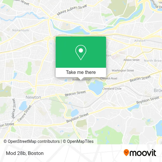
See Mod 28b, Boston, on the map
Public Transit to Mod 28b in Boston
Wondering how to get to Mod 28b in Boston? Moovit helps you find the best way to get to Mod 28b with step-by-step directions from the nearest public transit station.
Moovit provides free maps and live directions to help you navigate through your city. View schedules, routes, timetables, and find out how long does it take to get to Mod 28b in real time.
Looking for the nearest stop or station to Mod 28b? Check out this list of stops closest to your destination: Boston College - Commonwealth Ave @ St Thomas More Rd; Boston College - Commonwealth Ave @ Lake St; Chestnut Hill; Boston College.
Bus: 501, 57, 86, GREEN LINE B SHUTTLE, SHUTTLE, GREEN LINE B SHUTTLE, GREEN LINE B SHUTTLE, GREEN LINE B SHUTTLE, GREEN LINE B SHUTTLE.Train: FRAMINGHAM/WORCESTER.Subway: GREEN LINE B, GREEN LINE D.
Want to see if there’s another route that gets you there at an earlier time? Moovit helps you find alternative routes or times. Get directions from and directions to Mod 28b easily from the Moovit App or Website.
We make riding to Mod 28b easy, which is why over 1.7 million users, including users in Boston, trust Moovit as the best app for public transit. You don’t need to download an individual bus app or train app, Moovit is your all-in-one transit app that helps you find the best bus time or train time available.
For information on prices of subway, bus and train, costs and ride fares to Mod 28b, please check the Moovit app.
Use the app to navigate to popular places including to the airport, hospital, stadium, grocery store, mall, coffee shop, school, college, and university.
Location: Boston
- The Mods (Modulars),
- Corcoran Commons (Lower Dining Hall),
- Vera Bradley,
- Boston College Police Department,
- Robsham Theater,
- Commonwealth Avenue Garage,
- Boston Liturgical Dance Ense,
- Amazon Locker-Bench,
- ChargePoint,
- Boston College,
- Margot Connell Recreation Center,
- Follett,
- Little Village Greek Yogurt & Honey,
- Auto Locksmith,
- Doug Flutie Statue,
- Boston College (BC),
- Playa Bowls,
- Executive It Strategies,
- Brighton Movers,
- Shred Nations
Places Near Mod 28b (Boston)
- Wang Theater, Boston,
- Massachusetts General Hospital, Boston,
- Cheers, Boston,
- Td Garden, Boston,
- Boston Medical Center, Boston,
- Quincy Market, Boston,
- North End, Boston,
- Seaport District, Boston,
- Faneuil Hall, Boston,
- Isabella Stewart Gardner Museum, Boston,
- Boston Convention & Exhibition Center, Boston,
- Museum Of Science, Boston,
- Boston Common, Boston,
- Leader Bank Pavilion (Leader Bank Pavillion), Boston,
- Wilbur Theatre, Boston,
- Mgm Music Hall, Boston,
- Prudential Center, Boston,
- Castle Island, Boston,
- House Of Blues, Boston,
- Boston Children's Hospital, Boston
How to get to popular places in Boston with public transit
Get around Boston by public transit!
Traveling around Boston has never been so easy. See step by step directions as you travel to any attraction, street or major public transit station. View bus and train schedules, arrival times, service alerts and detailed routes on a map, so you know exactly how to get to anywhere in Boston.
When traveling to any destination around Boston use Moovit's Live Directions with Get Off Notifications to know exactly where and how far to walk, how long to wait for your line, and how many stops are left. Moovit will alert you when it's time to get off — no need to constantly re-check whether yours is the next stop.
Wondering how to use public transit in Boston or how to pay for public transit in Boston? Moovit public transit app can help you navigate your way with public transit easily, and at minimum cost. It includes public transit fees, ticket prices, and costs. Looking for a map of Boston public transit lines? Moovit public transit app shows all public transit maps in Boston with all Bus, Train, Subway and Ferry routes and stops on an interactive map.
Boston has 4 transit type(s), including: Bus, Train, Subway and Ferry, operated by several transit agencies, including MBTA, Southeastern Regional Transit Authority, MetroWest Regional Transit Authority, Rhode Island Public Transit Authority, WRTA, Lowell Regional Transit Authority, Merrimack Valley Transit, Montachusett Regional Transit Authority, Cape Cod Regional Transit Authority, Brockton Area Transit Authority, Martha's Vineyard Transit Authority, the WAVE - Nantucket Regional Transit Authority, GATRA, Cape Ann Transportation Authority and Massport