Directions to Model (Boston) with public transportation
The following transit lines have routes that pass near Model
 Bus: 39, 66, 35, GREEN LINE E SHUTTLE, GREEN LINE E SHUTTLE.
- Train: PROVIDENCE/STOUGHTON.
- Subway: GREEN LINE E.
How to get to Model by bus?
Click on the bus route to see step by step directions with maps, line arrival times and updated time schedules.
From Lower Mills, Boston
55 minFrom Chelsea District Court, Chelsea
72 minFrom Registry of Motor Vehicles (RMV) Boston, Boston
44 minFrom Arlington, MA, Arlington
89 minFrom Mass Eye And Ear, Boston
66 minFrom Assembly Square Mall Shopping Center, Somerville
72 minFrom Hilton Garden Inn Boston Logan Airport, Boston
72 minFrom Qea, Quincy
96 min
How to get to Model by train?
Click on the train route to see step by step directions with maps, line arrival times and updated time schedules.
How to get to Model by subway?
Click on the subway route to see step by step directions with maps, line arrival times and updated time schedules.
Bus stops near Model in Boston
Subway station near Model in Boston
- Fenwood Road, 8 min walk,VIEW
Bus lines to Model in Boston
What are the closest stations to Model?
The closest stations to Model are:
- Huntington Ave @ Parker Hill Ave is 287 yards away, 4 min walk.
- Fenwood Road is 628 yards away, 8 min walk.
- Heath St @ S Huntington Ave is 853 yards away, 11 min walk.
- Brookline Ave Opp Aspinwall Ave is 948 yards away, 12 min walk.
Which bus lines stop near Model?
These bus lines stop near Model: 39, 66.
Which train line stops near Model?
PROVIDENCE/STOUGHTON (#828 | South Station)
Which subway line stops near Model?
GREEN LINE E (Heath Street)
What’s the nearest subway station to Model in Boston?
The nearest subway station to Model in Boston is Fenwood Road. It’s a 8 min walk away.
What’s the nearest bus station to Model in Boston?
The nearest bus station to Model in Boston is Huntington Ave @ Parker Hill Ave. It’s a 4 min walk away.
What time is the first subway to Model in Boston?
The GREEN LINE E is the first subway that goes to Model in Boston. It stops nearby at 5:27 AM.
What time is the last subway to Model in Boston?
The GREEN LINE E is the last subway that goes to Model in Boston. It stops nearby at 2:01 AM.
What time is the first bus to Model in Boston?
The 39 is the first bus that goes to Model in Boston. It stops nearby at 4:46 AM.
What time is the last bus to Model in Boston?
The 66 is the last bus that goes to Model in Boston. It stops nearby at 2:25 AM.
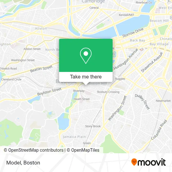
See Model, Boston, on the map
Public Transit to Model in Boston
Wondering how to get to Model in Boston? Moovit helps you find the best way to get to Model with step-by-step directions from the nearest public transit station.
Moovit provides free maps and live directions to help you navigate through your city. View schedules, routes, timetables, and find out how long does it take to get to Model in real time.
Looking for the nearest stop or station to Model? Check out this list of stops closest to your destination: Huntington Ave @ Parker Hill Ave; Fenwood Road; Heath St @ S Huntington Ave; Brookline Ave Opp Aspinwall Ave.
Bus: 39, 66, 35, GREEN LINE E SHUTTLE, GREEN LINE E SHUTTLE, 14, 60, 65.Train: PROVIDENCE/STOUGHTON.Subway: GREEN LINE E.
Want to see if there’s another route that gets you there at an earlier time? Moovit helps you find alternative routes or times. Get directions from and directions to Model easily from the Moovit App or Website.
We make riding to Model easy, which is why over 1.7 million users, including users in Boston, trust Moovit as the best app for public transit. You don’t need to download an individual bus app or train app, Moovit is your all-in-one transit app that helps you find the best bus time or train time available.
For information on prices of bus, subway and train, costs and ride fares to Model, please check the Moovit app.
Use the app to navigate to popular places including to the airport, hospital, stadium, grocery store, mall, coffee shop, school, college, and university.
Model Address: 56 Frawley St street in Boston
- Kathy L. Joy, Pt, Mba,
- Mass Eye & Ear,
- Massachusetts Eye and Ear Longwood (Mass. Eye and Ear),
- Neil Bhattacharyya, MD,
- Allen C. Lam, MD (Blake C. Alkire, M.D., MPH),
- Massachusetts Eye And Ear, Longwood,
- Mission Hill,
- Gail H Kaufman MD,
- Sunset Lofts,
- Huntington Ave & Mission Park Dr,
- Parker Hill Ave & Sunset St,
- MBTA Mission Park Station,
- Edward H. Haskell Home for Nurses,
- N E Baptist Hos,
- epiphany school,
- Hayden Box, MD,
- Insurance Covered Chiropractic Care,
- FedEx,
- New England Baptist Hospital,
- Universitas Bostoniensis
Places Near Model (Boston)
- Leader Bank Pavilion (Leader Bank Pavillion), Boston,
- Seaport District, Boston,
- Museum Of Science, Boston,
- House Of Blues, Boston,
- North End, Boston,
- Boston Children's Hospital, Boston,
- Quincy Market, Boston,
- Mgm Music Hall, Boston,
- Boston Medical Center, Boston,
- Faneuil Hall, Boston,
- Castle Island, Boston,
- Cheers, Boston,
- Boston Common, Boston,
- Td Garden, Boston,
- Isabella Stewart Gardner Museum, Boston,
- Massachusetts General Hospital, Boston,
- Boston Convention & Exhibition Center, Boston,
- Prudential Center, Boston,
- Wilbur Theatre, Boston,
- Wang Theater, Boston
How to get to popular places in Boston with public transit
Get around Boston by public transit!
Traveling around Boston has never been so easy. See step by step directions as you travel to any attraction, street or major public transit station. View bus and train schedules, arrival times, service alerts and detailed routes on a map, so you know exactly how to get to anywhere in Boston.
When traveling to any destination around Boston use Moovit's Live Directions with Get Off Notifications to know exactly where and how far to walk, how long to wait for your line, and how many stops are left. Moovit will alert you when it's time to get off — no need to constantly re-check whether yours is the next stop.
Wondering how to use public transit in Boston or how to pay for public transit in Boston? Moovit public transit app can help you navigate your way with public transit easily, and at minimum cost. It includes public transit fees, ticket prices, and costs. Looking for a map of Boston public transit lines? Moovit public transit app shows all public transit maps in Boston with all Bus, Train, Subway and Ferry routes and stops on an interactive map.
Boston has 4 transit type(s), including: Bus, Train, Subway and Ferry, operated by several transit agencies, including MBTA, Southeastern Regional Transit Authority, MetroWest Regional Transit Authority, Rhode Island Public Transit Authority, WRTA, Lowell Regional Transit Authority, Merrimack Valley Transit, Montachusett Regional Transit Authority, Cape Cod Regional Transit Authority, Brockton Area Transit Authority, Martha's Vineyard Transit Authority, the WAVE - Nantucket Regional Transit Authority, GATRA, Cape Ann Transportation Authority and Massport