See Monarch Park Collegiate, Toronto, on the map
Directions to Monarch Park Collegiate (Toronto) with public transportation
The following transit lines have routes that pass near Monarch Park Collegiate
 Bus:
Bus: - Train:
- Subway:
How to get to Monarch Park Collegiate by bus?
Click on the bus route to see step by step directions with maps, line arrival times and updated time schedules.
How to get to Monarch Park Collegiate by train?
Click on the train route to see step by step directions with maps, line arrival times and updated time schedules.
How to get to Monarch Park Collegiate by subway?
Click on the subway route to see step by step directions with maps, line arrival times and updated time schedules.
Bus stations near Monarch Park Collegiate in Toronto
- Coxwell Ave at Hanson St South Side,3 min walk,
- Coxwell Ave at Hanson St,3 min walk,
- Danforth Ave at Coxwell Ave,7 min walk,
- Coxwell Ave at Danforth Ave,8 min walk,
- Coxwell Station,10 min walk,
Streetcar stations near Monarch Park Collegiate in Toronto
- Gerrard St East at Coxwell Ave,9 min walk,
- Queen St East at Woodfield Rd,24 min walk,
Subway stations near Monarch Park Collegiate in Toronto
- Coxwell,10 min walk,
Bus lines to Monarch Park Collegiate in Toronto
- 22,Coxwell Station,
- 322,Bingham Loop,
- 322S,Coxwell Ave at Danforth Ave,
- 300A,3450 Danforth Ave,
- 300B,Kennedy Station - Platform B,
- 300S,Bloor St West at Bathurst St,
- 31,Eastern Ave at Queen St East South Side,
- 70,Craigton Dr at Pharmacy Ave,
- 404,Coxwell Station,
What are the closest stations to Monarch Park Collegiate?
The closest stations to Monarch Park Collegiate are:
- Coxwell Ave at Hanson St South Side is 70 meters away, 3 min walk.
- Coxwell Ave at Hanson St is 77 meters away, 3 min walk.
- Danforth Ave at Coxwell Ave is 463 meters away, 7 min walk.
- Coxwell Ave at Danforth Ave is 489 meters away, 8 min walk.
- Gerrard St East at Coxwell Ave is 592 meters away, 9 min walk.
- Coxwell is 640 meters away, 10 min walk.
- Coxwell Station is 665 meters away, 10 min walk.
- Queen St East at Woodfield Rd is 1764 meters away, 24 min walk.
Which bus lines stop near Monarch Park Collegiate?
These bus lines stop near Monarch Park Collegiate: 506, 56, 70.
Which train line stops near Monarch Park Collegiate?
LE
Which subway line stops near Monarch Park Collegiate?
2
What’s the nearest Streetcar station to Monarch Park Collegiate in Toronto?
The nearest Streetcar station to Monarch Park Collegiate in Toronto is Gerrard St East at Coxwell Ave. It’s a 9 min walk away.
What’s the nearest subway station to Monarch Park Collegiate in Toronto?
The nearest subway station to Monarch Park Collegiate in Toronto is Coxwell. It’s a 10 min walk away.
What’s the nearest bus stop to Monarch Park Collegiate in Toronto?
The nearest bus stops to Monarch Park Collegiate in Toronto are Coxwell Ave at Hanson St South Side and Coxwell Ave at Hanson St. The closest one is a 3 min walk away.
See Monarch Park Collegiate, Toronto, on the map
Public Transit to Monarch Park Collegiate in Toronto
Wondering how to get to Monarch Park Collegiate in Toronto, Canada? Moovit helps you find the best way to get to Monarch Park Collegiate with step-by-step directions from the nearest public transit station.
Moovit provides free maps and live directions to help you navigate through your city. View schedules, routes, timetables, and find out how long does it take to get to Monarch Park Collegiate in real time.
Looking for the nearest stop or station to Monarch Park Collegiate? Check out this list of stops closest to your destination: Coxwell Ave at Hanson St South Side; Coxwell Ave at Hanson St; Danforth Ave at Coxwell Ave; Coxwell Ave at Danforth Ave; Gerrard St East at Coxwell Ave; Coxwell; Coxwell Station; Queen St East at Woodfield Rd.
Bus:Train:Subway:
Want to see if there’s another route that gets you there at an earlier time? Moovit helps you find alternative routes or times. Get directions from and directions to Monarch Park Collegiate easily from the Moovit App or Website.
We make riding to Monarch Park Collegiate easy, which is why over 1.5 million users, including users in Toronto, trust Moovit as the best app for public transit. You don’t need to download an individual bus app or train app, Moovit is your all-in-one transit app that helps you find the best bus time or train time available.
For information on prices of subway, bus and train, costs and ride fares to Monarch Park Collegiate, please check the Moovit app.
Use the app to navigate to popular places including to the airport, hospital, stadium, grocery store, mall, coffee shop, school, college, and university.
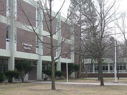
Monarch Park Collegiate Address: Hanson Street street in Toronto
Attractions near Monarch Park Collegiate
Monarch Park Stadium,Monarch Park Collegiate Institute,Monarch Park Collegiate - Track & Field,1 Hanson Street,11 Coatsworth Crescent,Monarch Park,Greenwood - Coxwell,688 Coxwell Ave,100-688 Coxwell Avenue,Dr. Mersal Children's Clinic,The Rail Garden,Kumon Math & Reading Centre of Toronto,Tiff Bell Lightbox Canteen,1554 Danforth Avenue,Alterna Savings Coxwell Branch,CIBC,Massage and Yoga with Morgen,Roden Community Child Care Centre,M4J 1N4,Gerrard St East at Coxwell AveHow to get to popular attractions in Toronto with public transit
Meadowvale Town Centre Bus Terminal, Mississauga,Brampton ON, Brampton,City of Burlington, Burlington,Cineplex Cinemas Oakville and VIP, Oakville,TTC 505 Dundas Streetcar, Toronto,Trinity Common Bus Terminal, Brampton,Dixie Outlet Mall, Mississauga,University Of Toronto Mississauga Campus, Mississauga,TTC #511 Bathurst Streetcar, Toronto,The Keg Steakhouse + Bar - Keg Mansion, Toronto,Wayne Gretzky's Toronto, Toronto,Highway 401 & 404 Merge, Toronto,Fresh On Spadina, Toronto,Erin Mills Town Centre, Mississauga,Mapleview Shopping Centre, Burlington,The Beach, Toronto,City of St. Catharines, St. Catharines,GoodLife Fitness Centres, Toronto,Starbucks, Toronto,Communitech Hub, KitchenerGet around Toronto by public transit!
Traveling around Toronto has never been so easy. See step by step directions as you travel to any attraction, street or major public transit station. View bus and train schedules, arrival times, service alerts and detailed routes on a map, so you know exactly how to get to anywhere in Toronto.
When traveling to any destination around Toronto use Moovit's Live Directions with Get Off Notifications to know exactly where and how far to walk, how long to wait for your line, and how many stops are left. Moovit will alert you when it's time to get off — no need to constantly re-check whether yours is the next stop.
Wondering how to use public transit in Toronto or how to pay for public transit in Toronto? Moovit public transit app can help you navigate your way with public transit easily, and at minimum cost. It includes public transit fees, ticket prices, and costs. Looking for a map of Toronto public transit lines? Moovit public transit app shows all public transit maps in Toronto with all subway, bus or train routes and stops on an interactive map.
Toronto has 3 transit type(s), including: subway, bus or train, operated by several transit agencies, including TTC, TTC Streetcar, Toronto Subway, GO Transit Bus, GO Transit, Amtrak, York Region Transit, Grand River Transit, Guelph Transit, grt, Hamilton Street Railway, MiWay, Brampton Transit, Burlington Transit and Oakville Transit