Directions to Monongahela Incline (Pittsburgh) with public transportation
The following transit lines have routes that pass near Monongahela Incline
 Bus:
Bus: - Funicular:
How to get to Monongahela Incline by bus?
Click on the bus route to see step by step directions with maps, line arrival times and updated time schedules.
How to get to Monongahela Incline by {{TRANSIT_TYPE}}?
Click on the {{TRANSIT_TYPE}} route to see step by step directions with maps, line arrival times and updated time schedules.
Funicular stations near Monongahela Incline in Pittsburgh
- Duquesne Incline At Lower Station,1 min walk,
What are the closest stations to Monongahela Incline?
The closest stations to Monongahela Incline are:
- Duquesne Incline At Lower Station is 17 yards away, 1 min walk.
Which bus lines stop near Monongahela Incline?
These bus lines stop near Monongahela Incline: 21, 22, G2.
What’s the nearest funicular station to Monongahela Incline in Pittsburgh?
The nearest funicular station to Monongahela Incline in Pittsburgh is Duquesne Incline At Lower Station. It’s a 1 min walk away.
See Monongahela Incline, Pittsburgh, on the map
Public Transit to Monongahela Incline in Pittsburgh
Wondering how to get to Monongahela Incline in Pittsburgh, United States? Moovit helps you find the best way to get to Monongahela Incline with step-by-step directions from the nearest public transit station.
Moovit provides free maps and live directions to help you navigate through your city. View schedules, routes, timetables, and find out how long does it take to get to Monongahela Incline in real time.
Looking for the nearest stop or station to Monongahela Incline? Check out this list of stops closest to your destination: Duquesne Incline At Lower Station.
Bus:Funicular:
Want to see if there’s another route that gets you there at an earlier time? Moovit helps you find alternative routes or times. Get directions from and directions to Monongahela Incline easily from the Moovit App or Website.
We make riding to Monongahela Incline easy, which is why over 1.5 million users, including users in Pittsburgh, trust Moovit as the best app for public transit. You don’t need to download an individual bus app or train app, Moovit is your all-in-one transit app that helps you find the best bus time or train time available.
For information on prices of bus, costs and ride fares to Monongahela Incline, please check the Moovit app.
Use the app to navigate to popular places including to the airport, hospital, stadium, grocery store, mall, coffee shop, school, college, and university.
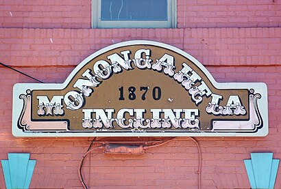
Monongahela Incline Address: 1197 W Carson St street in Pittsburgh
Attractions near Monongahela Incline
1197 W Carson St,West Carson,1197 West Carson Street,Philter Media Co Of America,Duquesne Incline,Hunt Stained Glass Studios Inc,The Restaurant At Grand View,Stewart Co,Iron City Warehouse & Elevator,Three Rivers Heritage Trail-W Station Sq Dr-Off Road,Machinery Graveyard,Duquesne Incline at Lower Station,W Carson St Opp Duquesne Incline,AGH Emergency dept,Battaglia Auto Recycling,1210 Lincoln Highway,W Station Square Dr / W Carson St,Thursday flotilla,John Gruden MNF Big Play Porch,Poli-sciHow to get to popular attractions in Pittsburgh with public transit
Bar Louie, Pittsburgh,Carnegie Science Center, Pittsburgh,Carrick, Pittsburgh,Lawrence Hall, Pittsburgh,Ingram, PA, Crafton,Upmc Saint Margaret, Pittsburgh,Petersen Events Center, Pittsburgh,SouthBridge EMS - Station 815,Tequila Cowboy, Pittsburgh,VAPHS - H.J. Heinz - Aspinwall - Building 71,William Pitt Union, Pittsburgh,Aldi, Pittsburgh,29-Robinson, Crafton,Lawrenceville, Pittsburgh,Hofbräuhaus, Pittsburgh,Clever Park,ridc park,David L. Lawrence Convention Center, Pittsburgh,Clapp Hall, Pittsburgh,UPMC St. Margaret Hospital - Department Of Radiology, PittsburghGet around Pittsburgh by public transit!
Traveling around Pittsburgh has never been so easy. See step by step directions as you travel to any attraction, street or major public transit station. View bus and train schedules, arrival times, service alerts and detailed routes on a map, so you know exactly how to get to anywhere in Pittsburgh.
When traveling to any destination around Pittsburgh use Moovit's Live Directions with Get Off Notifications to know exactly where and how far to walk, how long to wait for your line, and how many stops are left. Moovit will alert you when it's time to get off — no need to constantly re-check whether yours is the next stop.
Wondering how to use public transit in Pittsburgh or how to pay for public transit in Pittsburgh? Moovit public transit app can help you navigate your way with public transit easily, and at minimum cost. It includes public transit fees, ticket prices, and costs. Looking for a map of Pittsburgh public transit lines? Moovit public transit app shows all public transit maps in Pittsburgh with all bus routes and stops on an interactive map.
Pittsburgh has 1 transit type(s), including: bus, operated by several transit agencies, including Pittsburgh Regional Transit, Pittsburgh Regional Transit, CamTran, Amtran, Mid Mon Valley Transit, BCTA, Butler Transit Authority, IndiGo, Area Transportation Authority, Freedom Transit, Pittsburgh Regional Transit, Mountain Line Transit Authority, Megabus, Greyhound-us and Fullington Trailways