See Monroe Station CTA Red Line, Chicago, on the map
Directions to Monroe Station CTA Red Line (Chicago) with public transportation
The following transit lines have routes that pass near Monroe Station CTA Red Line
 Bus:
Bus: - Train:
- Chicago 'L':
How to get to Monroe Station CTA Red Line by bus?
Click on the bus route to see step by step directions with maps, line arrival times and updated time schedules.
How to get to Monroe Station CTA Red Line by train?
Click on the train route to see step by step directions with maps, line arrival times and updated time schedules.
How to get to Monroe Station CTA Red Line by Chicago 'L'?
Click on the Chicago 'L' route to see step by step directions with maps, line arrival times and updated time schedules.
Chicago 'l' stations near Monroe Station CTA Red Line in Chicago
- Adams/Wabash,1 min walk,
- Jackson (Red),4 min walk,
- Jackson-Blue,5 min walk,
Bus stations near Monroe Station CTA Red Line in Chicago
- Monroe St & Wabash Ave (Drop Off Only),2 min walk,
- Adams & Wabash (West),2 min walk,
- State & Washington (North),2 min walk,
- Michigan & Monroe (South),3 min walk,
- State & Adams (North),3 min walk,
- Adams & State (West),4 min walk,
- Dearborn & Monroe (North),4 min walk,
- State & Monroe (South),4 min walk,
- Madison & Wabash (West),4 min walk,
Bus lines to Monroe Station CTA Red Line in Chicago
- 850,North Bolingbrook – East Loop Express,
- 855,Plainfield-East Loop Express,
- 1,Desplaines & Harrison Terminal (South),
- 7,Harrison & Central Terminal (North),
- 28,Union Station Transit Center (East),
- 126,Jackson & Kedzie (West),
- 151,Michigan & Delaware/Walton (North),
- 4,State & 95th Street (North),
- 66,Chicago & Pulaski (West),
- 3,King Drive,
- X4,Cottage Grove Express,
- J14,Jeffery Jump,
- 26,South Shore Express,
- 143,Stockton/Michigan Express,
- 147,Outer DuSable Lake Shore Express,
- 2,Midway Plaisance & Cottage Grove (East),
- 10,Chestnut & Mies Van Der Rohe (West),
- 29,Navy Pier Terminal (North),
- 146,Foster & Broadway (West),
- 148,Marine Drive & Winona (North),
What are the closest stations to Monroe Station CTA Red Line?
The closest stations to Monroe Station CTA Red Line are:
- Adams/Wabash is 27 yards away, 1 min walk.
- Monroe St & Wabash Ave (Drop Off Only) is 61 yards away, 2 min walk.
- Adams & Wabash (West) is 69 yards away, 2 min walk.
- State & Washington (North) is 91 yards away, 2 min walk.
- Michigan & Monroe (South) is 108 yards away, 3 min walk.
- State & Adams (North) is 189 yards away, 3 min walk.
- Adams & State (West) is 221 yards away, 4 min walk.
- Dearborn & Monroe (North) is 223 yards away, 4 min walk.
- Jackson (Red) is 226 yards away, 4 min walk.
- State & Monroe (South) is 229 yards away, 4 min walk.
- Madison & Wabash (West) is 245 yards away, 4 min walk.
- Jackson-Blue is 316 yards away, 5 min walk.
Which bus lines stop near Monroe Station CTA Red Line?
These bus lines stop near Monroe Station CTA Red Line: 148, 2, 20, 22, 28, 36, 56, 62.
Which train lines stop near Monroe Station CTA Red Line?
These train lines stop near Monroe Station CTA Red Line: MD-W, ME, UP-N, UP-NW.
Which Chicago 'L' lines stop near Monroe Station CTA Red Line?
These Chicago 'L' lines stop near Monroe Station CTA Red Line: BLUE LINE, GREEN LINE, RED LINE.
What’s the nearest Chicago 'L' station to Monroe Station CTA Red Line in Chicago?
The nearest Chicago 'L' station to Monroe Station CTA Red Line in Chicago is Adams/Wabash. It’s a 1 min walk away.
What’s the nearest bus stop to Monroe Station CTA Red Line in Chicago?
The nearest bus stops to Monroe Station CTA Red Line in Chicago are Monroe St & Wabash Ave (Drop Off Only), Adams & Wabash (West) and State & Washington (North). The closest one is a 2 min walk away.
What time is the first Chicago 'L' to Monroe Station CTA Red Line in Chicago?
The BLUE LINE is the first Chicago 'L' that goes to Monroe Station CTA Red Line in Chicago. It stops nearby at 3:06 AM.
What time is the last Chicago 'L' to Monroe Station CTA Red Line in Chicago?
The RED LINE is the last Chicago 'L' that goes to Monroe Station CTA Red Line in Chicago. It stops nearby at 3:23 AM.
What time is the first bus to Monroe Station CTA Red Line in Chicago?
The 66 is the first bus that goes to Monroe Station CTA Red Line in Chicago. It stops nearby at 3:01 AM.
What time is the last bus to Monroe Station CTA Red Line in Chicago?
The 4 is the last bus that goes to Monroe Station CTA Red Line in Chicago. It stops nearby at 3:33 AM.
How much is the train fare to Monroe Station CTA Red Line?
The train fare to Monroe Station CTA Red Line costs about $4.00 - $4.25.
How much is the Chicago 'L' fare to Monroe Station CTA Red Line?
The Chicago 'L' fare to Monroe Station CTA Red Line costs about $2.50 - $5.00.
How much is the bus fare to Monroe Station CTA Red Line?
The bus fare to Monroe Station CTA Red Line costs about $2.25.
See Monroe Station CTA Red Line, Chicago, on the map
Public Transit to Monroe Station CTA Red Line in Chicago
Wondering how to get to Monroe Station CTA Red Line in Chicago, United States? Moovit helps you find the best way to get to Monroe Station CTA Red Line with step-by-step directions from the nearest public transit station.
Moovit provides free maps and live directions to help you navigate through your city. View schedules, routes, timetables, and find out how long does it take to get to Monroe Station CTA Red Line in real time.
Looking for the nearest stop or station to Monroe Station CTA Red Line? Check out this list of stops closest to your destination: Adams/Wabash; Monroe St & Wabash Ave (Drop Off Only); Adams & Wabash (West); State & Washington (North); Michigan & Monroe (South); State & Adams (North); Adams & State (West); Dearborn & Monroe (North); Jackson (Red); State & Monroe (South); Madison & Wabash (West); Jackson-Blue.
Bus:Train:Chicago 'L':
Want to see if there’s another route that gets you there at an earlier time? Moovit helps you find alternative routes or times. Get directions from and directions to Monroe Station CTA Red Line easily from the Moovit App or Website.
We make riding to Monroe Station CTA Red Line easy, which is why over 1.5 million users, including users in Chicago, trust Moovit as the best app for public transit. You don’t need to download an individual bus app or train app, Moovit is your all-in-one transit app that helps you find the best bus time or train time available.
For information on prices of bus, Chicago 'L' and train, costs and ride fares to Monroe Station CTA Red Line, please check the Moovit app.
Use the app to navigate to popular places including to the airport, hospital, stadium, grocery store, mall, coffee shop, school, college, and university.
Location: Chicago
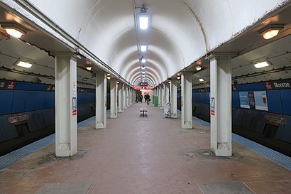
Monroe is an "L" station on the CTA's Red Line. The station opened on October 17, 1943, as part of the State Street subway. The station is located in the Chicago Loop, and is open 24/7.Wiki
Attractions near Monroe Station CTA Red Line
Palmer House,Peet's Coffee,32 South State (32 Jordan Store),Blick Art Materials,Bright Ideas Company,Capital One,Price Point,White Knight Services,Feelings Gift Shop (Feeling Gift Shop),La Court Reporters (L.A. Court Reporters,),CIBC Theatre,Palmer House - A Hilton Hotel,Bank of America Theater ,Hamilton,Cibc Theatre,Hampton Inn Majestic Chicago Theatre District Hotel,Centro,The Palmer House Hilton,33 West Monroe Fitness Center,Hampton Inn Majestic Chicago Theatre DistrictHow to get to popular attractions in Chicago with public transit
Palos Heights, IL,Ballydoyle Irish Pub, Downers Grove,Chipotle Mexican Grill, Chicago,Boeing Building, Chicago,Elmhurst Center for Health, Elmhurst,Ford City Mall, Chicago,Rt 83 & Thorndale, Bensenville,Garrett Popcorn Shops, Chicago,Metra - 55th / 56th / 57th St, Chicago,Dark Matter Coffee, Chicago,Chama Gaucha Brazilian Steakhouse, Downers Grove,Route 66 Raceway, Joliet,120 S. LaSalle St., Chicago,Chicago Ridge Mall, Chicago Ridge,Target, South Elgin,Walmart Supercenter, Streamwood,Hotel Arista, Naperville,Woodfield Mall, Schaumburg,Garfield Ridge, Chicago,Metra/Amtrak - Homewood, HomewoodGet around Chicago by public transit!
Traveling around Chicago has never been so easy. See step by step directions as you travel to any attraction, street or major public transit station. View bus and train schedules, arrival times, service alerts and detailed routes on a map, so you know exactly how to get to anywhere in Chicago.
When traveling to any destination around Chicago use Moovit's Live Directions with Get Off Notifications to know exactly where and how far to walk, how long to wait for your line, and how many stops are left. Moovit will alert you when it's time to get off — no need to constantly re-check whether yours is the next stop.
Wondering how to use public transit in Chicago or how to pay for public transit in Chicago? Moovit public transit app can help you navigate your way with public transit easily, and at minimum cost. It includes public transit fees, ticket prices, and costs. Looking for a map of Chicago public transit lines? Moovit public transit app shows all public transit maps in Chicago with all bus, Chicago 'L' or train routes and stops on an interactive map.
Chicago has 3 transit type(s), including: bus, Chicago 'L' or train, operated by several transit agencies, including CTA 'L', Metra, Northern Indiana Commuter Transportation District, CTA, PACE, O'Hare International Airport Shuttle Bus, Gary Public Transit, Amtrak, River Valley Metro, Valpo Transit, DeKalb Public Transit, FlixBus-us, Greyhound-us, Van Galder (Coach USA) and Wisconsin Coach Lines