See Montclair Heights, Clifton, Nj, on the map
Directions to Montclair Heights (Clifton, Nj) with public transportation
The following transit lines have routes that pass near Montclair Heights
 Bus:
Bus: - Train:
How to get to Montclair Heights by bus?
Click on the bus route to see step by step directions with maps, line arrival times and updated time schedules.
How to get to Montclair Heights by train?
Click on the train route to see step by step directions with maps, line arrival times and updated time schedules.
Bus stations near Montclair Heights in Clifton, Nj
- Van Houten Ave At Maple Hill Rd,10 min walk,
- Valley Rd At Robin Hood Rd,13 min walk,
- Rt-3 At Grove St,17 min walk,
Bus lines to Montclair Heights in Clifton, Nj
- 192,New York Via Union City,
- 199,New York Via Nutley,
- 702,Elmwood Park Dayton Ave,
- 101,New York Express,
- 191,191x New York Express,
- 105,W Caldwell Express,
- 195,Cedar Grove Willowbrook,
What are the closest stations to Montclair Heights?
The closest stations to Montclair Heights are:
- Van Houten Ave At Maple Hill Rd is 780 yards away, 10 min walk.
- Valley Rd At Robin Hood Rd is 1044 yards away, 13 min walk.
- Rt-3 At Grove St is 1386 yards away, 17 min walk.
Which bus lines stop near Montclair Heights?
These bus lines stop near Montclair Heights: 191, 192, 199, 702.
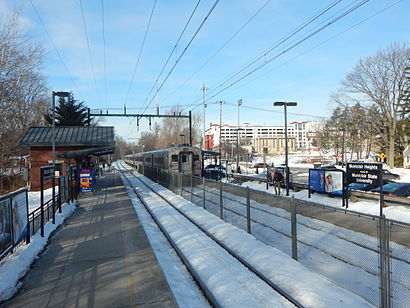
Which train line stops near Montclair Heights?
ML
What’s the nearest bus stop to Montclair Heights in Clifton, Nj?
The nearest bus stop to Montclair Heights in Clifton, Nj is Van Houten Ave At Maple Hill Rd. It’s a 10 min walk away.
See Montclair Heights, Clifton, Nj, on the map
Public Transit to Montclair Heights in Clifton, Nj
Wondering how to get to Montclair Heights in Clifton, Nj, United States? Moovit helps you find the best way to get to Montclair Heights with step-by-step directions from the nearest public transit station.
Moovit provides free maps and live directions to help you navigate through your city. View schedules, routes, timetables, and find out how long does it take to get to Montclair Heights in real time.
Looking for the nearest stop or station to Montclair Heights? Check out this list of stops closest to your destination: Van Houten Ave At Maple Hill Rd; Valley Rd At Robin Hood Rd; Rt-3 At Grove St.
Bus:Train:
Want to see if there’s another route that gets you there at an earlier time? Moovit helps you find alternative routes or times. Get directions from and directions to Montclair Heights easily from the Moovit App or Website.
We make riding to Montclair Heights easy, which is why over 1.5 million users, including users in Clifton, Nj, trust Moovit as the best app for public transit. You don’t need to download an individual bus app or train app, Moovit is your all-in-one transit app that helps you find the best bus time or train time available.
For information on prices of bus, train and subway, costs and ride fares to Montclair Heights, please check the Moovit app.
Use the app to navigate to popular places including to the airport, hospital, stadium, grocery store, mall, coffee shop, school, college, and university.
Location: Clifton, Nj, New York - New Jersey
Attractions near Montclair Heights
52 Brook Hill Terrace,62 Brookhill Ter,40 Melody Hill Rd,Maria's Homemade Pasta,Cyndi Plumbing & Heating, Inc,Therapeutic school,Breaker Billiards,Verizon Premium Retailer - Wireless Zone,Verones Family Farm,Psychic Sharon,ATM,Breaker Billiards Billiards,Accu Stats Video,King's Cleaners,Euro Tan & Spa,Getting Banged Up On The Sofa,CKO Kickboxing,Cko Kickboxing Clifton,Euro Tans and Spa,Leslie's Swimming Pool SuppliesHow to get to popular attractions in Clifton, Nj with public transit
Smith Haven Mall, Lake Grove, Ny,J.G. Melon, Manhattan,Shake Shack, Manhattan,Secaucus, NJ, Secaucus, Nj,Ace Hotel Lobby Bar, Manhattan,The Dutch, Manhattan,Caesars Atlantic City Hotel and Casino, Atlantic City, Nj,The Tippler, Manhattan,Virgin America Ticket Counter, Elizabeth, Nj,Gramercy Tavern, Manhattan,The Stumble Inn, Manhattan,Hotel Chantelle, Manhattan,The Grey Dog, Manhattan,LIRR - Babylon Station, Babylon, Ny,Dos Toros Taquería, Manhattan,Beauty & Essex, Manhattan,Gregory's Coffee, Manhattan,Mission Dolores,MTA Subway - 30th Ave (N/W), Queens,The Biergarten at The Standard, ManhattanGet around Clifton, Nj by public transit!
Traveling around Clifton, Nj has never been so easy. See step by step directions as you travel to any attraction, street or major public transit station. View bus and train schedules, arrival times, service alerts and detailed routes on a map, so you know exactly how to get to anywhere in Clifton, Nj.
When traveling to any destination around Clifton, Nj use Moovit's Live Directions with Get Off Notifications to know exactly where and how far to walk, how long to wait for your line, and how many stops are left. Moovit will alert you when it's time to get off — no need to constantly re-check whether yours is the next stop.
Wondering how to use public transit in Clifton, Nj or how to pay for public transit in Clifton, Nj? Moovit public transit app can help you navigate your way with public transit easily, and at minimum cost. It includes public transit fees, ticket prices, and costs. Looking for a map of Clifton, Nj public transit lines? Moovit public transit app shows all public transit maps in Clifton, Nj with all bus, train or subway routes and stops on an interactive map.
Clifton, Nj has 3 transit type(s), including: bus, train or subway, operated by several transit agencies, including MTA Subway, Metro-North Railroad, LIRR, PATH, Shore Line East, MTA Bus Company, MTA New York City Transit - Express routes, MTA Bus, NJ Transit, NYC Ferry, NICE bus, Bee-Line Bus, NJ Transit Rail, NJ Transit Rail and Norwalk Transit District