Directions to Montgomery Village with public transportation
The following transit lines have routes that pass near Montgomery Village
How to get to Montgomery Village by bus?
Click on the bus route to see step by step directions with maps, line arrival times and updated time schedules.
Bus stations near Montgomery Village
- Apple Ridge Rd & Darlington Dr, 26 min walk,
- Montgomery Village Ave & Russell Ave, 33 min walk,
Bus lines to Montgomery Village
- 64, Montgomery Village,
- 56, Rockville Edison Park,
What are the closest stations to Montgomery Village?
The closest stations to Montgomery Village are:
- Apple Ridge Rd & Darlington Dr is 2152 yards away, 26 min walk.
- Montgomery Village Ave & Russell Ave is 2739 yards away, 33 min walk.
Which bus lines stop near Montgomery Village?
These bus lines stop near Montgomery Village: 58, 59, 64.
See Montgomery Village on the map
Public Transportation to Montgomery Village
Wondering how to get to Montgomery Village, United States? Moovit helps you find the best way to get to Montgomery Village with step-by-step directions from the nearest public transit station.
Moovit provides free maps and live directions to help you navigate through your city. View schedules, routes, timetables, and find out how long does it take to get to Montgomery Village in real time.
Looking for the nearest stop or station to Montgomery Village? Check out this list of stops closest to your destination: Apple Ridge Rd & Darlington Dr; Montgomery Village Ave & Russell Ave.
Bus: 58, 59, 64, 56.
Want to see if there’s another route that gets you there at an earlier time? Moovit helps you find alternative routes or times. Get directions from and directions to Montgomery Village easily from the Moovit App or Website.
We make riding to Montgomery Village easy, which is why over 1.5 million users, including users in Montgomery Village, trust Moovit as the best app for public transit. You don’t need to download an individual bus app or train app, Moovit is your all-in-one transit app that helps you find the best bus time or train time available.
For information on prices of bus and metro, costs and ride fares to Montgomery Village, please check the Moovit app.
Use the app to navigate to popular places including to the airport, hospital, stadium, grocery store, mall, coffee shop, school, college, and university.
Montgomery Village Address: Centerway Road street in Montgomery Village
Attractions near Montgomery Village
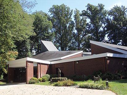
Christ The Servant Lutheran Church,Centerway Rd (montgomery village ave & centerway rd),Hayes Real Estate Inc,W I Motors Inc,BP Service Stations,Simmonds & Simmonds,Montgomery Physicians Assoc,Cheryl Winchell MD,David J Levine Mdpa,Major League Barbers,Allergy & Asthma Care Centers,Childrens Pediatricians Assoc,Village Orthodontics,Ear Nose & Throat Medical Grp,David R Jones DDS,Linda's Nails Gaithersburg,Xiecom,Drs Anderson Yazdani Farahi,Osteoporosis Analysis Clinic,Patel RameshHow to get to popular attractions in Montgomery Village with public transit
Dunkin Donuts, Washington,Caboose Brewing Company, Fairfax County,Redland, Maryland, Montgomery County,Sully Station, Fairfax County,Exit 69 - US 29 (Lee Hwy) / SR 237 (Washington Blvd) / Sycamore St, Arlington County,Gaithersburg High School, Montgomery County,Residence Inn Tysons Corner, Fairfax County,Liberty Crossing, Fairfax County,U.S. 301 Park and Ride, Charles County,I-66 Exit 67: Dulles Toll Road (VA-267), Fairfax County,GCDC, Washington,Federal Reserve Board, Washington,St. Casimir Catholic Church, Baltimore,Edmondson High School, Baltimore,Gadsby's Tavern, Alexandria,MICA Fox Building, Baltimore,BJ's Wholesale Club, Baltimore,Crispus Attucks Park, Washington,Library Of Congress, Washington,Cherry Hill Light Rail Station, BaltimoreGet around Washington, D.C. - Baltimore, MD by public transit!
Traveling around Washington, D.C. - Baltimore, MD has never been so easy. See step by step directions as you travel to any attraction, street or major public transit station. View bus and train schedules, arrival times, service alerts and detailed routes on a map, so you know exactly how to get to anywhere in Washington, D.C. - Baltimore, MD.
When traveling to any destination around Washington, D.C. - Baltimore, MD use Moovit's Live Directions with Get Off Notifications to know exactly where and how far to walk, how long to wait for your line, and how many stops are left. Moovit will alert you when it's time to get off — no need to constantly re-check whether yours is the next stop.
Wondering how to use public transit in Washington, D.C. - Baltimore, MD or how to pay for public transit in Washington, D.C. - Baltimore, MD? Moovit public transit app can help you navigate your way with public transit easily, and at minimum cost. It includes public transit fees, ticket prices, and costs. Looking for a map of Washington, D.C. - Baltimore, MD public transit lines? Moovit public transit app shows all public transit maps in Washington, D.C. - Baltimore, MD with all Bus, Train, Metro, Light Rail and Ferry routes and stops on an interactive map.
Washington, D.C. - Baltimore, MD has 5 transit type(s), including: Bus, Train, Metro, Light Rail and Ferry, operated by several transit agencies, including WMATA, Montgomery County Ride On, Fairfax Connector, TheBus, PRTC, DC Circulator, DASH - Alexandria, Arlington Transit (ART), DC Streetcar, RTA of Central Maryland, FRED, MDOT MTA, Marc, Virginia Railway Express (VRE), University of Maryland Shuttle-UM