See Moray Channel Bridge, Southwest British Columbia, on the map
Directions to Moray Channel Bridge (Southwest British Columbia) with public transportation
The following transit lines have routes that pass near Moray Channel Bridge
 Bus:
Bus: - SkyTrain:
How to get to Moray Channel Bridge by bus?
Click on the bus route to see step by step directions with maps, line arrival times and updated time schedules.
How to get to Moray Channel Bridge by SkyTrain?
Click on the SkyTrain route to see step by step directions with maps, line arrival times and updated time schedules.
Bus stations near Moray Channel Bridge in Southwest British Columbia
- Southbound No. 3 Rd @ Capstan Way,3 min walk,
- Westbound Capstan Way @ No. 3 Rd,4 min walk,
- Eastbound Sea Island Way @ No. 3 Rd,5 min walk,
Skytrain stations near Moray Channel Bridge in Southwest British Columbia
- Lansdowne Station,21 min walk,
Bus lines to Moray Channel Bridge in Southwest British Columbia
- 403,Bridgeport Station,
- N10,Brighouse Station via YVR,
- 407,Lansdowne Station,
- 412,Bridgeport Station,
What are the closest stations to Moray Channel Bridge?
The closest stations to Moray Channel Bridge are:
- Southbound No. 3 Rd @ Capstan Way is 215 meters away, 3 min walk.
- Westbound Capstan Way @ No. 3 Rd is 296 meters away, 4 min walk.
- Eastbound Sea Island Way @ No. 3 Rd is 349 meters away, 5 min walk.
- Lansdowne Station is 1576 meters away, 21 min walk.
Which bus lines stop near Moray Channel Bridge?
These bus lines stop near Moray Channel Bridge: 403, 407, 412, 430.
Which SkyTrain line stops near Moray Channel Bridge?
CANADA LINE
What’s the nearest SkyTrain station to Moray Channel Bridge in Southwest British Columbia?
The nearest SkyTrain station to Moray Channel Bridge in Southwest British Columbia is Lansdowne Station. It’s a 21 min walk away.
What’s the nearest bus stop to Moray Channel Bridge in Southwest British Columbia?
The nearest bus stop to Moray Channel Bridge in Southwest British Columbia is Southbound No. 3 Rd @ Capstan Way. It’s a 3 min walk away.
What time is the first SkyTrain to Moray Channel Bridge in Southwest British Columbia?
The CANADA LINE is the first SkyTrain that goes to Moray Channel Bridge in Southwest British Columbia. It stops nearby at 5:03 AM.
What time is the last SkyTrain to Moray Channel Bridge in Southwest British Columbia?
The CANADA LINE is the last SkyTrain that goes to Moray Channel Bridge in Southwest British Columbia. It stops nearby at 1:39 AM.
What time is the first bus to Moray Channel Bridge in Southwest British Columbia?
The N10 is the first bus that goes to Moray Channel Bridge in Southwest British Columbia. It stops nearby at 3:02 AM.
What time is the last bus to Moray Channel Bridge in Southwest British Columbia?
The N10 is the last bus that goes to Moray Channel Bridge in Southwest British Columbia. It stops nearby at 3:23 AM.
How much is the bus fare to Moray Channel Bridge?
The bus fare to Moray Channel Bridge costs about $2.55 - $7.55.
See Moray Channel Bridge, Southwest British Columbia, on the map
Public Transit to Moray Channel Bridge in Southwest British Columbia
Wondering how to get to Moray Channel Bridge in Southwest British Columbia, Canada? Moovit helps you find the best way to get to Moray Channel Bridge with step-by-step directions from the nearest public transit station.
Moovit provides free maps and live directions to help you navigate through your city. View schedules, routes, timetables, and find out how long does it take to get to Moray Channel Bridge in real time.
Looking for the nearest stop or station to Moray Channel Bridge? Check out this list of stops closest to your destination: Southbound No. 3 Rd @ Capstan Way; Westbound Capstan Way @ No. 3 Rd; Eastbound Sea Island Way @ No. 3 Rd; Lansdowne Station.
Bus:SkyTrain:
Want to see if there’s another route that gets you there at an earlier time? Moovit helps you find alternative routes or times. Get directions from and directions to Moray Channel Bridge easily from the Moovit App or Website.
We make riding to Moray Channel Bridge easy, which is why over 1.5 million users, including users in Southwest British Columbia, trust Moovit as the best app for public transit. You don’t need to download an individual bus app or train app, Moovit is your all-in-one transit app that helps you find the best bus time or train time available.
For information on prices of bus and SkyTrain, costs and ride fares to Moray Channel Bridge, please check the Moovit app.
Use the app to navigate to popular places including to the airport, hospital, stadium, grocery store, mall, coffee shop, school, college, and university.
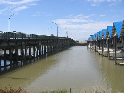
Moray Channel Bridge Address: Sea Island Way street in Southwest British Columbia
Attractions near Moray Channel Bridge
Sea Island Connector,Moray bridge,Southern Straits Yacht Sales,Galleon Marine (RMD),Silverthrone,Parkavenue Leasing,Cali Haan Writer Editor,Pacific Coast Yacht Sales LTD,Springloaded Fishing Charters,Westin Wall Centre Vancouver Airport Traditional,3099 Corvette Way,Waterwalkers Entertainment,Mama's Fish & Chips,Virgin Cocktail - Richmond Night Market,Beavertails Pastry,Pingoo Frozen Yogurt,The Westin Wall Centre, Vancouver Airport,Sixt,Lobby Restaurant & Bar (Pier 73),The Westin Wall Centre Vancouver Airport RichmondHow to get to popular attractions in Southwest British Columbia with public transit
Robson Street, Vancouver,Chong Lee Market 昌利市場, Vancouver,Phnom Penh, Vancouver,Burnaby Mountain Secondary School, Burnaby,Surrey Central Bus Loop, Surrey,Bus 257 Horseshoe Bay / Vancouver Express, West Vancouver,Save-On-Foods, Surrey,Bentall Centre, Vancouver,Listel Hotel, Vancouver,Arthur Laing Bridge, Vancouver,Willingdon Park, Burnaby,Real Canadian Superstore, Delta,Huntingdon / Sumas Border Crossing, Abbotsford,The Naam Restaurant, Vancouver,The Flying Beaver Bar & Grill,Ubc, Greater Vancouver A,Langara College, Vancouver,Costco Wholesale, Abbotsford,Haney Place Bus Station, Maple Ridge,Coquitlam Centre, CoquitlamGet around Southwest British Columbia by public transit!
Traveling around Southwest British Columbia has never been so easy. See step by step directions as you travel to any attraction, street or major public transit station. View bus and train schedules, arrival times, service alerts and detailed routes on a map, so you know exactly how to get to anywhere in Southwest British Columbia.
When traveling to any destination around Southwest British Columbia use Moovit's Live Directions with Get Off Notifications to know exactly where and how far to walk, how long to wait for your line, and how many stops are left. Moovit will alert you when it's time to get off — no need to constantly re-check whether yours is the next stop.
Wondering how to use public transit in Southwest British Columbia or how to pay for public transit in Southwest British Columbia? Moovit public transit app can help you navigate your way with public transit easily, and at minimum cost. It includes public transit fees, ticket prices, and costs. Looking for a map of Southwest British Columbia public transit lines? Moovit public transit app shows all public transit maps in Southwest British Columbia with all bus or SkyTrain routes and stops on an interactive map.
Southwest British Columbia has 2 transit type(s), including: bus or SkyTrain, operated by several transit agencies, including TransLink, TransLink, TransLink, TransLink, False Creek Ferries, BC Ferries, Aquabus, BC Transit - Central Fraser Valley Transit System, BCTransit, BC Transit - Comox Valley Transit System, BC Transit - Aggasiz-Harrison and Hope Transit System, BC Transit - Chilliwack Transit System, BC Transit - Squamish, BC Transit - Whistler Transit System and BC Transit - Cowichan Valley Regional Transit System