Directions to More Local Calls (Newton) with public transportation
The following transit lines have routes that pass near More Local Calls
 Bus: 52, 60, GREEN LINE D SHUTTLE, GREEN LINE D SHUTTLE, GREEN LINE D SHUTTLE.
- Train: FRAMINGHAM/WORCESTER.
- Subway: GREEN LINE D, GREEN LINE B.
How to get to More Local Calls by bus?
Click on the bus route to see step by step directions with maps, line arrival times and updated time schedules.
From Prudential Center, Boston
40 minFrom Liberty Mutual, Boston
37 minFrom MBTA-Museum of Fine Arts, Boston
58 minFrom Cathedral Of the Holy Cross, Boston
54 minFrom Bidmc, Boston
44 minFrom Revolution Hotel, Boston
42 minFrom Dorchester, Boston
80 minFrom Arnold Arboretum, Boston
86 minFrom WGBH, Boston
57 minFrom Grill 23 & Bar, Boston
44 min
How to get to More Local Calls by train?
Click on the train route to see step by step directions with maps, line arrival times and updated time schedules.
From Prudential Center, Boston
75 minFrom Liberty Mutual, Boston
73 minFrom MBTA-Museum of Fine Arts, Boston
79 minFrom Cathedral Of the Holy Cross, Boston
81 minFrom Revolution Hotel, Boston
75 minFrom Dorchester, Boston
186 minFrom Arnold Arboretum, Boston
171 minFrom WGBH, Boston
157 minFrom Grill 23 & Bar, Boston
73 min
How to get to More Local Calls by subway?
Click on the subway route to see step by step directions with maps, line arrival times and updated time schedules.
From Prudential Center, Boston
45 minFrom Liberty Mutual, Boston
44 minFrom MBTA-Museum of Fine Arts, Boston
48 minFrom Cathedral Of the Holy Cross, Boston
55 minFrom Bidmc, Boston
33 minFrom Revolution Hotel, Boston
49 minFrom Dorchester, Boston
83 minFrom Arnold Arboretum, Boston
76 minFrom WGBH, Boston
46 minFrom Grill 23 & Bar, Boston
44 min
Bus stops near More Local Calls in Newton
Subway stations near More Local Calls in Newton
Bus lines to More Local Calls in Newton
- 52, Dedham Mall,VIEW
- GREEN LINE D SHUTTLE, Newton Highlands - Kenmore,VIEW
- GREEN LINE D SHUTTLE, Riverside - Kenmore via Saint Mary's Street,VIEW
- GREEN LINE D SHUTTLE, Riverside - Brookline Hills,VIEW
- GREEN LINE D SHUTTLE, Newton Highlands - Brookline Hills,VIEW
- GREEN LINE D SHUTTLE, Newton Highlands - Fenway,VIEW
- GREEN LINE D SHUTTLE, Riverside - Fenway,VIEW
- GREEN LINE D SHUTTLE, Riverside - Kenmore (Shuttle),VIEW
- GREEN LINE D SHUTTLE, Riverside - Brookline Village,VIEW
- GREEN LINE D SHUTTLE, Riverside - Reservoir,VIEW
- GREEN LINE D SHUTTLE, Newton Highlands - Kenmore via Saint Mary's Street,VIEW
- GREEN LINE D SHUTTLE, Newton Highlands - Reservoir,VIEW
- GREEN LINE D SHUTTLE, Riverside - Kenmore,VIEW
What are the closest stations to More Local Calls?
The closest stations to More Local Calls are:
- Centre St @ Gibbs St is 437 yards away, 6 min walk.
- Newton Centre - Langley Rd Opp Braeland Ave is 440 yards away, 6 min walk.
- Chestnut Hill is 1382 yards away, 17 min walk.
- Boston College is 2128 yards away, 25 min walk.
Which bus lines stop near More Local Calls?
These bus lines stop near More Local Calls: 52, 60.
Which train line stops near More Local Calls?
FRAMINGHAM/WORCESTER (#521 | Worcester)
Which subway line stops near More Local Calls?
GREEN LINE D (Riverside)
What’s the nearest subway station to More Local Calls in Newton?
The nearest subway station to More Local Calls in Newton is Chestnut Hill. It’s a 17 min walk away.
What’s the nearest bus station to More Local Calls in Newton?
The nearest bus stations to More Local Calls in Newton are Centre St @ Gibbs St and Newton Centre - Langley Rd Opp Braeland Ave. The closest one is a 6 min walk away.
What time is the first subway to More Local Calls in Newton?
The GREEN LINE D is the first subway that goes to More Local Calls in Newton. It stops nearby at 4:50 AM.
What time is the last subway to More Local Calls in Newton?
The GREEN LINE D is the last subway that goes to More Local Calls in Newton. It stops nearby at 2:41 AM.
What time is the first bus to More Local Calls in Newton?
The 52 is the first bus that goes to More Local Calls in Newton. It stops nearby at 6:42 AM.
What time is the last bus to More Local Calls in Newton?
The 52 is the last bus that goes to More Local Calls in Newton. It stops nearby at 7:02 PM.
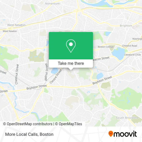
See More Local Calls, Newton, on the map
Public Transit to More Local Calls in Newton
Wondering how to get to More Local Calls in Newton? Moovit helps you find the best way to get to More Local Calls with step-by-step directions from the nearest public transit station.
Moovit provides free maps and live directions to help you navigate through your city. View schedules, routes, timetables, and find out how long does it take to get to More Local Calls in real time.
Looking for the nearest stop or station to More Local Calls? Check out this list of stops closest to your destination: Centre St @ Gibbs St; Newton Centre - Langley Rd Opp Braeland Ave; Chestnut Hill; Boston College.
Bus: 52, 60, GREEN LINE D SHUTTLE, GREEN LINE D SHUTTLE, GREEN LINE D SHUTTLE, GREEN LINE D SHUTTLE, GREEN LINE D SHUTTLE.Train: FRAMINGHAM/WORCESTER.Subway: GREEN LINE D, GREEN LINE B.
Want to see if there’s another route that gets you there at an earlier time? Moovit helps you find alternative routes or times. Get directions from and directions to More Local Calls easily from the Moovit App or Website.
We make riding to More Local Calls easy, which is why over 1.7 million users, including users in Newton, trust Moovit as the best app for public transit. You don’t need to download an individual bus app or train app, Moovit is your all-in-one transit app that helps you find the best bus time or train time available.
For information on prices of bus, subway and train, costs and ride fares to More Local Calls, please check the Moovit app.
Use the app to navigate to popular places including to the airport, hospital, stadium, grocery store, mall, coffee shop, school, college, and university.
More Local Calls Address: 43 Kendall Rd street in Newton
- Newton, MA,
- The Boston Psychoanalytic Society And Institute,
- Sarina Steinmetz,
- Colby Hall,
- JF & CS,
- Jonas Salisbury House,
- MBTA Newton Centre Station,
- Crossroads Counseling Services,
- Rêve Salon,
- Boston Allergy Group,
- Jamie's on Union,
- Xuan Zhang,
- Piccadilly Square,
- Rêve Salon,
- Serina's Hair And Treatment Salon,
- Talori Jewelers,
- Jt Salon 55,
- Williams Constance L MD - Williams, Constance L MD,
- White Wind Wellness,
- Simply Beautiful Salon
Places Near More Local Calls (Newton)
- Td Garden, Boston,
- Wang Theater, Boston,
- Museum Of Science, Boston,
- North End, Boston,
- Isabella Stewart Gardner Museum, Boston,
- Faneuil Hall, Boston,
- Boston Medical Center, Boston,
- Wilbur Theatre, Boston,
- Prudential Center, Boston,
- Cheers, Boston,
- Boston Common, Boston,
- Mgm Music Hall, Boston,
- House Of Blues, Boston,
- Massachusetts General Hospital, Boston,
- Quincy Market, Boston,
- Boston Children's Hospital, Boston,
- Boston Convention & Exhibition Center, Boston,
- Seaport District, Boston,
- Leader Bank Pavilion (Leader Bank Pavillion), Boston,
- Castle Island, Boston
How to get to popular places in Boston with public transit
Get around Newton by public transit!
Traveling around Newton has never been so easy. See step by step directions as you travel to any attraction, street or major public transit station. View bus and train schedules, arrival times, service alerts and detailed routes on a map, so you know exactly how to get to anywhere in Newton.
When traveling to any destination around Newton use Moovit's Live Directions with Get Off Notifications to know exactly where and how far to walk, how long to wait for your line, and how many stops are left. Moovit will alert you when it's time to get off — no need to constantly re-check whether yours is the next stop.
Wondering how to use public transit in Newton or how to pay for public transit in Newton? Moovit public transit app can help you navigate your way with public transit easily, and at minimum cost. It includes public transit fees, ticket prices, and costs. Looking for a map of Newton public transit lines? Moovit public transit app shows all public transit maps in Newton with all Bus, Train, Subway and Ferry routes and stops on an interactive map.
Boston has 4 transit type(s), including: Bus, Train, Subway and Ferry, operated by several transit agencies, including MBTA, Southeastern Regional Transit Authority, MetroWest Regional Transit Authority, Rhode Island Public Transit Authority, WRTA, Lowell Regional Transit Authority, Merrimack Valley Transit, Montachusett Regional Transit Authority, Cape Cod Regional Transit Authority, Brockton Area Transit Authority, Martha's Vineyard Transit Authority, the WAVE - Nantucket Regional Transit Authority, GATRA, Cape Ann Transportation Authority and Massport