Directions to Morton Road Historic District (Newton) with public transportation
The following transit lines have routes that pass near Morton Road Historic District
How to get to Morton Road Historic District by bus?
Click on the bus route to see step by step directions with maps, line arrival times and updated time schedules.
How to get to Morton Road Historic District by train?
Click on the train route to see step by step directions with maps, line arrival times and updated time schedules.
How to get to Morton Road Historic District by subway?
Click on the subway route to see step by step directions with maps, line arrival times and updated time schedules.
Bus stations near Morton Road Historic District in Newton
- Walnut St @ Mill St, 9 min walk,
Bus lines to Morton Road Historic District in Newton
- 59, Needham Junction Via Needham St,
What are the closest stations to Morton Road Historic District?
The closest stations to Morton Road Historic District are:
- Walnut St @ Mill St is 700 yards away, 9 min walk.
Which bus lines stop near Morton Road Historic District?
These bus lines stop near Morton Road Historic District: 52, 59.
Which train line stops near Morton Road Historic District?
FRAMINGHAM/WORCESTER LINE
Which subway line stops near Morton Road Historic District?
GREEN LINE D
What’s the nearest bus stop to Morton Road Historic District in Newton?
The nearest bus stop to Morton Road Historic District in Newton is Walnut St @ Mill St. It’s a 9 min walk away.
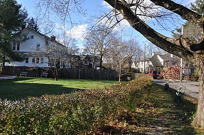
See Morton Road Historic District, Newton, on the map
Public Transit to Morton Road Historic District in Newton
Wondering how to get to Morton Road Historic District in Newton, United States? Moovit helps you find the best way to get to Morton Road Historic District with step-by-step directions from the nearest public transit station.
Moovit provides free maps and live directions to help you navigate through your city. View schedules, routes, timetables, and find out how long does it take to get to Morton Road Historic District in real time.
Looking for the nearest stop or station to Morton Road Historic District? Check out this list of stops closest to your destination: Walnut St @ Mill St.
Bus: 52, 59.Train: FRAMINGHAM/WORCESTER LINE.Subway: GREEN LINE D.
Want to see if there’s another route that gets you there at an earlier time? Moovit helps you find alternative routes or times. Get directions from and directions to Morton Road Historic District easily from the Moovit App or Website.
We make riding to Morton Road Historic District easy, which is why over 1.5 million users, including users in Newton, trust Moovit as the best app for public transit. You don’t need to download an individual bus app or train app, Moovit is your all-in-one transit app that helps you find the best bus time or train time available.
For information on prices of bus, subway and train, costs and ride fares to Morton Road Historic District, please check the Moovit app.
Use the app to navigate to popular places including to the airport, hospital, stadium, grocery store, mall, coffee shop, school, college, and university.
Morton Road Historic District Address: Morton Street street in Newton
Attractions near Morton Road Historic District
Fieldstone Realty,Rubin Associates,Hampden Ter,Pozen Research,Hampden Terrace,Safam,25 Morton St,15 Royce Rd,Lg Consulting,Eastern Litho Products,Geriatric Resource Ctr Inc,At-Hand Apps,Zetta Inc,21 Royce Road,Bells Piano Service,Victoria Cir,Vineyard Rd,189 Mill St,B Heywood John,10 Hamlin RdHow to get to popular attractions in Newton with public transit
Regina Pizzeria, Boston,Westwood, MA,Roslindale, Boston,Wayland,Paradise Rock Club, Boston,Logan Airport, Boston,Royal Sonesta, Cambridge,Hyde Park MBTA Station, Boston,Mission Hill, Boston,Castle Island Point, Boston,Yotel Boston, Boston,Le Meridien Cambridge-Mit, Cambridge,Mapparium, Boston,12 Channel Street, Boston,Target, Boston,Peabody, MA, Peabody,Airport MBTA Station - Blue Line, Boston,Homewood Suites by Hilton Boston Brookline-Longwood Medical, Brookline,Longwood MBTA Station - Green Line D, Brookline,Terminal B- Logan International Airport, BostonGet around Boston by public transit!
Traveling around Boston has never been so easy. See step by step directions as you travel to any attraction, street or major public transit station. View bus and train schedules, arrival times, service alerts and detailed routes on a map, so you know exactly how to get to anywhere in Boston.
When traveling to any destination around Boston use Moovit's Live Directions with Get Off Notifications to know exactly where and how far to walk, how long to wait for your line, and how many stops are left. Moovit will alert you when it's time to get off — no need to constantly re-check whether yours is the next stop.
Wondering how to use public transit in Boston or how to pay for public transit in Boston? Moovit public transit app can help you navigate your way with public transit easily, and at minimum cost. It includes public transit fees, ticket prices, and costs. Looking for a map of Boston public transit lines? Moovit public transit app shows all public transit maps in Boston with all Bus, Train, Subway and Ferry routes and stops on an interactive map.
Boston has 4 transit type(s), including: Bus, Train, Subway and Ferry, operated by several transit agencies, including MBTA, Southeastern Regional Transit Authority, MetroWest Regional Transit Authority, Rhode Island Public Transit Authority, WRTA, Lowell Regional Transit Authority, Merrimack Valley Transit, Montachusett Regional Transit Authority, Cape Cod Regional Transit Authority, Brockton Area Transit Authority, Martha's Vineyard Transit Authority, the WAVE - Nantucket Regional Transit Authority, GATRA, Cape Ann Transportation Authority, Massport