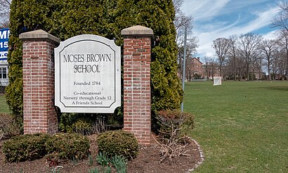
Directions to Moses Brown School (Boston) with public transportation
The following transit lines have routes that pass near Moses Brown School
How to get to Moses Brown School by bus?
Click on the bus route to see step by step directions with maps, line arrival times and updated time schedules.
How to get to Moses Brown School by train?
Click on the train route to see step by step directions with maps, line arrival times and updated time schedules.
Train stations near Moses Brown School in Boston
- Providence, 30 min walk,
What are the closest stations to Moses Brown School?
The closest stations to Moses Brown School are:
- Providence is 2469 yards away, 30 min walk.
Which bus lines stop near Moses Brown School?
These bus lines stop near Moses Brown School: 1, 32, 40.
Which train lines stop near Moses Brown School?
These train lines stop near Moses Brown School: NORTHEAST REGIONAL, PROVIDENCE/STOUGHTON.
What’s the nearest train station to Moses Brown School in Boston?
The nearest train station to Moses Brown School in Boston is Providence. It’s a 30 min walk away.
See Moses Brown School, Boston, on the map
Public Transit to Moses Brown School in Boston
Wondering how to get to Moses Brown School in Boston, United States? Moovit helps you find the best way to get to Moses Brown School with step-by-step directions from the nearest public transit station.
Moovit provides free maps and live directions to help you navigate through your city. View schedules, routes, timetables, and find out how long does it take to get to Moses Brown School in real time.
Looking for the nearest stop or station to Moses Brown School? Check out this list of stops closest to your destination: Providence.
Bus: 1, 32, 40.Train: NORTHEAST REGIONAL, PROVIDENCE/STOUGHTON, ACELA.
Want to see if there’s another route that gets you there at an earlier time? Moovit helps you find alternative routes or times. Get directions from and directions to Moses Brown School easily from the Moovit App or Website.
We make riding to Moses Brown School easy, which is why over 1.5 million users, including users in Boston, trust Moovit as the best app for public transit. You don’t need to download an individual bus app or train app, Moovit is your all-in-one transit app that helps you find the best bus time or train time available.
For information on prices of bus and train, costs and ride fares to Moses Brown School, please check the Moovit app.
Use the app to navigate to popular places including to the airport, hospital, stadium, grocery store, mall, coffee shop, school, college, and university.
Location: Boston
Attractions near Moses Brown School
Terrance S Martiesian Attorney,404 Lloyd Ave,80 Cole Ave,111 Cole Ave,3 Lorraine Ave,19 Angell Ct,Charlie's Knife Sharpening,Femme Fatale Salon,Balencia Medspa + Wellness,Berylson Family Fields,BCX Energy,Medway St,Gutterman Leslie Y Rabbi,Glu,Goldstein Sue-Rita,Wendy Brown Home,Ricci & Huntley Commu,26 S Angell St,Marry Me,MagnetHow to get to popular attractions in Boston with public transit
Financial District, Boston,Godfrey Hotel Boston, Boston,Seaport Hotel, Boston,Topsfield Fairgrounds, Topsfield,Nahant Beach, Nahant,Newton, MA, Newton,Westborough, MA, Westborough,Foxwoods, Worcester,Hopkinton, MA, Hopkinton,Abe & Louie's, Boston,MBTA Broadway Station, Boston,Encore, Boston,John Hancock Tower, Boston,Royal Sonesta, Cambridge,Endicott College Boston, Boston,Norwood, MA, Norwood,SoWa Open Market, Boston,Best Western Adams Inn Quincy - Boston, Quincy,Walmart Supercenter,Children's Hospital, BostonGet around Boston by public transit!
Traveling around Boston has never been so easy. See step by step directions as you travel to any attraction, street or major public transit station. View bus and train schedules, arrival times, service alerts and detailed routes on a map, so you know exactly how to get to anywhere in Boston.
When traveling to any destination around Boston use Moovit's Live Directions with Get Off Notifications to know exactly where and how far to walk, how long to wait for your line, and how many stops are left. Moovit will alert you when it's time to get off — no need to constantly re-check whether yours is the next stop.
Wondering how to use public transit in Boston or how to pay for public transit in Boston? Moovit public transit app can help you navigate your way with public transit easily, and at minimum cost. It includes public transit fees, ticket prices, and costs. Looking for a map of Boston public transit lines? Moovit public transit app shows all public transit maps in Boston with all Bus, Train, Subway and Ferry routes and stops on an interactive map.
Boston has 4 transit type(s), including: Bus, Train, Subway and Ferry, operated by several transit agencies, including MBTA, Southeastern Regional Transit Authority, MetroWest Regional Transit Authority, Rhode Island Public Transit Authority, WRTA, Lowell Regional Transit Authority, Merrimack Valley Transit, Montachusett Regional Transit Authority, Cape Cod Regional Transit Authority, Brockton Area Transit Authority, Martha's Vineyard Transit Authority, the WAVE - Nantucket Regional Transit Authority, GATRA, Cape Ann Transportation Authority, Massport