Directions to Moses Ellis House (Framingham) with public transportation
The following transit lines have routes that pass near Moses Ellis House
 Bus: 02, 07, 09, 07C, MWES.
- Train: FRAMINGHAM/WORCESTER, LAKE SHORE LIMITED.
How to get to Moses Ellis House by bus?
Click on the bus route to see step by step directions with maps, line arrival times and updated time schedules.
Bus stops near Moses Ellis House in Framingham
Train stations near Moses Ellis House in Framingham
Bus lines to Moses Ellis House in Framingham
What are the closest stations to Moses Ellis House?
The closest stations to Moses Ellis House are:
- Stop And Shop Temple St is 1714 yards away, 20 min walk.
- Water View Village is 1773 yards away, 21 min walk.
- Framingham is 3628 yards away, 43 min walk.
- Framingham Amtrak is 3628 yards away, 43 min walk.
Which bus lines stop near Moses Ellis House?
These bus lines stop near Moses Ellis House: 02, 07, 09.
What time is the first train to Moses Ellis House in Framingham?
The FRAMINGHAM/WORCESTER is the first train that goes to Moses Ellis House in Framingham. It stops nearby at 4:54 AM.
What time is the last train to Moses Ellis House in Framingham?
The LAKE SHORE LIMITED is the last train that goes to Moses Ellis House in Framingham. It stops nearby at 8:00 PM.
What time is the first bus to Moses Ellis House in Framingham?
The 07C is the first bus that goes to Moses Ellis House in Framingham. It stops nearby at 5:17 AM.
What time is the last bus to Moses Ellis House in Framingham?
The 07 is the last bus that goes to Moses Ellis House in Framingham. It stops nearby at 11:18 PM.
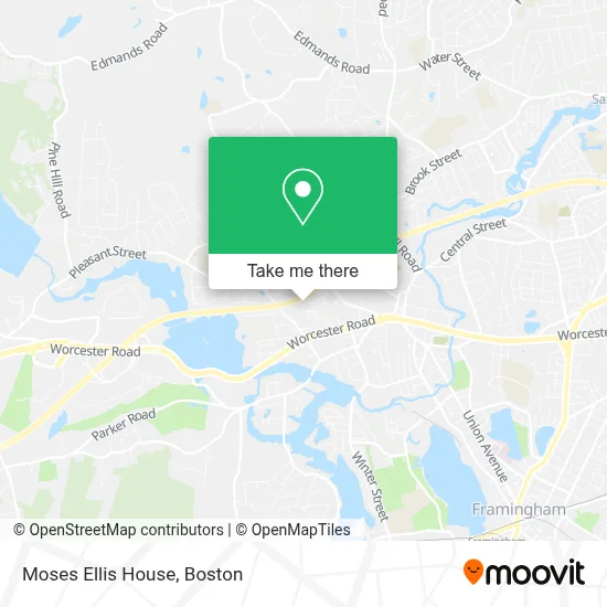
See Moses Ellis House, Framingham, on the map
Public Transit to Moses Ellis House in Framingham
Wondering how to get to Moses Ellis House in Framingham? Moovit helps you find the best way to get to Moses Ellis House with step-by-step directions from the nearest public transit station.
Moovit provides free maps and live directions to help you navigate through your city. View schedules, routes, timetables, and find out how long does it take to get to Moses Ellis House in real time.
Looking for the nearest stop or station to Moses Ellis House? Check out this list of stops closest to your destination: Stop And Shop Temple St; Water View Village; Framingham; Framingham Amtrak.
Bus: 02, 07, 09, 07C, MWES.Train: FRAMINGHAM/WORCESTER, LAKE SHORE LIMITED.
Want to see if there’s another route that gets you there at an earlier time? Moovit helps you find alternative routes or times. Get directions from and directions to Moses Ellis House easily from the Moovit App or Website.
We make riding to Moses Ellis House easy, which is why over 1.7 million users, including users in Framingham, trust Moovit as the best app for public transit. You don’t need to download an individual bus app or train app, Moovit is your all-in-one transit app that helps you find the best bus time or train time available.
For information on prices of bus and train, costs and ride fares to Moses Ellis House, please check the Moovit app.
Use the app to navigate to popular places including to the airport, hospital, stadium, grocery store, mall, coffee shop, school, college, and university.
Location: Framingham, Boston
- Citizens Bank Supermarket Branch,
- RW Holmes,
- Camacho Financial,
- Magik Garage Door Opener,
- Law Office of David M Click,
- Vericode,
- Msa Mortgage,
- Virgo Home Improvement,
- Kenney Associates,
- Shred Nations,
- Buildbak by the Hamel Company,
- My Favorite Super Heroes (James M. Reiss, CPA Add To Favorites),
- Commercial Carpet Cleaner,
- Spotless Cleaners,
- Times Two Technology,
- Cinch It of Framingham,
- R&C Roofing,
- La Gazza Brazilian Kitchen,
- Cummins-Allison,
- Sai India Market
Places Near Moses Ellis House (Framingham)
- Castle Island, Boston,
- Faneuil Hall, Boston,
- Boston Common, Boston,
- Cheers, Boston,
- Boston Convention & Exhibition Center, Boston,
- House Of Blues, Boston,
- Boston Children's Hospital, Boston,
- Wilbur Theatre, Boston,
- Massachusetts General Hospital, Boston,
- Leader Bank Pavilion (Leader Bank Pavillion), Boston,
- Boston Medical Center, Boston,
- Quincy Market, Boston,
- Isabella Stewart Gardner Museum, Boston,
- Prudential Center, Boston,
- Td Garden, Boston,
- North End, Boston,
- Seaport District, Boston,
- Wang Theater, Boston,
- Museum Of Science, Boston,
- Mgm Music Hall, Boston
How to get to popular places in Boston with public transit
Get around Framingham by public transit!
Traveling around Framingham has never been so easy. See step by step directions as you travel to any attraction, street or major public transit station. View bus and train schedules, arrival times, service alerts and detailed routes on a map, so you know exactly how to get to anywhere in Framingham.
When traveling to any destination around Framingham use Moovit's Live Directions with Get Off Notifications to know exactly where and how far to walk, how long to wait for your line, and how many stops are left. Moovit will alert you when it's time to get off — no need to constantly re-check whether yours is the next stop.
Wondering how to use public transit in Framingham or how to pay for public transit in Framingham? Moovit public transit app can help you navigate your way with public transit easily, and at minimum cost. It includes public transit fees, ticket prices, and costs. Looking for a map of Framingham public transit lines? Moovit public transit app shows all public transit maps in Framingham with all Bus, Train, Subway and Ferry routes and stops on an interactive map.
Boston has 4 transit type(s), including: Bus, Train, Subway and Ferry, operated by several transit agencies, including MBTA, Southeastern Regional Transit Authority, MetroWest Regional Transit Authority, Rhode Island Public Transit Authority, WRTA, Lowell Regional Transit Authority, Merrimack Valley Transit, Montachusett Regional Transit Authority, Cape Cod Regional Transit Authority, Brockton Area Transit Authority, Martha's Vineyard Transit Authority, the WAVE - Nantucket Regional Transit Authority, GATRA, Cape Ann Transportation Authority and Massport